


 Leeds
Leeds Doncaster
 Sheffield
 Bradford
 Hull
Hull Halifax
 Sunderland
 Newcastle
 Middlesborough
 Yorkshire Moors
 Teesside
 Cumbria
 Harrogate
 York
York Yorkshire Dales
 Northumberland
 Goole
Goole Carlisle
 Keswick
 Kendal
 Barrow-in-Furness
 Lancaster
 Blackpool
 Morecambe
 Southport
 Liverpool
 Wigan
Wigan Manchester
 Blackburn
 Burnley
 Forest of Bowland
 Oldham
 Chester
 Stockport
 Peak District
 Skipton
 Crewe
Crewe Rotherham
 Stoke
Stoke Driffield
Precision data for sustainable decisions. Survey methodology that matches the environment.
Commercial & Retail Surveying
Environmental and energy projects in the North West present survey challenges that standard construction methodology cannot always address. Wetland sites where ground-based access is restricted or harmful to the habitat. River corridors where the data needed lies beneath the water surface. Wind farm and solar development sites across challenging Pennine, Lakeland and moorland terrain. Flood risk assessments where every level and drainage feature matters to the modelling. Water infrastructure upgrade schemes operating under AMP8 investment where the survey data directly underpins programme-critical design decisions.
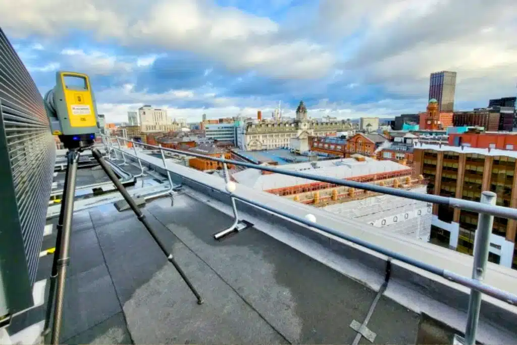
Site Surveying Services has been delivering survey across this sector since 1997 — using UAV LiDAR, unmanned surface vessels, remote sensing and GPS-controlled ground survey to capture data safely and accurately in environments where traditional methods are impractical, too slow or potentially damaging to what is being surveyed. We are Lancashire-based, nationally capable, and our equipment is specifically chosen for the environments this sector demands.
Surveying for Commercial & Retail Projects
Surveying for Commercial & Retail Projects
From feasibility to construction, even a small inaccuracy in site levels, utilities, or structure can cause cost overruns, design errors, and delays that impact budgets and tenants alike. Developers need survey partners who can move quickly without compromising on quality, adapt to complex sites, and deliver data that supports every stakeholder, from architects to investors.
Why Accuracy Matters...
Optimise site layouts and designs
o maximise rentable floor space and efficien
Reduce design risk
by uncovering site constraints early, avoiding rework and costly redesigns.
Speed up planning and approvals
with compliant, verifiable drawings.
Enhance asset value
through detailed documentation that supports lifecycle management and refurbishment.
Keep projects on budget and on schedule
by making every decision data-driven.
Innovation in Action
Innovation in Action

Our Services
Topographical Surveys
OS-controlled accurate, efficient and cost effective surveys for highways, civils and development. Cad and BIM-ready output.
PAS 128 utility mapping
Providing the location of underground services in 2D or 3D through qualified utility mapping surveys, using advanced GPR and Electromagnetic Location.
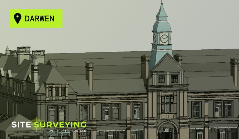
Measured building survey
Delivering accurate as-built information that supports design, refurbishment, planning and construction with the latest technology. Producing reliable drawings and digital models.
Laser Scanning
3D laser scanners capture millions of points per second, creating a point cloud which enables the finer details and the physical site to be viewed remotely.
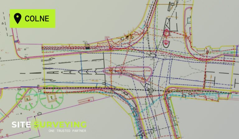
Mobile mapping
For highway engineers, infrastructure managers, local authorities and contractors working on live road schemes, mobile mapping is now the standard for corridor surveys.
3D Machine control
With decades of supporting major earthworks contractors and large-scale infrastructure schemes, we provide reliable machine control across Lancashire and the wider UK.
Setting out engineers
With strong, long-standing relationships across the civil engineering and construction sector, we supply skilled professionals who keep your projects accurate, efficient and on programme.
bathymetric surveys & river surveys
Using modern technology, we capture detailed underwater and river channel information safely and efficiently – delivering reliable data you can trust.
Stockpile surveys & volumetric analysis
Whether a one-off stockpile measurement or regular monitoring, we deliver reliable, repeatable data tailored to your project using advanced technology.
Control Network Installation
Delivering robust and precise site control systems to support every stage of construction in developments, infrastructure schemes or major earthworks.
aerial & drone surveys
CAA-approved drone operations for aerial mapping, photogrammetry and volumetric analysis, providing a comprehensive view of terrain, structures and landscapes.
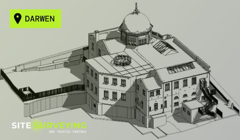
3D BIM Modelling
Whether you require an as-built Revit model, federated coordination model or detailed digital twin, our team delivers high quality, design-ready outputs.
survey equipment hire
We offer a vast range of surveying and engineering equipment for hire and will always try to beat a comparable quote. Discover the fleet.
monitoring
Providing reliable monitoring surveys across the UK, delivering precise data that supports risk management, compliance and informed decision making throughout a project lifecycle.
Virtual Tour 3D
An immersive experience which instantly transports your clients to your business, guiding them through your space and creating a seamless experience.
Impermeable area surveys
We deliver georeferenced impermeable area data that drainage engineers and planning consultants can work from directly.
CCTV & Drainage surveys
Acoustic & Noise Assessments
We deliver acoustic and noise assessments, supporting planning applications, discharge of conditions and Environmental Impact Assessments.
Why choose site surveying services
On site. On spec. On time.
Lease plans to RICS Property Measurement standard.
Accurate floor area plans for lease and tenancy purposes produced from laser scan data. The standard that property managers, solicitors and valuers require — delivered in the format they need.
PAS 128 before any commercial groundworks.
Commercial sites carry buried service risk from previous occupiers and development phases. Physical verification before any excavation — the standard that protects the programme and the CDM principal designer.
Planning survey package for commercial applications.
Topographic survey, impermeable area survey and acoustic assessment — the complete package for commercial planning applications where drainage and noise are both material considerations.
Frequently Asked Questions
Frequently Asked Questions
What surveys are typically required before a commercial development or fit-out?
For a new commercial development on a greenfield or brownfield site, a topographic survey is the starting point — capturing ground levels, boundaries, drainage, services at surface and contextual detail for the planning application and structural design. PAS 128 utility mapping before any groundworks. For an existing commercial building requiring fit-out, refurbishment or extension, a measured building survey using laser scanning captures the complete existing building geometry in the format the architect and fit-out contractor require. Where a BIM requirement exists, we build the survey scope around the Employer’s Information Requirements from the first conversation.
Do you carry out lease plan surveys for commercial property?
Yes. Accurately measured floor area plans to RICS Property Measurement standards for lease and tenancy purposes are part of our measured building survey capability. We produce lease plans as standalone commissions or as part of a full measured building survey. All lease plans are produced from laser scan data — accurate, consistent and measurable in the format the surveyor, solicitor or property manager requires.
Can you produce a Virtual Tour 3D of a commercial premises for marketing?
Yes — and it is one of the most commercially effective applications of Matterport Pro 3 technology. A virtual tour allows prospective tenants and buyers to conduct a meaningful first viewing remotely, arriving at a physical viewing already familiar with the space. We have delivered virtual tours of commercial premises, retail units, office buildings and industrial facilities across Lancashire and the North West. The tour is delivered as a shareable web link and embed code, accessible from any browser on any device, typically within hours of the site visit.
What is the right survey for a commercial planning application?
A topographic survey of the site tied to OS National Grid — capturing ground levels, boundaries, drainage, services at surface, adjacent building heights and all contextual features the LPA’s validation requirements specify. For applications involving existing buildings, a measured building survey. For applications where the LPA or LLFA requires drainage compliance data, an impermeable area survey. For applications where noise is a material consideration — a commercial premises near residential, or a food production or entertainment venue — an acoustic and noise assessment. We advise on the complete survey package for your specific application and LPA at the time of enquiry.
Do you survey shopping centres, retail parks and large commercial sites?
Yes. Large commercial sites — shopping centres, retail parks, logistics hubs and mixed-use developments — are well-suited to UAV survey combined with GPS ground survey, producing complete site datasets rapidly and efficiently. For the buildings themselves, laser scanning and measured building survey. For utility mapping before any groundworks, PAS 128 to the quality level the programme requires. For Virtual Tour 3D of individual units or the wider development, Matterport Pro 3 for pre-letting marketing and client handover.
What is the right survey methodology for a commercial building condition survey?
Laser scanning combined with measured building survey is the most effective methodology for commercial building condition surveys — capturing the complete existing building geometry, structural elements, services and building fabric in a single site visit, without requiring prolonged access to individual spaces. The resulting point cloud and CAD deliverables give the property manager, structural engineer or refurbishment architect a complete, accurate record of the existing conditions. For a visual condition record alongside the geometric data, Matterport Pro 3 virtual tour provides a navigable photographic record of every space.