

PAS 128 Utility Mapping Surveys Lancashire and UK
PAS 128 Utility Mapping Surveys
Topographical Surveys Lancashire
PAS 128 Compliant Utility Surveys Across the UK
PAS 128 Compliant Utility Surveys Across the UK
What is a PAS 128 Utility Survey?
PAS 128 is a specification published by the British Standards Institution (BSI) that sets out best practice for underground utility detection and mapping. The survey combines multiple detection methods to produce reliable and clearly classified results, allowing designers and contractors to make informed decisions before excavation begins. A PAS 128 survey identifies underground services such as:
- Electricity cables
- Gas Mains
- Water Pipes
- Telecoms & Data cables
- Drainage & Sewer Systems
What is underground determines whether your programme runs.
What PAS 128 Quality Levels Actually Mean
What PAS 128 Quality Levels Actually Mean
An underground service strike stops a construction programme. It injures people. It destroys equipment. It triggers CDM investigations. It costs the Principal Contractor money they cannot recover and exposes the people who approved the groundworks to liability they cannot easily defend. Every one of these consequences is preventable — with the right utility mapping, commissioned at the right stage, produced to the right standard.
PAS 128 is that standard. It is the British Standard Institution specification for underground utility detection and mapping — the only methodology that defines quality levels, classifies detection methods and produces a georeferenced, documented dataset that a CDM-compliant construction programme can actually rely on. Site Surveying Services delivers PAS 128-compliant utility mapping to Quality Level B, C and D across Lancashire, the North West and nationally. In 2025 we completed over 480 utility mapping surveys — on construction sites, brownfield developments, live industrial facilities, AMP8 water infrastructure programmes and security-critical MOD estates.
PAS 128 defines four survey quality levels. Understanding the difference between them is important — commissioning the wrong quality level for your project type does not just waste money, it leaves risk on the table that the programme cannot see. We advise on the right quality level for your specific site and programme at the time of enquiry.
Quality Level D — Desk study
A compilation of available records from statutory undertakers, local authorities and utility companies. No site detection whatsoever. Useful as a starting point to understand what services are likely to be present and to plan a physical survey — not useful as a standalone dataset for any project involving excavation. QLD alone should never inform a groundworks programme.
Quality Level C — Detection survey, no verification
Active detection of underground services using EML (electromagnetic location) and GPR (ground-penetrating radar) without physical verification of the results. Services are located and plotted to the accuracy of the detection equipment and conditions. The most common survey type commissioned but also the most commonly misunderstood — QLC identifies what is likely to be there, not what is definitely there. Appropriate for lower-risk environments and preliminary design stages.
Quality Level B — Detection and classification
Detection survey combined with positive identification of services — confirming service type, ownership and condition where accessible features (manholes, valve chambers, meters) allow. QLC data enhanced with verified service attribution. Appropriate for most construction and development projects where groundworks are planned.
Quality Level A — Physical verification
The highest standard. Services are physically exposed — using vacuum excavation (suction or air) at designated test points — and measured directly. Depth, position, size and material confirmed by direct measurement, not inference. The verified data is integrated with the QLC/QLB detection data to produce a dataset where every service is accounted for and documented. This is the standard that protects programmes, satisfies CDM principal designer requirements and stands up to scrutiny if a service strike occurs.
Land Surveying Services
Utility Mapping for Your Sector
What Our Utility Surveys Include.
What Our Utility Surveys Include
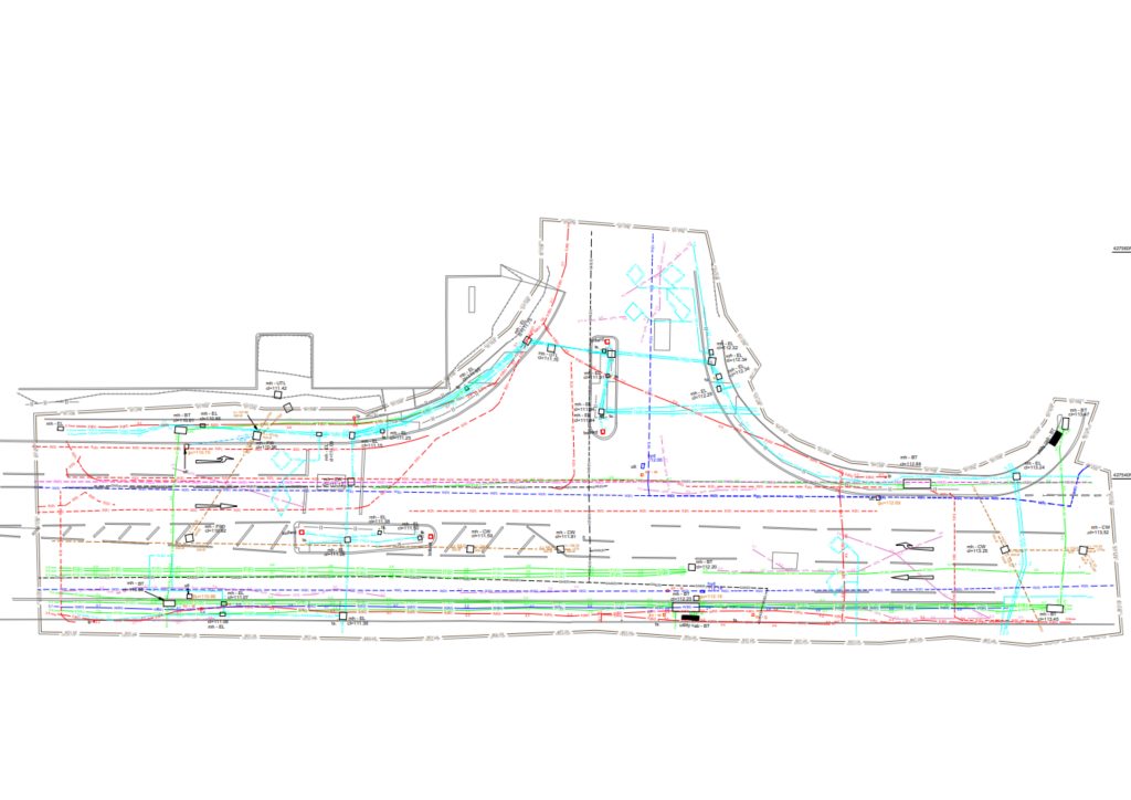
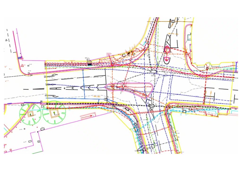
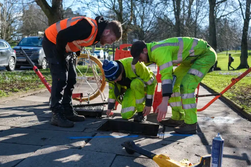
Our PAS 128 utility mapping surveys typically include:
Detection methods and equipment
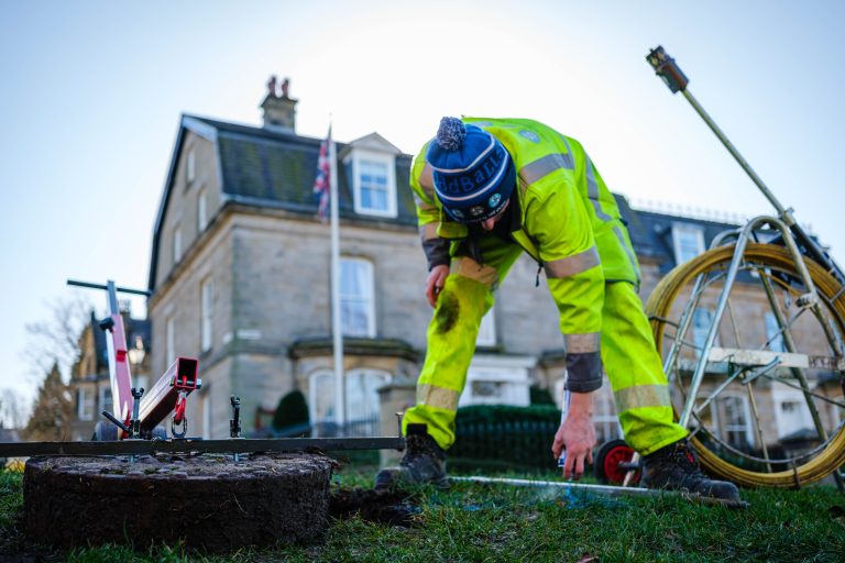
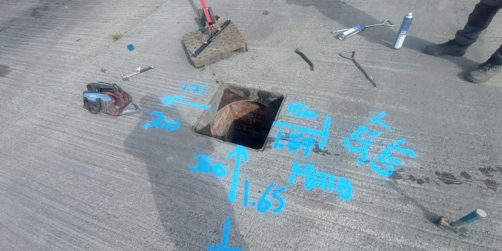
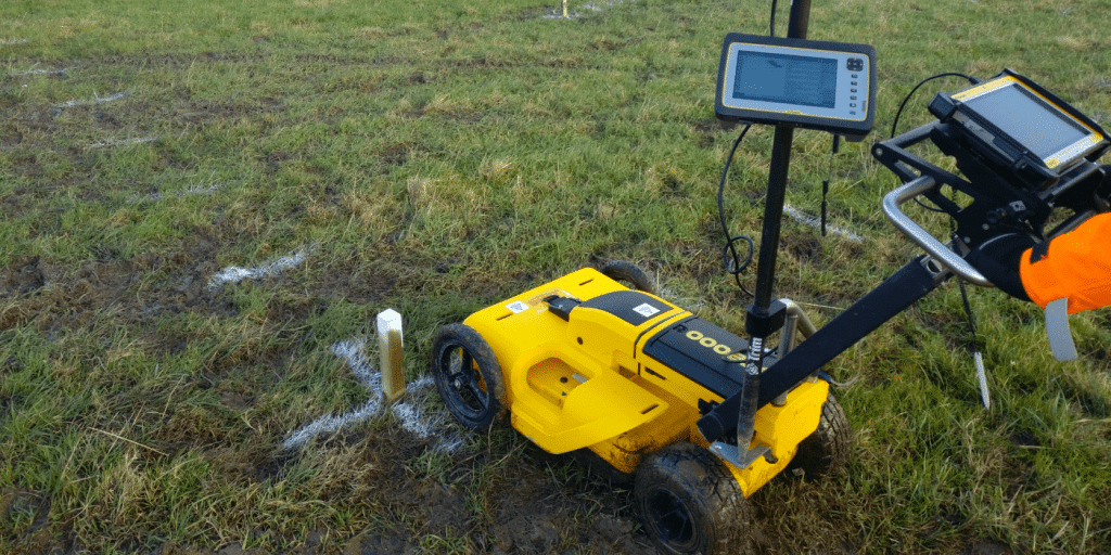
PAS 128-compliant utility mapping combines multiple detection technologies to maximise the probability of locating all buried services. No single method detects every service type in every ground condition — combining methods is fundamental to the standard.
Electromagnetic Location (EML)
The primary active detection method for conductive services — electricity cables, gas mains, water pipes with metallic content and metallic communications conduits. A signal is applied to the service (directly or inductively) and the cable avoidance tool detects the electromagnetic field produced. Effective for metallic services with a clear signal path.
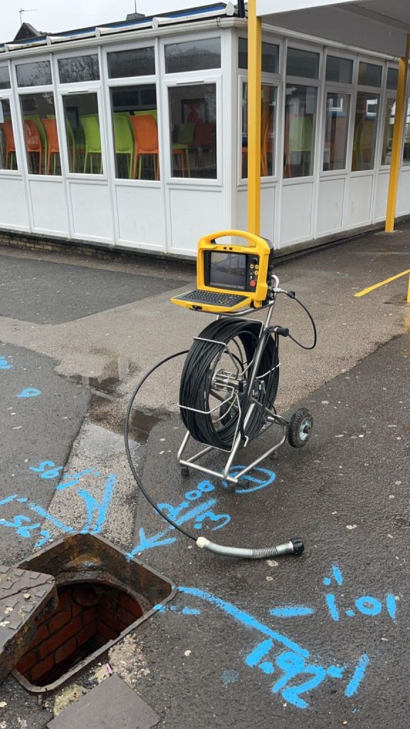
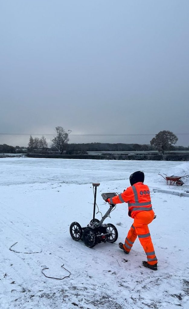
Ground Penetrating Radar (GPR)
The primary detection method for non-conductive services — plastic water mains, HDPE gas pipes, non-metallic ducts — and for detecting anomalies in the ground that may indicate buried infrastructure. GPR transmits a radar pulse into the ground and measures the reflected signal from buried features. Effective in sandy, dry and granular soils. Less effective in heavy clay and saturated ground where signal attenuation is high. We advise on ground condition suitability at the time of scoping.
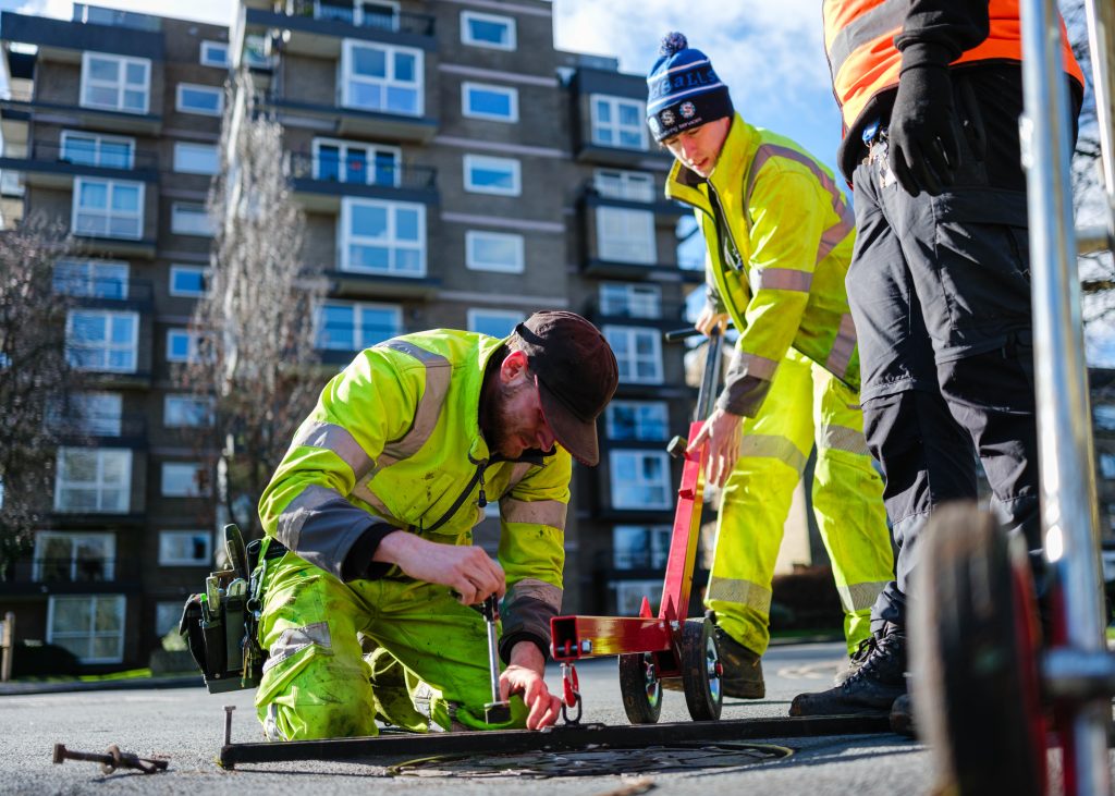
Cable Avoidance Tools (CAT and Genny)
Signal generators (Genny) apply a signal to accessible service entry points — meter boxes, valve chambers, connection points — allowing the CAT to trace the service path. Used in combination with EML for active tracing and passive detection of live electricity and communications services.
Combining methods
On most sites we deploy EML and GPR together, with CAT and Genny for services with accessible connection points. The combination of active and passive detection, electromagnetic and radar methods, maximises coverage across all service types and ground conditions — which is precisely what PAS 128 requires.
our Utility mapping survey case studies
BAE Systems — Barrow-in-Furness MOD Facility
PAS 128 QLB utility mapping and topographic survey on a live MOD industrial facility at Barrow-in-Furness — one of the most operationally demanding utility survey environments we have worked in. Decades of buried infrastructure across a large, complex site. Restricted access, phased delivery, real-time quality assurance and seamless coordination between our topographic and utility mapping teams. Every service physically verified. Zero disruption to site operations. The completed dataset now underpins critical design decisions for the facility expansion — giving the design team and contractor the confidence to proceed with groundworks on a site where a service strike would have been operationally catastrophic.

HMP Manchester — Security-Critical Utility Mapping
PAS 128 utility mapping at HMP Manchester — a secure custodial environment where access protocols, coordination with site security and the sensitivity of the operating environment make every survey visit significantly more complex than a standard site. Our team navigated the access requirements, produced the full PAS 128 compliant dataset and delivered without incident. The utility data supported the design and planning of works on the estate without any disruption to the secure operation of the facility.

What Our PAS 128 Utility Mapping Delivers
What Our PAS 128 Utility Mapping Delivers
Every utility mapping survey produced by Site Surveying Services includes:
Detection and mapping of all located underground services
Electricity, gas, water, telecoms, drainage, sewer and any unidentified anomalies — plotted in plan and, where depth data is available, in 3D.
Service classification
Positively identified services (QL B), detected services (QL C) and records-only information (QL D).
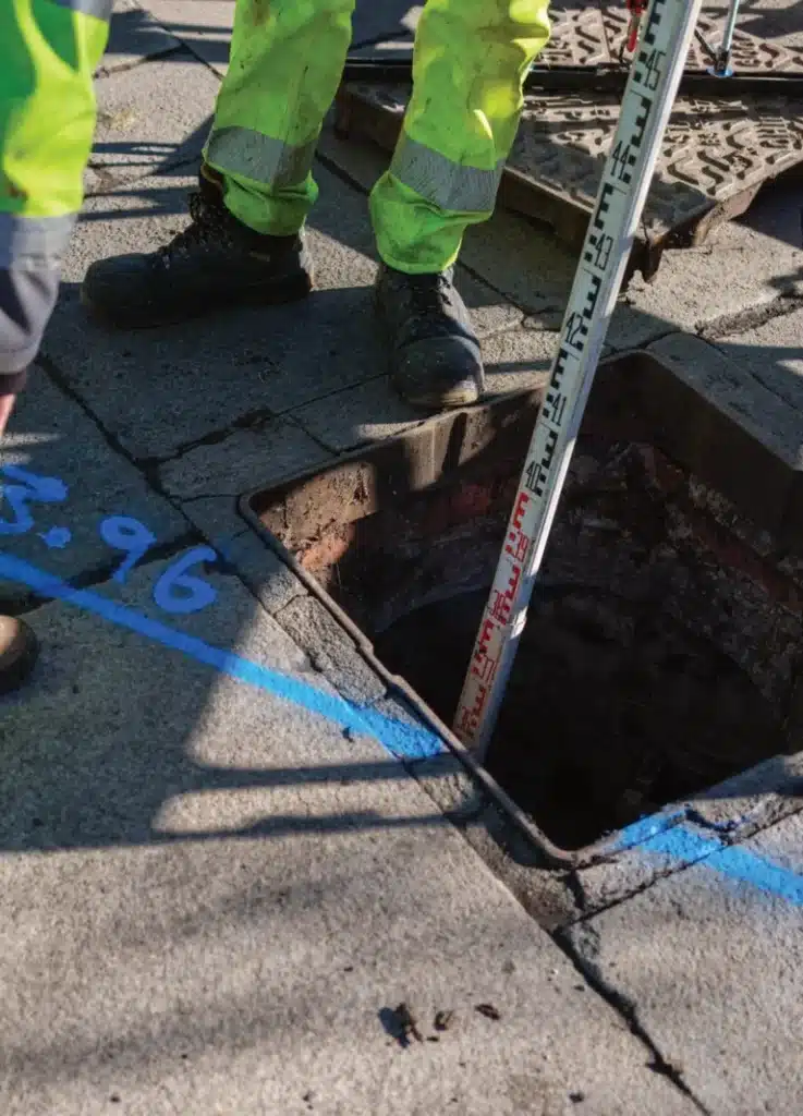
Depth data
Where the detection method and ground conditions allow, service depths are recorded and plotted. Where depth cannot be reliably determined, this is clearly noted in the dataset and the methodology statement.
Georeferenced dataset
All data tied to OS National Grid as standard, integrating directly with your topographic survey, site model and CAD environment without additional registration.
CAD drawings
Methodology statement
A full written record of the survey methodology, equipment used, detection methods deployed, ground conditions encountered, limitations identified and quality level achieved. This is the document that protects the programme in the event of a CDM investigation or service strike dispute.
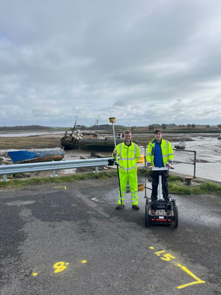
Integration with topographic survey
where a topographic survey has been commissioned alongside the utility mapping, both datasets are delivered as a single georeferenced product. Ground features, drainage, boundaries and service information in one coordinated dataset.
Who We Work With
Who We Work With
Utility mapping sits at the start of every construction, infrastructure and development programme that involves any ground investigation or excavation. The clients who commission it include:
Discharging the pre-construction information duty under CDM 2015.
Commissioning utility data at design stage to inform drainage, foundation, service diversion and construction methodology design. The earlier the survey, the more design decisions it can inform.
Road improvement, active travel and water infrastructure programmes across the North West all require PAS 128 utility mapping before groundworks commence. We are already delivering across the United Utilities AMP8 supply chain in Lancashire, Cheshire, Cumbria and Greater Manchester.
Utility information to support planning applications, drainage design and utility diversion strategies.
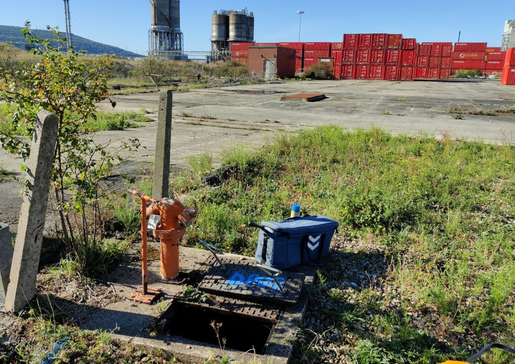
live industrial sites with decades of buried infrastructure require PAS 128 survey before any groundworks, maintenance excavation or facility expansion begins.

Our Services
How PAS 128 Utility Mapping Integrates With Other Services
How PAS 128 Utility Mapping Integrates With Other Services
Topographical Surveys
OS-controlled accurate, efficient and cost effective surveys for highways, civils and development. Cad and BIM-ready output.
PAS 128 utility mapping
Providing the location of underground services in 2D or 3D through qualified utility mapping surveys, using advanced GPR and Electromagnetic Location.
Measured building survey
Delivering accurate as-built information that supports design, refurbishment, planning and construction with the latest technology. Producing reliable drawings and digital models.
Laser Scanning
3D laser scanners capture millions of points per second, creating a point cloud which enables the finer details and the physical site to be viewed remotely.
Mobile mapping
For highway engineers, infrastructure managers, local authorities and contractors working on live road schemes, mobile mapping is now the standard for corridor surveys.
3D Machine control
With decades of supporting major earthworks contractors and large-scale infrastructure schemes, we provide reliable machine control across Lancashire and the wider UK.
Setting out engineers
With strong, long-standing relationships across the civil engineering and construction sector, we supply skilled professionals who keep your projects accurate, efficient and on programme.
bathymetric surveys & river surveys
Using modern technology, we capture detailed underwater and river channel information safely and efficiently – delivering reliable data you can trust.
Stockpile surveys & volumetric analysis
Whether a one-off stockpile measurement or regular monitoring, we deliver reliable, repeatable data tailored to your project using advanced technology.
Control Network Installation
Delivering robust and precise site control systems to support every stage of construction in developments, infrastructure schemes or major earthworks.
aerial & drone surveys
CAA-approved drone operations for aerial mapping, photogrammetry and volumetric analysis, providing a comprehensive view of terrain, structures and landscapes.
3D BIM Modelling
Whether you require an as-built Revit model, federated coordination model or detailed digital twin, our team delivers high quality, design-ready outputs.
survey equipment hire
We offer a vast range of surveying and engineering equipment for hire and will always try to beat a comparable quote. Discover the fleet.
monitoring
Providing reliable monitoring surveys across the UK, delivering precise data that supports risk management, compliance and informed decision making throughout a project lifecycle.
Virtual Tour 3D
An immersive experience which instantly transports your clients to your business, guiding them through your space and creating a seamless experience.
Impermeable area surveys
We deliver georeferenced impermeable area data that drainage engineers and planning consultants can work from directly.
CCTV & Drainage surveys
Acoustic & Noise Assessments
We deliver acoustic and noise assessments, supporting planning applications, discharge of conditions and Environmental Impact Assessments.
Topographical Surveys
PAS 128 utility mapping
Laser Scanning
Mobile mapping
Setting out engineers
bathymetric surveys & river surveys
Control Network Installation
aerial & drone surveys
survey equipment hire
monitoring
Impermeable area surveys
CCTV & Drainage surveys
3D Machine control
Acoustic & Noise Assessments
Stockpile surveys & volumetric analysis
3D BIM Modelling
3D BIM Modelling
Virtual Tour 3D
Why choose site surveying services
On site. On spec. On time.
The accreditation that matters.
PAS 128 accredited. The only standard that defines quality levels, detection methods and CDM-compliant deliverables. Not all utility survey firms are accredited. Ours are.
Both methods. Every survey.
GPR and EML deployed simultaneously on every survey — because no single method detects all service types in all ground conditions. The combination that protects the programme.
Georeferenced and delivered on time.
Every dataset tied to OS National Grid. Delivered in AutoCAD DWG with full methodology statement. In the format your designer and contractor need from day one.
Frequently Asked Questions
Frequently Asked Questions
What is PAS 128 and why does it matter?
PAS 128 is the British Standards Institution specification for underground utility detection, verification, location and mapping. It defines quality levels, detection methods, confidence classifications and deliverable requirements. It matters because it is the only recognised standard that tells you — and any subsequent CDM investigation — exactly what was done to locate underground services before excavation began, how it was done, and what confidence can be placed in the results. Without PAS 128, utility data has no defined standard against which it can be assessed or defended.
What is the difference between Quality Level A and Quality Level C?
Quality Level C is an active detection survey — GPR and EML used to locate services in the ground, with results plotted on a drawing. Quality Level A adds physical verification — services are exposed at test points using vacuum excavation, measured directly and confirmed. QLC tells you where services are likely to be. QLA tells you where they definitely are, how deep they are and what they are made of.
Do I need PAS 128 utility mapping for a small project?
The scale of the project does not determine whether utility mapping is needed — the nature of the excavation does. A small residential extension can encounter the same buried services as a major infrastructure scheme. The difference is that on a small project, a service strike has proportionally greater programme and financial impact. We recommend PAS 128 utility mapping on any project involving ground investigation or excavation, regardless of scale. We can advise on the appropriate quality level for your specific site and excavation scope.
How long does a PAS 128 utility survey take?
This depends on the site size, the complexity of the service environment and the quality level specified. A straightforward QLC detection survey on a small to medium site can typically be completed in a single day. We will give you a realistic timescale when we return your quote — and we will tell you if your timescale is not achievable for the quality level you have specified, rather than delivering a survey that does not meet your brief.
What file format will the utility mapping be delivered in?
We deliver utility mapping in AutoCAD DWG, DXF or PDF format as standard, tied to OS National Grid. Where the utility mapping is being combined with a topographic survey, both datasets are delivered in the same coordinate system in a single DWG file. If your project has specific format requirements — GIS-compatible output, integration with a specific BIM platform — confirm this at the time of instruction and we will build it into the deliverable specification.
Can you combine utility mapping with a topographic survey?
Yes — and in most cases we recommend it. Combining PAS 128 utility mapping with a topographic survey gives the design team a complete picture of the site above and below ground in a single georeferenced dataset. It is more efficient, more cost-effective and reduces the risk of design-stage surprises caused by services conflicting with proposed drainage or foundation layouts. On most construction and development programmes, the two surveys should be specified together from the outset.
What is the difference between EML and GPR — and why do you need both?
EML (electromagnetic location) is most effective at detecting metallic services — electricity cables, gas mains, metallic water pipes. GPR (ground-penetrating radar) is most effective at detecting non-metallic services — plastic water mains, HDPE gas pipes, non-metallic ducts — and at identifying anomalies in the ground that EML cannot detect. No single method detects all service types in all ground conditions. PAS 128 requires a combination of detection methods precisely because of this limitation. We always deploy both EML and GPR on utility surveys, using each method to cover the limitations of the other.
Is GPR effective in all ground conditions?
GPR performance varies with ground conditions. It works best in dry, sandy or granular soils where radar signals penetrate cleanly and return clear reflections. In heavy clay soils, saturated ground or made ground with significant debris content, GPR signal attenuation reduces the effective detection depth and reliability. We will advise on ground condition suitability and any limitations at the time of scoping — and we document ground conditions encountered in the methodology statement delivered with the survey.
What happens if a service is found that is not in any utility records?
This is common — particularly on brownfield sites, legacy industrial land and urban sites with long development histories. When we locate a service that does not appear in the utility records, we record it in the dataset with a classification indicating that it is unattributed. We note it clearly in the methodology statement and flag it to the client. In some cases, additional investigation — including vacuum excavation test pits — is required to determine service type and ownership. We advise on next steps when this occurs rather than simply plotting an unidentified service and moving on.
Do you cover the whole of the UK?
Yes. Our head office is in Clitheroe, Lancashire, with offices in Matlock, Newcastle and Bristol. We deliver PAS 128 utility mapping across the North West, North East, Midlands, South West and nationally. All work is carried out by our directly employed team — not subcontractors. In 2025 we completed over 480 utility mapping surveys across a national programme.