

Accurate site data from acquisition to handover. The survey that makes every housing programme run.
Housing & Development Surveying
Need the full package?
Surveying for Housing and Development Projects
Surveying for Housing and Development Projects
Why Accuracy Matters...
Accurate survey data is essential in helping to protect ecosystems and supporting sustainability goals. With reliable information, clients can:
Design efficiently
ensuring layouts, access, and drainage systems integrate seamlessly with real-world conditions.
Reduce
risk
uncovering hidden constraints and utilities early to avoid delays and redesigns.
Support planning approvals
providing compliant, verified data to streamline submissions and stakeholder confidence.
Control
costs
preventing rework and unnecessary excavation by knowing exactly what’s on and below site.
Build sustainably
supporting modern housing standards, biodiversity goals, and low-impact design.
Innovation in Action
Innovation in Action
…we produce complete, high-resolution site models that help developers visualise constraints, plan infrastructure, and mitigate risk before construction begins.
Our integrated survey approach ensures every dataset aligns perfectly, giving designers and engineers the certainty they need to build smarter and faster.
As the UK transitions towards renewable energy and climate-resilient infrastructure, accurate surveying is the foundation. We see our role as partners shaping the future of sustainable development, providing the clarity and confidence needed to balance growth with environmental care.


The Housing and Development Sector in Lancashire and the North West
The Housing and Development Sector in Lancashire and the North West
Lancashire and the North West have some of the most varied and active housing markets in England — driven by several distinct investment and policy programmes:
Brownfield land release
Lancashire’s former industrial and mill towns carry significant brownfield land supply. Darwen, Colne, Accrington, Burnley, Blackburn and Rossendale all have active brownfield housing programmes. Brownfield sites carry the highest survey risk of any housing land type — undocumented buried services, legacy foundations, contamination indicators at surface and irregular ground conditions all require careful pre-construction survey to identify and manage before design is fixed.
Urban regeneration
Housing-led urban regeneration across East Lancashire is one of the most active development programmes in the region. We have delivered topographic and utility survey across multiple regeneration sites in Darwen, Colne and Accrington — providing the accurate, georeferenced data that planning authorities and design teams need for housing-led regeneration submissions.
Affordable housing and housing association programmes
Registered Providers across the North West — Wigan and Leigh Housing, Together Housing, Progress Housing Group and others — are delivering sustained programmes of affordable housing new build across Lancashire and Greater Manchester. Survey demand for topographic survey, PAS 128 utility mapping and setting-out engineering is consistent across these programmes.
Strategic housing sites
Large strategic housing sites across the Fylde, the Ribble Valley, Chorley, Preston and South Ribble are being brought forward through the planning system. These sites require large-area topographic survey at masterplan stage, often using UAV survey combined with GPS ground control for efficient coverage.
Barn conversions and rural residential
The Forest of Bowland, the Ribble Valley and rural Lancashire generate steady demand for barn conversion and rural residential development survey — measured building surveys of agricultural buildings, topographic surveys of rural sites and planning application support for change of use.
Build to Rent and later living
The North West’s growing Build to Rent and later living sectors require measured building surveys, topographic surveys and BIM delivery for large-scale residential schemes across Greater Manchester and Lancashire.
Project Types We Support
Project Types We Support
Strategic housing sites
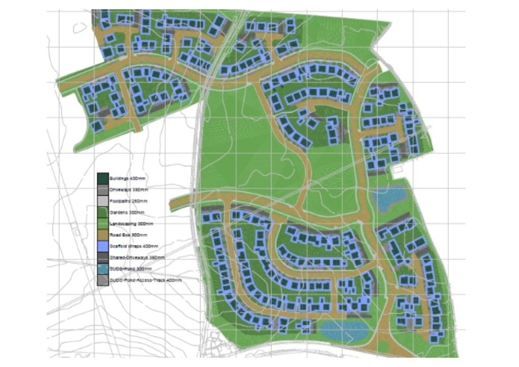
large-area topographic survey for masterplan and outline planning applications. UAV survey combined with GPS ground control for efficient coverage across sites of 10 hectares and above. Boundaries, drainage, trees, existing structures and all constraints captured for the planning consultant and masterplan designer.
Brownfield residential development
comprehensive pre-construction survey for brownfield housing sites. Topographic survey capturing existing ground conditions. PAS 128 utility mapping at Quality Level A before any groundworks on sites with legacy industrial service infrastructure. Measured building survey of any existing structures involved in the scheme. Pre-demolition surveys where existing buildings are to be cleared.
Affordable housing and housing association development
topographic survey, PAS 128 utility mapping, control network and setting-out engineering for affordable housing new build programmes. We understand the programme pressure and budget constraints of housing association development and deliver efficiently without compromising on quality.
Urban regeneration housing
laser scanning and SLAM scanning for tunnel inspection, as-built recording and condition survey. Confinsurvey for housing-led urban regeneration schemes across East Lancashire and the wider North West. Our surveys in Darwen, Colne and Accrington are the direct demonstration of this capability — OS-controlled, georeferenced survey data supporting planning submissions and design across multiple regeneration sites.ed space methodology, phased access and safety compliance throughout.
Barn conversion and rural residential
measured building surveys of agricultural buildings for change of use and barn conversion planning applications. Topographic survey of rural residential sites. We use 3D laser scanning for complex or historic agricultural buildings where tape survey cannot reliably capture the irregular geometry.
Housing estate infrastructure and S38 highways
topographic survey and setting-out for housing estate roads and drainage. S38 highway design survey and as-built survey for highway adoption.
Plot setting-out
directly employed setting-out engineers for individual plot and multi-plot setting-out on housing development programmes across Lancashire and the North West. Over 600 setting-out programmes delivered in 2025.
Residential conversion and refurbishment
measured building surveys for residential conversion and refurbishment — apartments from former commercial buildings, listed building conversions, terraced property refurbishment. Laser scanning for complex geometry and confined access.
Build to Rent and later living
topographic survey, measured building survey and BIM delivery for large-scale Build to Rent and retirement living development in the North West.
Student accommodation
topographic survey, PAS 128 utility mapping and measured building survey for student accommodation development adjacent to North West universities and FE colleges.
Who We Work With in the Housing and Development Sector
Who We Work With in the Housing and Development Sector
National housebuilders
Topographic survey, PAS 128 utility mapping and setting-out engineering for strategic housing sites and brownfield residential development across Lancashire and the North West.
Regional residential developers
Survey from acquisition through to handover for residential schemes of all scales. Topographic survey at acquisition stage. Full pre-construction survey package before groundworks. As-built at completion.
Housing associations and Registered Providers
Topographic survey, PAS 128 utility mapping and setting-out for affordable housing new build and residential regeneration programmes across the North West.
Planning consultants on residential schemes
Topographic survey for planning applications, flood risk survey data and utility records to support housing planning submissions.
Residential architects
Measured building surveys for residential conversion and extension, topographic surveys for new build residential design, BIM delivery for larger residential projects.
Land agents and acquisitions teams
Indicative topographic survey at acquisition stage to inform land purchase decisions and development appraisals.
Brownfield developers and remediation contractors
Pre-demolition survey, PAS 128 utility mapping and topographic survey for brownfield housing development.


Our Services
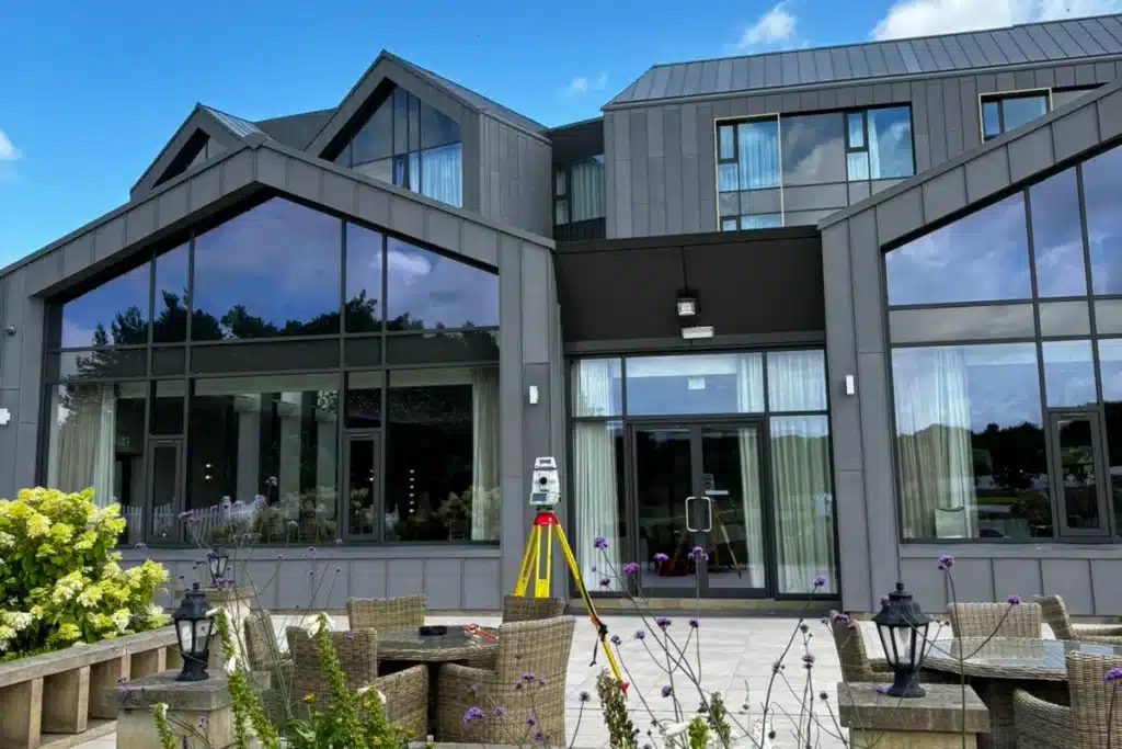
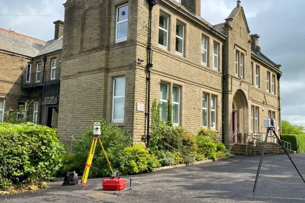
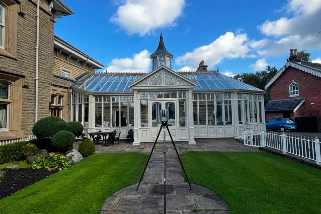
Topographical Surveys
OS-controlled accurate, efficient and cost effective surveys for highways, civils and development. Cad and BIM-ready output.
PAS 128 utility mapping
Providing the location of underground services in 2D or 3D through qualified utility mapping surveys, using advanced GPR and Electromagnetic Location.
Measured building survey
Delivering accurate as-built information that supports design, refurbishment, planning and construction with the latest technology. Producing reliable drawings and digital models.
Laser Scanning
3D laser scanners capture millions of points per second, creating a point cloud which enables the finer details and the physical site to be viewed remotely.
Mobile mapping
For highway engineers, infrastructure managers, local authorities and contractors working on live road schemes, mobile mapping is now the standard for corridor surveys.
3D Machine control
With decades of supporting major earthworks contractors and large-scale infrastructure schemes, we provide reliable machine control across Lancashire and the wider UK.
Setting out engineers
With strong, long-standing relationships across the civil engineering and construction sector, we supply skilled professionals who keep your projects accurate, efficient and on programme.
bathymetric surveys & river surveys
Using modern technology, we capture detailed underwater and river channel information safely and efficiently – delivering reliable data you can trust.
Stockpile surveys & volumetric analysis
Whether a one-off stockpile measurement or regular monitoring, we deliver reliable, repeatable data tailored to your project using advanced technology.
Control Network Installation
Delivering robust and precise site control systems to support every stage of construction in developments, infrastructure schemes or major earthworks.
aerial & drone surveys
CAA-approved drone operations for aerial mapping, photogrammetry and volumetric analysis, providing a comprehensive view of terrain, structures and landscapes.
3D BIM Modelling
Whether you require an as-built Revit model, federated coordination model or detailed digital twin, our team delivers high quality, design-ready outputs.
survey equipment hire
We offer a vast range of surveying and engineering equipment for hire and will always try to beat a comparable quote. Discover the fleet.
monitoring
Providing reliable monitoring surveys across the UK, delivering precise data that supports risk management, compliance and informed decision making throughout a project lifecycle.
Virtual Tour 3D
An immersive experience which instantly transports your clients to your business, guiding them through your space and creating a seamless experience.
Impermeable area surveys
We deliver georeferenced impermeable area data that drainage engineers and planning consultants can work from directly.
CCTV & Drainage surveys
Acoustic & Noise Assessments
We deliver acoustic and noise assessments, supporting planning applications, discharge of conditions and Environmental Impact Assessments.
Topographical Surveys
PAS 128 utility mapping
Laser Scanning
Mobile mapping
Setting out engineers
bathymetric surveys & river surveys
Control Network Installation
aerial & drone surveys
survey equipment hire
monitoring
Impermeable area surveys
CCTV & Drainage surveys
3D Machine control
Acoustic & Noise Assessments
Stockpile surveys & volumetric analysis
3D BIM Modelling
3D BIM Modelling
Virtual Tour 3D
Why choose site surveying services
On site. On spec. On time.
Survey at every development stage.
Pre-application topographic to support planning. Pre-construction PAS 128 before groundworks. Setting-out through the build. One trusted partner throughout the programme.
Impermeable area and drainage surveys.
LPA and LLFA drainage validation is increasingly demanding measured impermeable area data. We deliver it alongside the topographic survey from a single site visit.
Section 104 adoption records. Right first time.
CCTV drainage survey at practical completion, WRC SRM coded, in the format the water company requires. Adoption records produced correctly the first time — not revised after a rejection.
Virtual Tour 3D for pre-completion marketing.
Matterport Pro 3 virtual tour of completed units before physical access is available. The pre-completion marketing tool that allows buyers and tenants to view from anywhere .
Frequently Asked Questions
Frequently Asked Questions
What survey is needed for a housing planning application?
At a minimum, a topographic survey of the site tied to OS National Grid — capturing ground levels, boundaries, drainage, trees, existing structures and the surrounding context. For applications involving existing buildings, a measured building survey. For applications in Flood Zone 2 or 3, flood risk survey data. For sites where any ground investigation is planned before or during the application process, PAS 128 utility mapping. The exact scope depends on the site, the LPA and the scale of the application — we advise on the right specification for your specific scheme at the time of enquiry.
How early in the development process should I commission a topographic survey?
As early as possible — ideally at acquisition stage. The topographic survey that informs the purchase decision is worth significantly more than the same survey commissioned after contracts have exchanged and the design is already underway. It can confirm or challenge the assumed developable area, identify drainage constraints, flag flood risk indicators and reveal boundary issues that affect the development appraisal. The cost of an early survey is always less than the cost of a late surprise.
What PAS 128 quality level do I need for a housing development?
This depends on the site type and history. For greenfield housing sites with limited service infrastructure, Quality Level C — active detection using GPR and EML — is typically sufficient for most pre-construction applications. For brownfield sites, urban infill and sites with any significant development history, Quality Level A — physical verification at test points using vacuum excavation — is appropriate at locations where service density or risk is highest. For the groundworks contractor, physical verification of critical service positions before excavation begins is the standard that protects the programme. We advise on the right quality level distribution for your specific site.
Can you survey a large strategic housing site efficiently?
Yes. For strategic housing sites of 10 hectares and above, we combine UAV survey with GPS ground control — capturing the full site topography, boundaries, drainage and constraint features in a single programme. The UAV covers the large-area terrain capture; GPS ground control ensures the data is accurately georeferenced to OS National Grid. This approach is significantly faster than ground-based survey alone on large sites and produces a denser, more complete dataset.
Do you do plot setting-out for housing developments?
Yes — and this is one of our most regularly commissioned services on housing programmes. Our directly employed setting-out engineers carry out individual plot setting-out, road layout, drainage and external works setting-out for housing developments across Lancashire and the North West. Fully self-equipped with robotic total stations and GPS. Over 600 setting-out programmes delivered in 2025. We supply visiting engineers for programmes where setting-out is needed periodically, and full-time placements for programmes where continuous site engineering presence is required.
What measured building survey do I need for a barn conversion?
A measured building survey capturing floor plans, elevations and sections of the existing agricultural building — at the scale and accuracy appropriate for the planning application. For most barn conversion applications, 1:50 or 1:100 scale floor plans and elevations are appropriate. For listed building applications or conversions in conservation areas, the survey scope may need to capture additional detail. We use 3D laser scanning for barn conversion surveys — it captures the complex roof profiles, irregular wall faces and structural geometry of agricultural buildings far more accurately and completely than tape survey.
Do you cover the whole of the North West for housing survey?
Yes. Our head office is in Clitheroe, Lancashire — at the heart of the region. We cover Lancashire, Greater Manchester, Merseyside, Cheshire, Cumbria and the wider North West as primary territory, and deliver nationally. We have delivered housing development surveys across East Lancashire, the Fylde, the Ribble Valley, Greater Manchester, South Lakeland and nationally. All work is carried out by our directly employed team.