

Land and engineering surveyors based in Lancashire
Setting Out Engineers & Site Engineering
- ConstructionLine gold
- pas 128 qlb
- cdm 2015
- caa approved
- rics
- is0 9001 (in progress)
Setting Out Engineers Lancashire and the North West
Professional Site Engineering Services Across the UK
Professional Site Engineering Services Across the UK
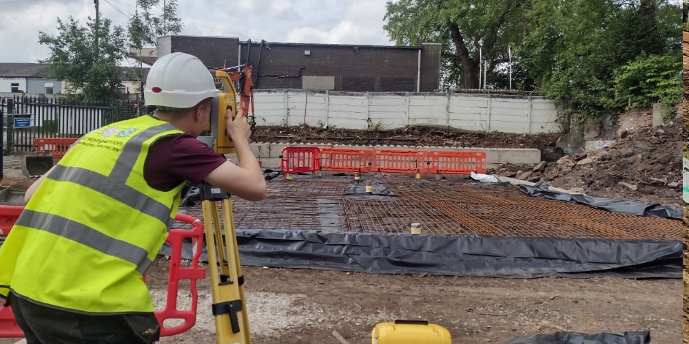
Setting out is where survey precision becomes construction reality. The accuracy of the control established at this stage determines the accuracy of everything built from it — every foundation, every drainage run, every structural element, every kerb line. There is no recovering from wrong control once the programme has moved on. The abortive work, the programme delay and the cost that follows a setting-out error cannot be recovered. The only solution is getting it right in the first place.Site Surveying Services supplies directly employed setting-out engineers and engineering surveyors for construction and infrastructure programmes across Lancashire, the North West and nationally. Our team has strong, long-standing relationships across tier 1 and tier 2 civil engineering and construction contractors throughout the region — and in 2025 we delivered over 600 setting-out and site engineering programmes across commercial, housing, civils, highways and infrastructure schemes. The engineer who confirms your booking is the engineer who shows up on site. Directly employed, fully equipped, and with no gap between the team you spoke to and the team in your site compound.
What Is Setting Out?
Setting out is the process of transferring design data from drawings and digital models onto the ground. It ensures that structures, roads, drainage systems and infrastructure are built precisely in accordance with design specifications. Accurate setting out is essential for:
Errors in setting out can result in costly delays and rework. Our experienced engineers ensure precision from the outset.
How Our Engineers Work On Site
How Our Engineers Work On Site
Directly employed
Fully equipped
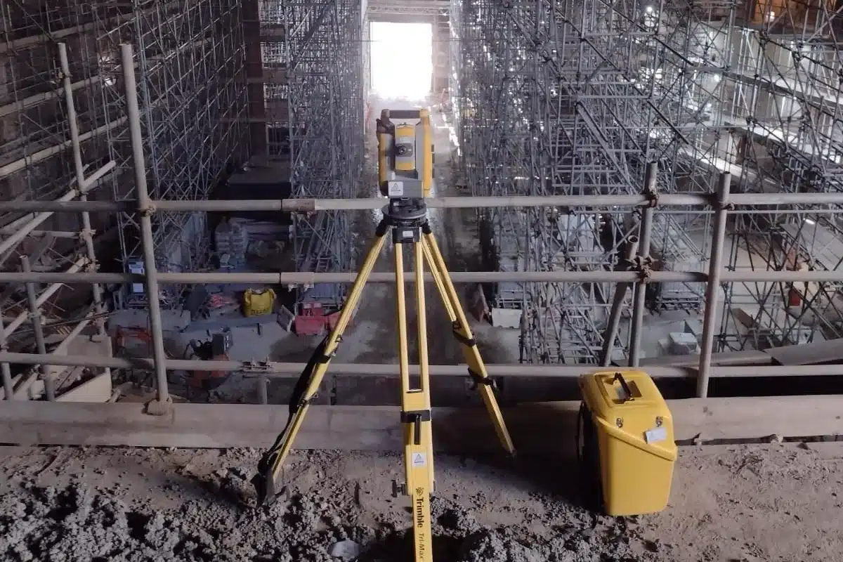
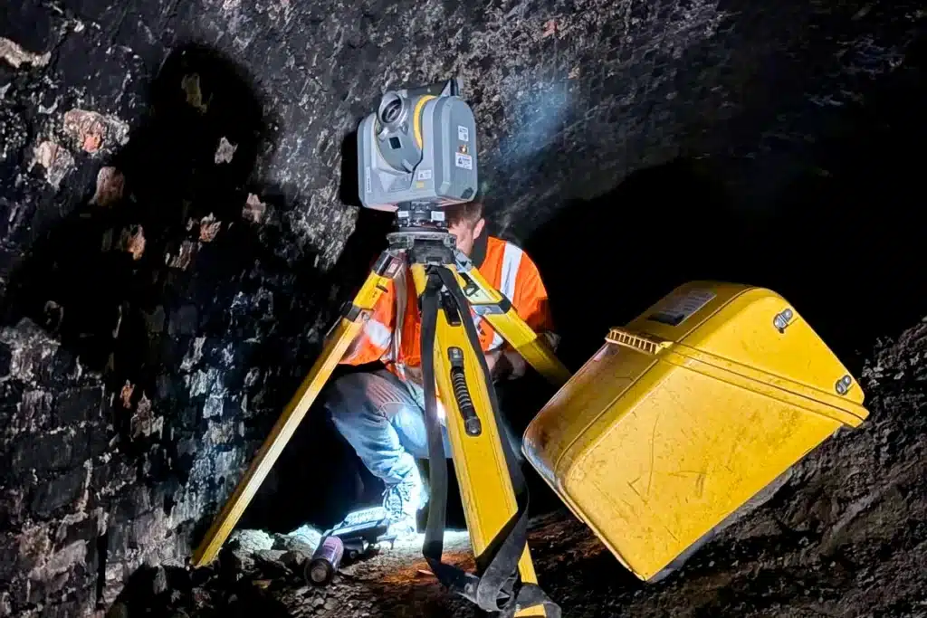
Our engineers bring their own Leica and CHCNAV robotic total stations, GPS rovers and digital levels. No equipment hire cost to you, no dependency on site equipment that may not be calibrated or available. The engineer arrives with everything they need to work independently from day one.
Programme aware
Our engineers understand construction programmes. They know what groundworks, RC frame, steelwork and drainage contractors need from a setting-out engineer — the right peg in the right place at the right time, without being the reason the programme waits. They work at the pace the programme demands.
Design literate
Our engineers work from 2D CAD drawings and 3D design models — Trimble, Topcon and Leica machine control file formats, AutoCAD drawings, Revit models. They extract the setting-out data from the design, check it for consistency and set it out on site. They flag conflicts between the design and the existing conditions before concrete is poured, not after.
Flexible engagement
We supply engineers on visiting arrangements — one or two days per week — for programmes where setting-out demand is periodic. We supply engineers on full-time placements for programmes where continuous presence is required. We cover short-term absences, programme peaks and specialist requirements at short notice. Tell us what your programme needs and we will match the right engineer and the right engagement to it.
What our setting-out engineers deliver
Setting out is not a single activity — it spans the full programme from initial control establishment through to final as-built verification. Our setting-out engineers deliver every stage.
Control check and verification
Before any setting-out begins, our engineers check the site control network for consistency and accuracy. If the control is wrong, every subsequent setting-out activity is wrong. We verify before we begin.
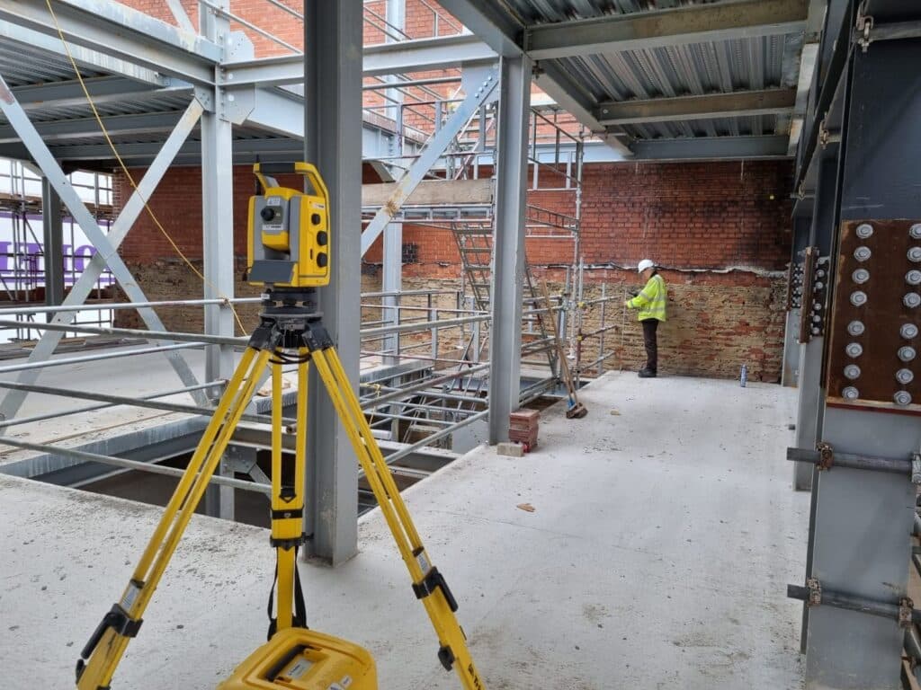
Foundation setting-out
Pile positions, pad foundations, strip foundations, raft slabs and basement structures. Setting-out to the tolerances the structural engineer has specified, with check measurements recorded and available to the project team.
Drainage and utilities setting-out
Sewer inverts, drainage gradients, chamber positions, pipe runs and connections. Getting drainage setting-out right protects the hydraulic design and prevents costly remediation when drainage surveys reveal falls that do not meet the specification.
Structural frame setting-out
Gridlines, column positions, beam centres and slab levels for steel and concrete frame structures. Co-ordinated with the structural engineer's drawings to ensure the frame goes in at the right position and at the right level.
Highway and road setting-out
Centreline, kerb lines, carriageway levels, junction geometry, visibility splays and horizontal and vertical alignment. We work directly from highway design CAD data and 3D models, setting out road geometry to the tolerances the highways engineer specifies.
External works and drainage
Plot boundaries, car park layouts, external drainage, soft landscaping positions and retaining structures. The finishing elements of a scheme that are often set out under programme pressure at the end of the build.
As-built survey and verification
Checking completed construction against the design at programme stages. Early identification of discrepancy before the next trade is on site is always more cost-effective than discovering it at handover.
Setting Out Across All Construction Types
Setting Out Across All Construction Types
Heavy civils and infrastructure
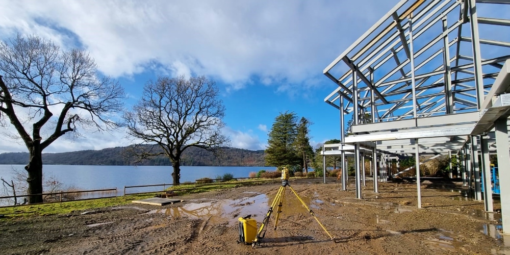
Highways, bridges, retaining structures, culverts, drainage infrastructure, earthworks and all associated setting-out. Our engineers are experienced in working on active construction sites alongside groundworks plant, piling rigs and civils contractors across the North West and nationally.
Housing and residential development
Plot setting-out, road layout, drainage, foundations and external works for housebuilders and residential developers across Lancashire and the North West. Housing setting-out requires precision, speed and the ability to work efficiently across multiple plots simultaneously.
Commercial and industrial construction
Steel frame, concrete frame, industrial units, logistics facilities, retail and mixed-use developments. Setting-out to the tolerances structural engineers require on commercial programmes where programme pressure is significant.
Education and public sector
Schools, healthcare facilities, civic buildings and public infrastructure. We understand the access constraints and occupant sensitivities of public sector construction environments.
Renewable energy and infrastructure
Turbine foundations, solar panel array setting-out, cable trench routes, substation setting-out and associated civils. Our engineers have delivered on renewable energy programmes across the North West and beyond.
Active transport and highways
kerb lines, centrelines, road markings, cycle infrastructure, junction geometry and pedestrian facilities on active transport and road improvement schemes across Lancashire and the North West.
Flexible Site Engineering Support
Flexible Site Engineering Support
We understand that projects require flexible support. That’s why we offer:
All personnel are fully equipped with the latest surveying technology and vehicles, ensuring seamless integration into your site operations.
Equipment & Technology
Equipment & Technology
Our setting out engineers are supported by modern surveying equipment including:
We can work directly from 2D drawings or 3D design models, ensuring accuracy and efficiency on site.
Why Professional Site Engineering Matters
Why Professional Site Engineering Matters
Professional site engineering services provide:
Our engineers work closely with site managers, project managers and design teams to ensure smooth delivery at every stage.
Our Services
How Setting-Out Integrates With Our Other Services
How Setting-Out Integrates With Our Other Services
Setting-out engineers work most effectively when the control network and the design data they are working from have been properly established. Site Surveying Services delivers all of the preceding activities as well as the setting-out itself — which means the engineer arriving on site has consistent, verified data to work from. Setting-out and control network installation is where we install the site control network before setting-out begins, the engineer works from a framework we have established, verified and documented. There is no uncertainty about the control quality and no risk that the engineer discovers a control problem on the day groundworks are due to start.
Topographical Surveys
OS-controlled accurate, efficient and cost effective surveys for highways, civils and development. Cad and BIM-ready output.
PAS 128 utility mapping
Providing the location of underground services in 2D or 3D through qualified utility mapping surveys, using advanced GPR and Electromagnetic Location.
Measured building survey
Delivering accurate as-built information that supports design, refurbishment, planning and construction with the latest technology. Producing reliable drawings and digital models.
Laser Scanning
3D laser scanners capture millions of points per second, creating a point cloud which enables the finer details and the physical site to be viewed remotely.
Mobile mapping
For highway engineers, infrastructure managers, local authorities and contractors working on live road schemes, mobile mapping is now the standard for corridor surveys.
3D Machine control
With decades of supporting major earthworks contractors and large-scale infrastructure schemes, we provide reliable machine control across Lancashire and the wider UK.
Setting out engineers
With strong, long-standing relationships across the civil engineering and construction sector, we supply skilled professionals who keep your projects accurate, efficient and on programme.
bathymetric surveys & river surveys
Using modern technology, we capture detailed underwater and river channel information safely and efficiently – delivering reliable data you can trust.
Stockpile surveys & volumetric analysis
Whether a one-off stockpile measurement or regular monitoring, we deliver reliable, repeatable data tailored to your project using advanced technology.
Control Network Installation
Delivering robust and precise site control systems to support every stage of construction in developments, infrastructure schemes or major earthworks.
aerial & drone surveys
CAA-approved drone operations for aerial mapping, photogrammetry and volumetric analysis, providing a comprehensive view of terrain, structures and landscapes.
3D BIM Modelling
Whether you require an as-built Revit model, federated coordination model or detailed digital twin, our team delivers high quality, design-ready outputs.
survey equipment hire
We offer a vast range of surveying and engineering equipment for hire and will always try to beat a comparable quote. Discover the fleet.
monitoring
Providing reliable monitoring surveys across the UK, delivering precise data that supports risk management, compliance and informed decision making throughout a project lifecycle.
Virtual Tour 3D
An immersive experience which instantly transports your clients to your business, guiding them through your space and creating a seamless experience.
Impermeable area surveys
We deliver georeferenced impermeable area data that drainage engineers and planning consultants can work from directly.
CCTV & Drainage surveys
Acoustic & Noise Assessments
We deliver acoustic and noise assessments, supporting planning applications, discharge of conditions and Environmental Impact Assessments.
Topographical Surveys
PAS 128 utility mapping
Measured building survey
Laser Scanning
Mobile mapping
3D Machine control
Setting out engineers
bathymetric surveys & river surveys
Stockpile surveys & volumetric analysis
Control Network Installation
aerial & drone surveys
3D BIM Modelling
survey equipment hire
monitoring
Virtual Tour 3D
Impermeable area surveys
CCTV & Drainage surveys
Acoustic & Noise Assessments
Why choose site surveying services
On site. On spec. On time.
Directly employed. Not agency.
Every engineer employed by Site Surveying Services. Our insurance, our standards, our accountability. One call to one firm when something needs resolving.
They bring their own kit.
Leica and CHCNAV robotic total stations and GPS rovers on every programme. No equipment hire cost. No dependency on site instrumentation that may not be calibrated.
They check before they set out.
The control network is verified before any setting-out begins. Design data is checked for consistency before it is used on site. Conflicts between design and existing ground are flagged.
Frequently Asked Questions
Frequently Asked Questions
What is setting out in construction?
Setting out is the process of transferring design data — from drawings or digital models — onto the physical ground, establishing the positions, levels and alignments from which construction is built. It is the link between what the designer has specified and what the contractor builds. Foundations, drainage, structural frames, road geometry, kerb lines and external works are all set out before construction begins. The accuracy of the setting-out determines the accuracy of everything built from it.
What is the difference between a setting-out engineer and a land surveyor?
Are your engineers directly employed or are they freelancers?
All our setting-out engineers are directly employed by Site Surveying Services. They are not freelancers placed by a labour agency. This matters for several reasons — our engineers carry our professional indemnity insurance, work to our quality standards, are accountable to us as well as to the client, and represent Site Surveying Services on your site. When something needs resolving, you call one number and speak to the people responsible. We do not subcontract our setting-out engineers to other firms.
What equipment do your engineers bring to site?
Our engineers are fully self-equipped. They bring their own Leica or CHCNAV robotic total stations, GPS GNSS rovers and digital levels. No equipment hire cost to you, no dependency on site equipment. On machine control programmes, our engineers are experienced in Trimble, Topcon and Leica machine control systems and carry the software required to load and verify designs. All equipment is regularly serviced and calibrated.
Can your engineers work from 3D design models as well as 2D drawings?
Yes. Our engineers work from both 2D CAD drawings and 3D design models as standard. They extract setting-out data from AutoCAD DWG, Trimble, Topcon and Leica design file formats, check it for internal consistency before site and set it out using the robotic total station or GPS system as appropriate. Where the design model contains conflicts or errors — discrepancies between drawings, co-ordination clashes, design levels that conflict with existing ground — our engineers identify them before concrete is poured and bring them to the attention of the project team.
What is a visiting engineer arrangement?
A visiting arrangement is where our engineer attends site on agreed days — typically one or two days per week — to carry out the setting-out required for that week’s programme. It is appropriate for programmes where setting-out demand is periodic rather than continuous — for example, a housing development where setting-out is required for each phase of groundworks but not every day. It is more cost-effective than a full-time placement when continuous presence is not required, and more reliable than calling in an engineer ad hoc when the programme demands it. We agree the visiting schedule at the start of the commission and adjust it as the programme evolves.
Can you cover short-notice requirements?
Yes — within the practical constraints of our programme commitments and the availability of the right engineer for your specific project type. We maintain a team of engineers across Lancashire and the North West and can typically respond to short-notice requirements faster than firms that rely on freelance networks. Call us directly if you have an urgent requirement and we will tell you honestly what we can do and when.
Do your engineers carry out as-built surveys?
Yes. As-built survey — checking completed construction against the design at programme stages — is a standard part of our setting-out service. Our engineers carry out as-built checks on foundations, drainage, structural frames and external works as part of the setting-out programme. Where a formal as-built record is required for the project documentation, we produce it in CAD format as an additional deliverable. Identifying discrepancies between as-built and design at programme stages is always more cost-effective than discovering them at handover or during a defects inspection.
What areas do you cover?
Our head office is in Clitheroe, Lancashire, with offices in Matlock, Newcastle and Bristol. We supply setting-out engineers across the North West, North East, Midlands and South West as primary territories, and nationally. In 2025 we delivered over 600 setting-out and site engineering programmes — across construction types from housing and commercial to major infrastructure and active transport. All engineers are directly employed and based across our office network.