

Land and engineering surveyors based in Lancashire
Monitoring Surveys
Monitoring Surveys Lancashire
Precise Monitoring Surveys Lancashire and the North West
Precise Monitoring Surveys Lancashire and the North West
When construction activity takes place near existing structures, live operational assets or sensitive ground, monitoring is the risk management tool that protects the programme, the structure and the people around it. Not optional. Not a preliminary task. The data produced by a monitoring survey tells us whether it is safe to continue operations and act before a problem becomes a catastrophic failure.
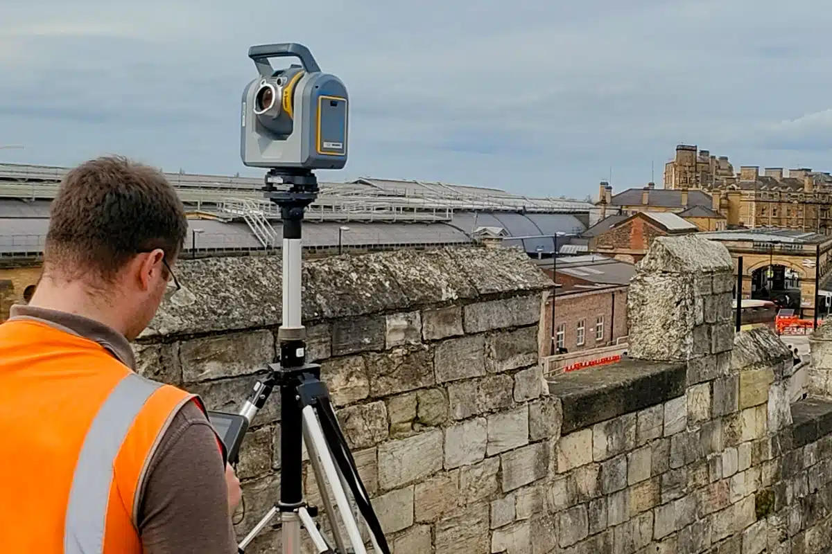
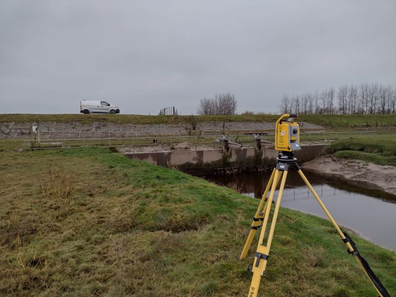
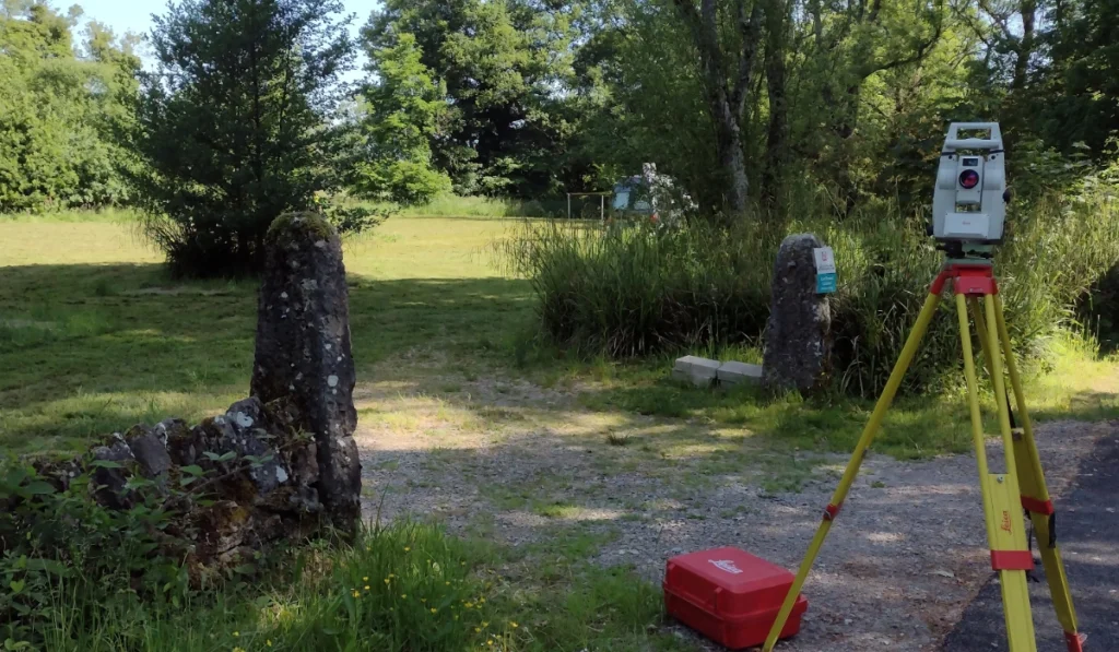
Site Surveying Services delivers precision structural and geotechnical monitoring across Lancashire, the North West and nationally. Using automated systems, precise levelling, total station instrumentation and fixed control networks, we detect movement accurately, provide real-time data where the programme requires it, and produce clear reporting that gives engineers, contractors and asset managers actionable information — not raw numbers in a spreadsheet. Our monitoring instrumentation has been deployed on live construction programmes across the North West and has detected and recorded seismic events across a wide area of Northern England — demonstrating the sensitivity and reliability of our systems well beyond the parameters of a standard construction monitoring programme. When the data matters, our instrumentation finds what needs to be found.

What is a Monitoring Survey?
What is a Monitoring Survey?
A monitoring survey involves the repeated measurement of fixed points to detect and quantify movement. These surveys are used to identify changes in position, level, or alignment, allowing potential issues to be identified early before they become costly or unsafe. The data collected provides clear evidence of whether movement is occurring, its magnitude, and whether it remains within acceptable limits.
Monitoring surveys can be carried out on:
What we capture
What Monitoring Surveys Protect
What Monitoring Surveys Protect
Types of Monitoring Surveys We Provide
Tracks movement in buildings, walls, bridges, and other structures during construction or excavation works.
Measures changes in ground levels, settlement, or heave caused by excavation, piling, or groundworks.
Monitors the development or widening of cracks within structures over time.
Provides a baseline record of existing conditions before works commence, protecting all parties involved.
Construction and infrastructure programmes that require monitoring include any situation where:
Excavation takes place adjacent to existing buildings
deep excavation for basements, piling, drainage installation and trenching all create ground movement risk for neighbouring structures. The magnitude of risk depends on excavation depth, proximity to structures, ground conditions and the structural sensitivity of what is adjacent.
Ground improvement or piling works are carried out
vibration from piling, dynamic compaction and ground treatment can cause settlement and cracking in nearby structures. Monitoring provides the evidence base that demonstrates whether vibration and settlement are within specification.
Tunnelling or underground construction takes place
TBM tunnelling, pipe jacking and microtunnelling all create predictable ground movement profiles. Monitoring verifies that actual movement matches predicted movement — and flags deviations before they become structural problems.
Structures are being retained during demolition or enabling works
retained facades, party walls and buildings being retained during redevelopment require monitoring throughout the programme to verify that temporary works are performing as designed.
Flood defence embankments are constructed or maintained
earth embankment flood defences require post-construction monitoring to verify that settlement and movement are within design parameters.
Infrastructure is operated near sensitive ground
highways, railways and utilities operating near slopes, embankments and structures all carry long-term monitoring requirements.
What We Measure & How
What We Measure & How
Settlement monitoring
Repeated precise levelling of fixed monitoring points — benchmark bolts, monitoring studs or survey nails — to detect vertical movement in structures, pavements, ground surfaces and infrastructure. Precise levelling achieves sub-millimetre accuracy in vertical movement detection and is the standard method for settlement monitoring adjacent to excavation and piling works. We establish a stable reference benchmark away from the influence zone and measure all monitoring points relative to it at each visit.
Structural movement monitoring
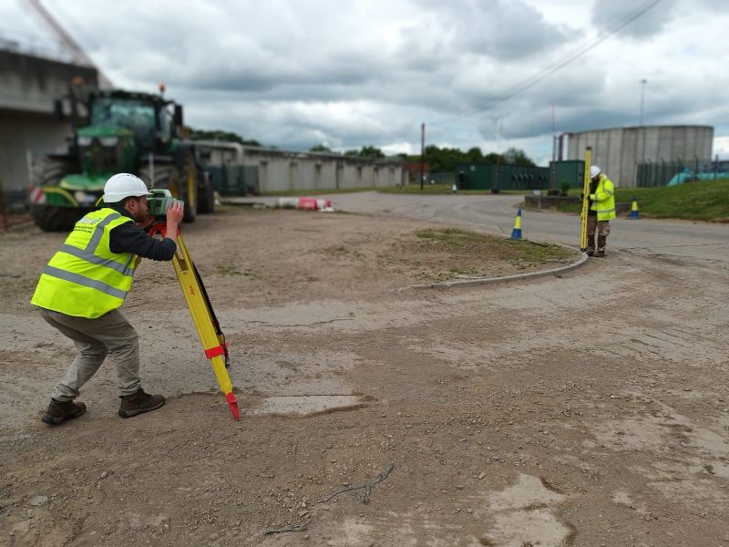
Total station monitoring of fixed targets — reflective prisms or survey targets — installed on structures, retaining walls, facades and other built elements. Total station monitoring detects both horizontal and vertical movement simultaneously, giving a complete three-dimensional picture of how a structure is moving. Ideal for retaining structures, facades, bridges and any structure where multi-directional movement is possible.
Tilt monitoring
Tilt sensors installed on structures or elements measure angular movement — rotation of walls, columns, retaining structures and bridge elements. Particularly valuable on retaining walls, where rotation at the top of the wall relative to the base is a key indicator of performance.
Crack monitoring
Calibrated crack monitoring gauges installed across existing cracks record change in crack width over time. Provides clear, defensible evidence of whether cracking is progressive — and whether it can be attributed to construction activity. Essential where pre-construction condition surveys have recorded existing cracking in adjacent properties.
Pre-construction condition surveys
Before monitoring begins, a thorough record of the existing condition of adjacent structures is essential — photographically and in writing, recording all existing cracks, defects, settlement and signs of distress. This baseline record protects the programme by establishing what pre-existed construction activity and what appeared during it. We produce pre-construction condition surveys as a standard part of all monitoring commissions.
Long-term asset observation
For infrastructure assets, heritage structures and flood defence works requiring observation over months or years rather than the duration of a construction programme — systematic monitoring at agreed intervals, producing a long-term record of movement and change.
Monitoring reports — what you receive
Every monitoring survey produces a clear, professional report designed to be immediately usable by engineers, project managers, contractors and their clients. Reports are delivered at agreed intervals — weekly, fortnightly, monthly or at programme milestones — and immediately if trigger levels are reached between scheduled visits.
Measured values at each monitoring point, compared against previous readings and trigger levels.
Time-series plots showing movement over the programme duration. The most effective way to identify whether movement is accelerating, stabilising or consistent with expected behaviour.
Monitoring point locations overlaid on site plans, with movement vectors where appropriate.
Clear statement of whether readings are within Alert, Action or Alarm thresholds, with recommended response where thresholds have been reached.
Plain language interpretation of the data, written for the engineer, project manager or client who needs to make a decision based on what the data shows. Not a raw data dump — a professional assessment.
Where required for design coordination or client reporting.
Land Surveying Services
Monitoring Surveys for Your Sector
Who commissions monitoring from us
Principal Contractors and CDM Principal Designers
Monitoring is frequently a condition of planning consent or a pre-condition of works adjacent to sensitive structures or utilities. We provide the monitoring programme, the pre-construction condition survey and the reporting structure that satisfies planning conditions and CDM pre-construction information requirements.
Civil engineers and geotechnical engineers
Commissioning monitoring to verify that ground movement during excavation, piling or dewatering is within the predicted and tolerable range. We work to the trigger levels and monitoring frequencies specified in the geotechnical design.
Infrastructure asset managers
Long-term monitoring of highways, flood defences, retaining structures, railway infrastructure and heritage assets. Regular, consistent measurement over extended periods producing a reliable record of movement and change.
Local authorities and public sector bodies
Insurance and legal professionals
Where structural damage has occurred and monitoring data is required as evidence of whether movement is progressive, stabilising or linked to a specific construction event.
Environmental & flood risk consultants
Long-term monitoring of flood defence embankments, watercourse banks and environmentally sensitive structures. Our instrumentation has detected seismic events across a wide area of Northern England — demonstrating the capability of our systems for sensitive environmental monitoring applications.
Monitoring Methods
Monitoring Methods
Survey frequency and accuracy levels are agreed at the outset to ensure the monitoring programme meets engineering, planning, or contractual requirements. We use accurate, surveying techniques, including:
Deliverables & Reporting
Deliverables & Reporting
Reports are designed to be easily understood by engineers, project managers, and stakeholders. Our monitoring surveys are supported by clear, professional reporting:
our monitoring survey case studies
Monitoring Equipment Detects Mini Earthquake — Lancashire and the Lake District
Our monitoring instrumentation detected and recorded seismic events across a wide area of Northern England — capturing data that demonstrated the precision and sensitivity of our systems operating at the limits of what structural monitoring instrumentation is expected to detect. The case study has become one of the most-read articles on our website, shared widely across the engineering and construction community in the North West. It is the clearest possible demonstration that when something moves, our equipment finds it.
Our Services
How Monitoring Surveys Integrate With Other Services
How Monitoring Surveys Integrate With Other Services
Every monitoring commission should begin with a pre-construction condition survey establishing the existing state of adjacent structures before works commence. The two are inseparable for a defensible monitoring programme. We deliver both as a single coordinated instruction. Monitoring and topographic surveys are where ground settlement across a wider area needs to be tracked alongside structural movement, combining precise monitoring of fixed points with periodic topographic survey of the ground surface gives a complete picture of how the ground is behaving across the full influence zone. Monitoring and control network installation is where all monitoring programmes depend on a stable reference benchmark away from the influence zone. We install and verify the reference network as part of every monitoring commission — not an add-on, a fundamental part of the monitoring methodology.
Topographical Surveys
OS-controlled accurate, efficient and cost effective surveys for highways, civils and development. Cad and BIM-ready output.
PAS 128 utility mapping
Providing the location of underground services in 2D or 3D through qualified utility mapping surveys, using advanced GPR and Electromagnetic Location.
Measured building survey
Delivering accurate as-built information that supports design, refurbishment, planning and construction with the latest technology. Producing reliable drawings and digital models.
Laser Scanning
3D laser scanners capture millions of points per second, creating a point cloud which enables the finer details and the physical site to be viewed remotely.
Mobile mapping
For highway engineers, infrastructure managers, local authorities and contractors working on live road schemes, mobile mapping is now the standard for corridor surveys.
3D Machine control
With decades of supporting major earthworks contractors and large-scale infrastructure schemes, we provide reliable machine control across Lancashire and the wider UK.
Setting out engineers
With strong, long-standing relationships across the civil engineering and construction sector, we supply skilled professionals who keep your projects accurate, efficient and on programme.
bathymetric surveys & river surveys
Using modern technology, we capture detailed underwater and river channel information safely and efficiently – delivering reliable data you can trust.
Stockpile surveys & volumetric analysis
Whether a one-off stockpile measurement or regular monitoring, we deliver reliable, repeatable data tailored to your project using advanced technology.
Control Network Installation
Delivering robust and precise site control systems to support every stage of construction in developments, infrastructure schemes or major earthworks.
aerial & drone surveys
CAA-approved drone operations for aerial mapping, photogrammetry and volumetric analysis, providing a comprehensive view of terrain, structures and landscapes.
3D BIM Modelling
Whether you require an as-built Revit model, federated coordination model or detailed digital twin, our team delivers high quality, design-ready outputs.
survey equipment hire
We offer a vast range of surveying and engineering equipment for hire and will always try to beat a comparable quote. Discover the fleet.
monitoring
Providing reliable monitoring surveys across the UK, delivering precise data that supports risk management, compliance and informed decision making throughout a project lifecycle.
Virtual Tour 3D
An immersive experience which instantly transports your clients to your business, guiding them through your space and creating a seamless experience.
Impermeable area surveys
We deliver georeferenced impermeable area data that drainage engineers and planning consultants can work from directly.
CCTV & Drainage surveys
Acoustic & Noise Assessments
We deliver acoustic and noise assessments, supporting planning applications, discharge of conditions and Environmental Impact Assessments.
Topographical Surveys
PAS 128 utility mapping
Laser Scanning
Mobile mapping
Setting out engineers
bathymetric surveys & river surveys
Control Network Installation
aerial & drone surveys
survey equipment hire
monitoring
Impermeable area surveys
CCTV & Drainage surveys
3D Machine control
Acoustic & Noise Assessments
Stockpile surveys & volumetric analysis
3D BIM Modelling
3D BIM Modelling
Virtual Tour 3D
Why choose site surveying services
On site. On spec. On time.
Immediate reporting. Not scheduled.
When readings approach or reach a trigger level, we report immediately — to the engineer and the contractor. Not at the next weekly visit. The early warning that only works if it is given in time to act.
Sub-millimetre vertical accuracy.
Precise levelling achieves sub-millimetre accuracy on settlement monitoring. The sensitivity that detects meaningful movement before it becomes a structural event — and, on one programme, detected a minor earthquake.
Pre-construction condition survey included.
Every monitoring commission begins with a documented baseline of adjacent structures before works start. The record that protects the programme before a third-party damage claim arises.
Trigger levels set by your engineer. Delivered to standard.
We implement the monitoring programme to the Alert, Action and Alarm levels your geotechnical or structural engineer specifies. We do not set our own thresholds. We deliver to yours.
Frequently Asked Questions
Frequently Asked Questions
What is a monitoring survey?
A monitoring survey involves the repeated measurement of fixed points to detect and quantify movement over time. The measurements are compared at each visit to identify whether movement is occurring, how much there is, in which direction it is occurring, and whether it is within acceptable limits. Monitoring surveys are used to protect structures, infrastructure and the public from the effects of ground movement during and after construction, and for long-term asset management of infrastructure that requires periodic observation.
When is monitoring required on a construction project?
Monitoring is required when construction activity creates a risk of movement in adjacent structures, ground or infrastructure. Common triggers include: excavation within the influence zone of existing buildings or utilities; piling or ground improvement works near sensitive structures; demolition adjacent to retained structures or party walls; tunnelling or pipe-jacking beneath or adjacent to buildings; and flood defence or earthworks construction where settlement of the new structure needs to be verified. It is also frequently a condition of planning consent for development adjacent to listed buildings, infrastructure or in areas of known ground sensitivity.
What is the difference between Alert, Action and Alarm trigger levels?
Monitoring programmes operate to three escalating trigger levels that define how the project team should respond when movement is detected. Alert level — the first threshold, indicating that movement is occurring and the monitoring frequency should be increased. Action level — movement has reached a point where the engineer needs to review the construction methodology and assess whether works should continue unchanged. Alarm level — movement has reached the point where work should stop and a structural assessment is required before proceeding. Trigger levels are set by the geotechnical or structural engineer based on the sensitivity of the adjacent structures and the predicted movement from the construction works.
How often do you visit for monitoring readings?
Monitoring frequency depends on the programme stage, the ground conditions, the rate of movement being recorded and the trigger level status. Typical frequencies range from weekly during active construction phases to monthly during lower-risk periods. Where movement is approaching trigger levels, we increase frequency and report immediately. For long-term asset monitoring, quarterly or six-monthly visits may be appropriate. We agree the frequency, the trigger levels and the escalation procedure with the engineer at the outset of every monitoring commission.
What is a pre-construction condition survey and why is it needed?
A pre-construction condition survey is a photographic and written record of the existing condition of structures adjacent to proposed works — recording all existing cracks, defects, settlement, distortion and any signs of pre-existing distress. It establishes a baseline before construction activity begins, which is essential for any subsequent assessment of whether damage has been caused by the construction programme. Without a pre-construction condition survey, it is impossible to demonstrate that damage to a neighbouring property occurred during construction rather than pre-existing it. We recommend a pre-construction condition survey as a standard part of all monitoring commissions.
Can you provide real-time or automated monitoring?
Yes. For programmes where manual periodic monitoring is not sufficient — high-risk excavations, rapid construction programmes, sensitive structures or infrastructure where continuous observation is required — we can deploy automated monitoring systems that take readings at set intervals and transmit data in real time. Automated monitoring is particularly appropriate for tunnelling and deep excavation adjacent to sensitive structures, where movement can occur rapidly. We advise on whether automated or periodic monitoring is appropriate for your specific programme at the time of scoping.
What accuracy do your monitoring surveys achieve?
Precise levelling achieves sub-millimetre accuracy in vertical movement detection — typically ±0.3–0.5mm on a well-established monitoring network. Total station monitoring achieves ±1–2mm in both horizontal and vertical movement detection depending on target distance and network geometry. These accuracy levels are appropriate for all standard construction monitoring applications. Where higher accuracy is required for sensitive structures or critical infrastructure, we confirm the achievable accuracy for your specific site and programme at the time of scoping.
What happens if readings reach a trigger level between scheduled visits?
We report immediately to the engineer and contractor when readings approach or reach trigger levels — we do not wait for the next scheduled visit. Our reporting protocol requires that Alert, Action and Alarm threshold events are communicated directly to the engineer on the day of measurement. We also increase monitoring frequency at Alert level as standard, without waiting to be asked. The purpose of monitoring is early warning. That only works if the warning is given in time to act.
How do you establish the monitoring reference benchmark?
The monitoring reference benchmark — the stable datum against which all monitoring point measurements are taken — must be located outside the influence zone of the construction activity and founded in stable ground. We select and install the reference benchmark as part of the monitoring commission set-up, verifying its stability by checking it against secondary benchmarks at each monitoring visit. A benchmark that moves invalidates all the monitoring data taken relative to it — getting this right at the start is fundamental.
Do you cover the whole of the UK?
Yes. Our head office is in Clitheroe, Lancashire, with offices in Matlock, Newcastle and Bristol. We deliver monitoring surveys across the North West, North East, Midlands and South West as primary territories, and nationally. All work is carried out by our directly employed team.