

Land and engineering surveyors based in Lancashire
Measured Building Surveys
measured building Surveys Lancashire and the North West
Accurate Measured Building Surveys Across the UK
Accurate Measured Building Surveys Across the UK
Before a building can be refurbished, extended, repurposed or accurately recorded, the existing conditions need to be established with precision. That means more than a rough floor plan. It means verified dimensions, accurate ceiling and floor heights, confirmed structural positions, correct window and door openings, and a complete record of the building fabric that the design team can work from without making assumptions.
Site Surveying Services delivers measured building surveys across Lancashire, the North West and nationally — for architects, project managers, heritage bodies, industrial facility managers, property developers and building surveyors who need accurate, usable building data delivered in the format their practice and design team works in. Based in Clitheroe, Lancashire, with offices in Matlock, Newcastle and Bristol, every measured building survey we produce is completed in-house — from site capture through to CAD and BIM output — by our directly employed team.
The survey team and the CAD team are the same organisation. The dimensions your architect receives have been checked against the scan data by the same people who captured it. There is no subcontractor in the chain, no handoff between survey and production, and no gap between what was captured on site and what is delivered to your practice.
What Is a Measured Building Survey?
What Is a Measured Building Survey?
A measured building survey is the process of capturing the precise geometry and layout of a building or structure. It records internal and external features to produce accurate drawings or 3D models for design and construction purposes.
Measured building surveys are essential for:
All surveys are completed to your specification, with expert guidance on the most efficient and cost-effective approach to achieve the deliverables you need.
What we capture
What a Measured Building Survey Delivers
What a measured building survey delivers
A measured building survey produces a detailed, accurate record of the existing building — its geometry, its layout, its dimensions and its physical condition — at the scale and accuracy your design stage requires.
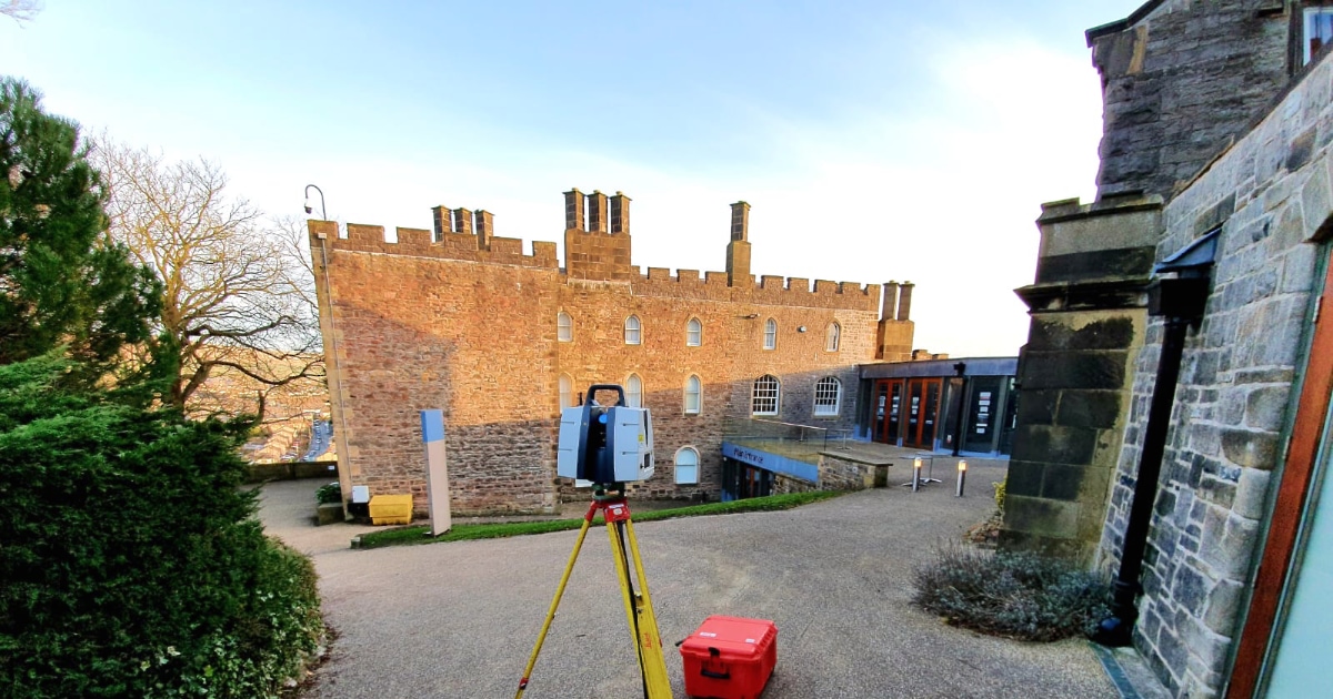
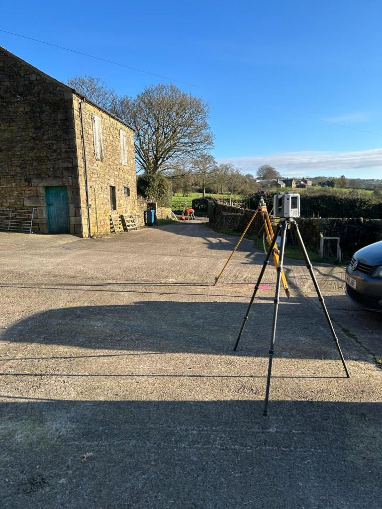
At Site Surveying Services we use 3D laser scanning as the primary capture methodology for all measured building surveys. This means the scan captures everything within the scanner’s field of view — not just the dimensions a traditional surveyor would manually measure, but every surface, every feature, every irregular geometry and every detail that the design team may need months later in the design process. From a single site visit, we capture data that would take days to record manually and that conventional tape survey cannot reliably reproduce on complex, irregular or heritage buildings.
We work closely with clients and project teams to ensure outputs meet design standards and integrate seamlessly into wider project workflows. All deliverables are produced with a full methodology statement confirming the equipment used, the accuracy achieved, the coordinate system and the date of survey.
What we capture on site
Our approach to measured building survey goes beyond the minimum required to produce a floor plan. We capture:
All floor levels
Floor surface levels at every change across the building, including step changes, ramps and level differences between rooms and spaces.
Ceiling heights
Confirmed ceiling heights in every space, including variations across the same room and differences between finished ceiling and structural soffit where relevant.
Structural elements
Columns, beams, lintels, structural walls and any exposed structural fabric that the design team needs to understand.
Building fabric
Wall thicknesses confirmed at every opening, reveals, splays, cornices, dado rails, skirtings and any architectural detail that matters for the design brief.
Confined and low-light spaces
Plant rooms, cellars, roof voids, attic spaces, service corridors and any area that a conventional tape survey team cannot safely or practically access. Laser scanning works in complete darkness and in spaces too small for a surveyor with a tape measure.
External context
External levels around the building, adjacent structures, boundaries, drainage and site features that provide the context the design team needs for extension and refurbishment design.
Internal floor plans
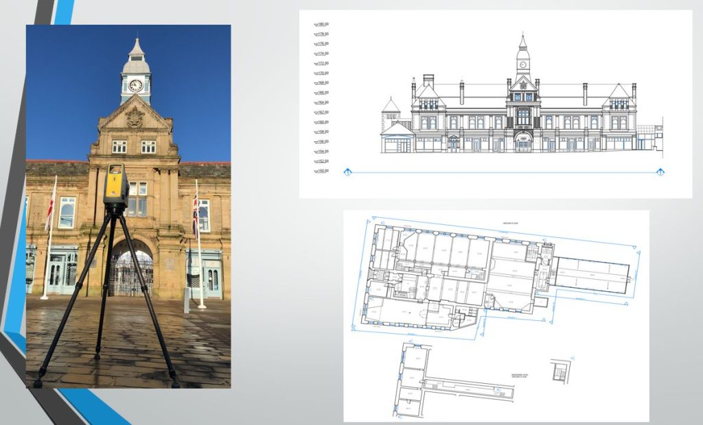
All rooms and spaces at every level of the building, including dimensions, internal walls, columns, structural elements, door and window openings, ceiling heights, floor levels and step changes. Produced to the scale and level of detail your architect requires — typically 1:50 or 1:100 for design, 1:20 for detail.
External elevations
All external façades including window and door positions, sill and head heights, string courses, rainwater goods, roof geometry and abutting features. Produced to scale, with or without photographic overlay depending on the project requirement.
Building sections
Longitudinal and cross-sections through the building showing the relationship between floor levels, ceiling heights, roof structure and structural elements.
Roof layout
Roof plan showing roof geometry, ridge and eaves levels, roof lights, plant, access hatches and drainage.
Street scene and façade drawings
For heritage applications, planning submissions and urban design work, showing the building in its streetscape context.
Lease plans
Accurately measured floor area plans for lease and tenancy purposes, produced to RICS Property Measurement standards.
Internal volume calculations
Where required for planning, building regulations or commercial purposes.
BIM and Revit models
3D models produced in-house from scan data to the LOD specified in your EIR, in Revit, AutoCAD or IFC format, ready for multidisciplinary coordination.
Point cloud dataset
Raw scan data in RCP, RCS, E57 or LAS format, available as an additional deliverable for practices that work directly from point cloud in their design software.
Latest Survey Technology & BIM Compatibility
Latest Survey Technology & BIM Compatibility
We pride ourselves on using the latest surveying technology to deliver accurate and efficient results. Our measured building surveys can be produced using:
Measured building surveys are essential for:
We pride ourselves on using the latest surveying technology to deliver accurate and efficient results. Our measured building surveys can be produced using:
Deliverables & Output Formats
Deliverables & Output Formats
Measured building survey deliverables typically include:
All deliverables are clearly structured, accurately layered and ready for immediate use by architects, engineers and contractors.
Applications of Measured Building Surveys
The measured building surveys we produce can be used for a wide variety of purposes, including:
Whatever your project type, we tailor the survey specification to suit your goals.
Building types we survey
We survey all building types across Lancashire, the North West and nationally. The specification and methodology are always matched to the building type and the design brief.
Commercial and office buildings
retail, office, mixed-use and commercial premises for refurbishment, fit-out, lease planning and development.
Heritage and listed buildings
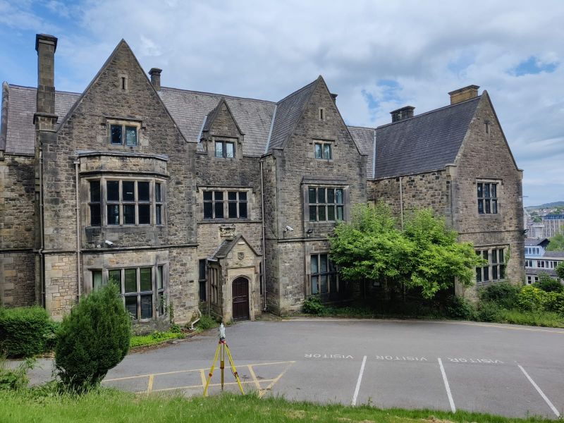
Grade I and II listed structures, historic buildings, Victorian commercial buildings, listed mills, ecclesiastical buildings and any structure where the existing fabric has significance beyond its functional geometry. Heritage surveys require particular care with access, with the level of detail captured and with the documentation produced.
Industrial and logistics facilities
factories, warehouses, process plant, cold stores and distribution facilities for as-built recording, retrofit planning, maintenance and expansion.
Education and healthcare
schools, universities, hospitals, GP surgeries and healthcare facilities for refurbishment, RAAC assessment, capital programme planning and estate management.
Public and civic buildings
civic centres, libraries, emergency services buildings and public infrastructure for refurbishment and asset management.
Residential — all scales
from individual houses and apartments through to residential estates, care homes and student accommodation.
Defence and security-critical estates
we have delivered measured building surveys at HMP Manchester, coordinating with site security and adapting to strict access protocols without incident. We understand what working in these environments requires.
Meeasured Building Surveys for Your Sector
Site Surveying Services delivers professional measured building surveys across a wide range of sectors. Our multidisciplinary experience allows us to adapt survey specifications to suit the technical requirements of each industry. Our experience across these sectors ensures we deliver the right level of detail – whether you require simple floor plans or fully coordinated BIM models. We regularly provide measured building surveys for:
our Topographical survey case studies
Darwen Market Hall — Surveying for Regeneration
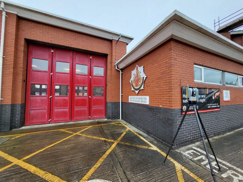
Eccles Fire Station Refurbishment
Full measured building survey and laser scan at a live fire station. Our team coordinated around operational shift patterns, emergency drills and vehicle movements — adapting the survey programme to the station’s operational requirements without disrupting a single callout. Complete internal and external building data captured in a single planned mobilisation. The architectural team received a complete, accurate measured building survey ready for the refurbishment design brief.
Our Services
How Measured Building Surveys Integrate With Other Services
How Measured Building Surveys Integrate With Other Services
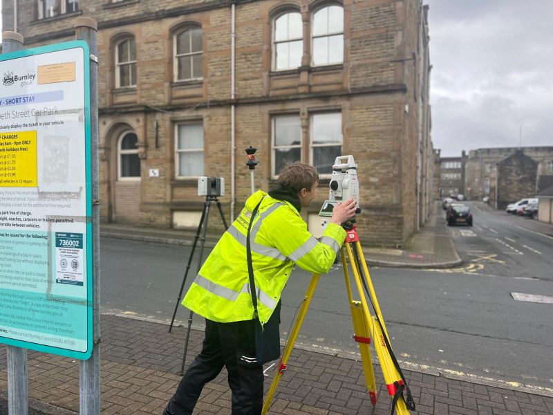
Measured building survey and topographic surveys are the most common combination for sites with existing structures. Building dimensions and ground levels in a single coordinated, georeferenced output. The design team has internal building data, external context, site levels and boundary information from one instruction. Our Burnley survey is a direct example of this integrated approach. Measured building survey and laser scanning which are not separate services. Our measured building surveys are produced using laser scanning as standard. The scan provides the raw data; our in-house CAD team produces the floor plans, elevations and sections from it. Where the client additionally needs the raw point cloud, we deliver both. where a BIM requirement exists, the measured building survey scope is built around your EIR from the first conversation. The scan data is processed in-house to produce a Revit model at the LOD your project specifies, coordinated and ready for structural and MEP disciplines to work from. Measured building survey and UAV surveys are for buildings with complex or inaccessible roof geometry, combining internal laser scanning with UAV-captured roof data produces a complete model of the building from foundation to ridge. Our Lancaster survey demonstrates this combined methodology.
Topographical Surveys
OS-controlled accurate, efficient and cost effective surveys for highways, civils and development. Cad and BIM-ready output.
PAS 128 utility mapping
Providing the location of underground services in 2D or 3D through qualified utility mapping surveys, using advanced GPR and Electromagnetic Location.
Measured building survey
Delivering accurate as-built information that supports design, refurbishment, planning and construction with the latest technology. Producing reliable drawings and digital models.
Laser Scanning
3D laser scanners capture millions of points per second, creating a point cloud which enables the finer details and the physical site to be viewed remotely.
Mobile mapping
For highway engineers, infrastructure managers, local authorities and contractors working on live road schemes, mobile mapping is now the standard for corridor surveys.
3D Machine control
With decades of supporting major earthworks contractors and large-scale infrastructure schemes, we provide reliable machine control across Lancashire and the wider UK.
Setting out engineers
With strong, long-standing relationships across the civil engineering and construction sector, we supply skilled professionals who keep your projects accurate, efficient and on programme.
bathymetric surveys & river surveys
Using modern technology, we capture detailed underwater and river channel information safely and efficiently – delivering reliable data you can trust.
Stockpile surveys & volumetric analysis
Whether a one-off stockpile measurement or regular monitoring, we deliver reliable, repeatable data tailored to your project using advanced technology.
Control Network Installation
Delivering robust and precise site control systems to support every stage of construction in developments, infrastructure schemes or major earthworks.
aerial & drone surveys
CAA-approved drone operations for aerial mapping, photogrammetry and volumetric analysis, providing a comprehensive view of terrain, structures and landscapes.
3D BIM Modelling
Whether you require an as-built Revit model, federated coordination model or detailed digital twin, our team delivers high quality, design-ready outputs.
survey equipment hire
We offer a vast range of surveying and engineering equipment for hire and will always try to beat a comparable quote. Discover the fleet.
monitoring
Providing reliable monitoring surveys across the UK, delivering precise data that supports risk management, compliance and informed decision making throughout a project lifecycle.
Virtual Tour 3D
An immersive experience which instantly transports your clients to your business, guiding them through your space and creating a seamless experience.
Impermeable area surveys
We deliver georeferenced impermeable area data that drainage engineers and planning consultants can work from directly.
CCTV & Drainage surveys
Acoustic & Noise Assessments
We deliver acoustic and noise assessments, supporting planning applications, discharge of conditions and Environmental Impact Assessments.
Topographical Surveys
PAS 128 utility mapping
Laser Scanning
Mobile mapping
Setting out engineers
bathymetric surveys & river surveys
Control Network Installation
aerial & drone surveys
survey equipment hire
monitoring
Impermeable area surveys
CCTV & Drainage surveys
3D Machine control
Acoustic & Noise Assessments
Stockpile surveys & volumetric analysis
3D BIM Modelling
3D BIM Modelling
Virtual Tour 3D
Why Choose Site Surveying Services for measured building surveys
On site. On spec. On time.
Laser scanning as standard. Not as an upgrade.
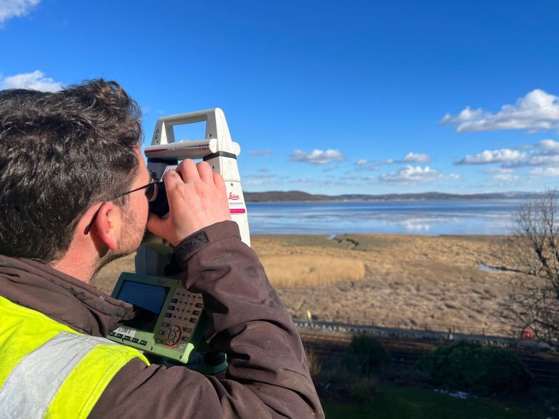
We use Trimble X7 and Leica instrumentation on every measured building survey. More accurate, faster and captures significantly more detail than tape survey.
In-house from survey to CAD.
Capture, processing, point cloud checking and CAD production by the same directly employed team. The dimensions your architect receives have been verified against the scan before delivery.
Every space. Including the ones nobody can reach.
Plant rooms, roof voids, confined spaces, low-light areas — the scan captures everything within its field of view. No area excluded because it was too difficult.
Frequently Asked Questions
Frequently Asked Questions
What is a measured building survey?
A measured building survey is a detailed, accurate record of the existing physical conditions of a building — its floor plans, elevations, sections, dimensions, ceiling heights, structural positions and building fabric detail. It is the base data from which architectural design, refurbishment, extension and heritage recording work proceeds. The accuracy of the survey determines the quality of every design decision that follows it.
What is the difference between a measured building survey and a floor plan?
A measured building survey is a detailed, accurate record of the existing physical conditions of a building — its floor plans, elevations, sections, dimensions, ceiling heights, structural positions and building fabric detail. It is the base data from which architectural design, refurbishment, extension and heritage recording work proceeds. The accuracy of the survey determines the quality of every design decision that follows it.
Do you use laser scanning for all measured building surveys?
Yes. We use 3D laser scanning as the primary capture methodology for all our measured building surveys. It is more accurate, faster and captures significantly more detail than traditional tape and offset methods — particularly on complex geometry, heritage buildings, industrial facilities and spaces with restricted or difficult access. The scan data is processed in-house by our CAD team to produce the floor plans, elevations and sections your practice requires.
What accuracy can I expect from a measured building survey?
Our measured building surveys are typically accurate to ±5–10mm for internal dimensions and external elevations. Where higher accuracy is required — for structural design, precision heritage recording or as-built verification — we can increase the specification and confirm the achievable accuracy for your specific building type at the time of scoping. Every survey is delivered with a methodology statement confirming the accuracy achieved.
What file formats do you deliver in?
We deliver measured building surveys in AutoCAD DWG, DXF, Revit and PDF formats as standard. Point cloud data is available in RCP, RCS, E57 or LAS format on request. If your practice uses a specific Revit version or requires a particular layer and naming convention, confirm this at the time of instruction and we will build it into the deliverable specification.
Can you deliver a Revit model from a measured building survey?
Yes. We produce Revit models in-house from laser scan data — structured to your EIR, at the LOD your project specifies, in the Revit version your practice uses. All modelling is completed by our directly employed team. The model is checked against the scan data before delivery — you receive a model that accurately represents the building as surveyed.
Do you survey listed and heritage buildings?
Yes — including sensitive access environments and buildings where the existing fabric requires particular care. Heritage buildings are some of the most important measured building survey applications — the scan captures the full complexity of irregular geometry, historic detailing and building fabric variation that conventional tape survey cannot reliably record. We have surveyed historic buildings across Lancashire and the North West including Victorian commercial buildings, listed market halls and ecclesiastical buildings. Our methodology for heritage survey is always agreed with the client before the site visit.
Can you survey occupied buildings?
Yes. We are experienced in surveying occupied buildings, live operational environments and sites with active programmes around the survey. We plan every site visit around the occupant’s requirements — adapting access timing, phasing the survey to minimise disruption and working around operational schedules. Eccles Fire Station and HMP Manchester are direct examples of this in demanding operational environments.
What information should I provide when commissioning a measured building survey?
The more information you provide at the outset, the better the survey will be scoped. Useful information includes: the building address and access arrangements, any existing drawings (even if inaccurate — they help us understand the building), the intended use of the survey data, the RIBA stage it needs to serve, the scale and accuracy required, the preferred deliverable format, any specific areas or features that need particular attention, and the programme timescale. If you are not sure what specification is appropriate for your project stage, tell us what the survey needs to support and we will advise.
Will the survey data be tied to OS National Grid?
All measured building surveys are set up on a local site grid derived from GPS observations tied to OS National Grid as standard — which means the building model can be accurately positioned in its site context and shared across structural, MEP and other disciplines from a common datum. If the project requires a specific coordinate system for BIM coordination purposes, confirm this at the time of instruction.
Do you cover the whole of the UK?
Yes. Our head office is in Clitheroe, Lancashire, with offices in Matlock, Newcastle and Bristol. We deliver measured building surveys across the North West, North East, Midlands and South West as primary territories, and nationally. All work is carried out by our directly employed team — not subcontractors.