


 Leeds
Leeds Doncaster
 Sheffield
 Bradford
 Hull
Hull Halifax
 Sunderland
 Newcastle
 Middlesborough
 Yorkshire Moors
 Teesside
 Cumbria
 Harrogate
 York
York Yorkshire Dales
 Northumberland
 Goole
Goole Carlisle
 Keswick
 Kendal
 Barrow-in-Furness
 Lancaster
 Blackpool
 Morecambe
 Southport
 Liverpool
 Wigan
Wigan Manchester
 Blackburn
 Burnley
 Forest of Bowland
 Oldham
 Chester
 Stockport
 Peak District
 Skipton
 Crewe
Crewe Rotherham
 Stoke
Stoke Driffield
Surveying Services North West
Site Surveying Services in Blackburn & Darwen, Lancashire
Based just 10 miles from Blackburn in Clitheroe, our team at Site Surveying Services is ideally placed to deliver fast, responsive survey support to clients operating across the borough — whether that’s a major public sector regeneration programme, a commercial development, or a heritage asset requiring careful 3D documentation.
We have delivered a wide range of surveying projects across Blackburn — from topographic surveys supporting active travel infrastructure to laser scanning of grade II listed buildings and NHS estates. Whatever your project requires, we bring the right technology, the right expertise, and the local knowledge to deliver it efficiently.
Our Surveying Services In Blackburn & Darwen
Topographic Surveys Blackburn & Darwen
detailed land and site surveys for planning applications, drainage design, and infrastructure projects
Measured Building Surveys Blackburn & Darwen
accurate floor plans, elevations, and sections for residential, commercial, and heritage properties
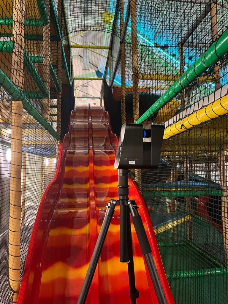
3D Laser Scanning Blackburn & Darwen
high-density point cloud surveys for BIM, renovation, asset management, and heritage recording
UAV / Drone Surveys Blackburn & Darwen
aerial data capture for large or complex sites, difficult access areas, and volume calculations
Sectors We Serve in Blackburn & Darwen
Our Blackburn project portfolio spans a broad range of sectors, reflecting the diversity of development and investment activity across the borough:
Public Sector & Local Authority Blackburn & Darwen
working with Blackburn with Darwen Borough Council and its partners on infrastructure and regeneration schemes
Healthcare Blackburn & Darwen
survey work on NHS estates including the Royal Blackburn Hospital
Heritage & Conservation Blackburn & Darwen
laser scanning and measured surveys of listed and historic buildings
Commercial & Retail Blackburn & Darwen
surveys supporting development, refurbishment, and asset management
Surveying Case Studies & Project Highlights in Blackburn & Darwen
Case Studies & Project Highlights
Active travel scheme
The primary objective of this topographical survey was to support the Active Travel Scheme aimed at improving cycle routes across the Southeast area of Blackburn, Lancashire. This initiative required precise and comprehensive data to facilitate the planning and development of enhanced cycling infrastructure.
Our team primarily used Leica TS16 total stations, known for their accuracy and reliability in capturing detailed topographical data.
To meet the high specifications of the project, we also deployed our advanced in-house laser scanners and UAVs. This combination ensured that even the finest details, such as road markings on heavily trafficked roads, were accurately captured.
The project’s specifications demanded a highly detailed survey, exceeding standard requirements. This necessitated the use of cutting-edge technology to ensure no detail was overlooked.
Laser Scanners were used to capture detailed, high-resolution 3D images of the survey area. The precision of laser scanning allowed us to gather data on intricate features that are often missed by traditional surveying methods.
Unmanned Aerial Vehicles (UAVs) provided aerial views and data collection from difficult-to-reach areas, significantly enhancing the comprehensiveness of the survey. This approach was particularly beneficial for mapping extensive and complex areas efficiently.
The integration of advanced technology enabled us to perform all survey activities during regular working hours. This approach minimised disruptions and avoided the need for costly and inconvenient out-of-hours work. By conducting surveys within normal working hours and using efficient technology, we achieved significant cost savings for our client, without compromising on the quality and detail of the survey.
Client details
Blackburn with Darwen Borough Council
service provided
Topographical Survey
Project timeline
110 days on site approx. 40 days in the office
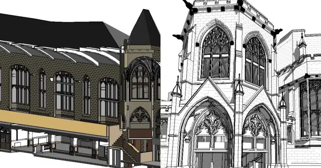
Blackburn Historic Scanning — Grade II Listed Exchange Building
3D Laser Scanning / BIM
Our team was engaged to carry out 3D laser scanning of Blackburn’s historic and grade II listed Exchange building — a former cinema of significant local character. The detailed scan data captured on site was subsequently used to produce a comprehensive BIM model, providing an accurate digital record of this important heritage asset to support future conservation and development decisions.
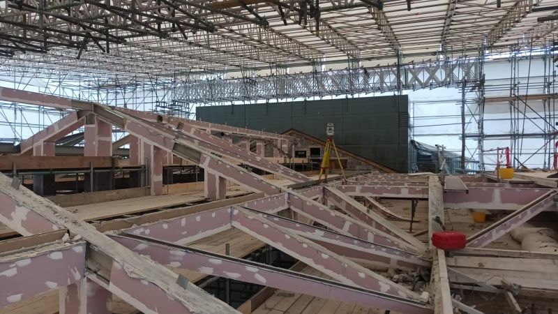
Royal Blackburn Hospital — Steel Frame Survey
3D Laser Scanning
A challenging but important commission: scanning the existing steel frame structure at the Royal Blackburn Hospital prior to its replacement. Working within a live hospital environment required careful coordination, with fire board removal forming part of the survey process. Our team navigated the complexity of the site efficiently, delivering the accurate structural data required to support the replacement programme.
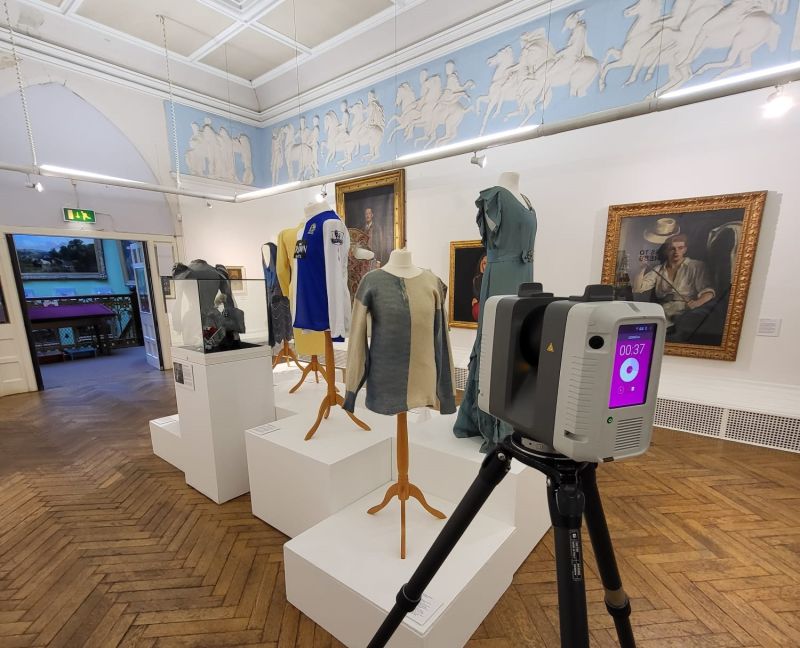
Blackburn Museum — Measured Building Survey
Measured Building Survey / 3D Laser Scanning
Our team completed a measured building survey at Blackburn Museum, capturing the external elevations using the RTC360 laser scanner. A beautiful example of civic Victorian architecture, the survey delivered precise, detailed data to support the ongoing management and potential future development of this much-loved community asset.
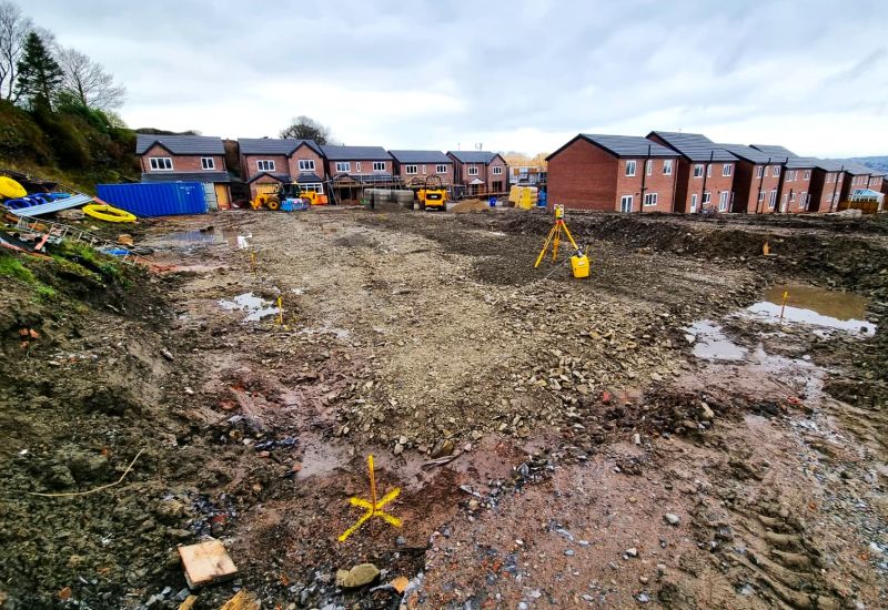
Blackburn Construction — Setting Out
Setting Out
Preparing clients for the next phase of development on site in Blackburn — our setting out service ensures that construction teams have the accurate spatial data they need before work begins, minimising the risk of costly errors and keeping programmes on track.
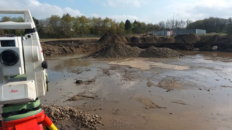
Old Gas Tower — Base Survey
Topographic / Structural Survey
Out on site in Blackburn surveying the base of an old gas tower — a reminder that no two days in surveying are the same. Industrial structures like this require careful approach and a methodical survey methodology to capture the data clients need safely and accurately.
Darwen Town Centre
measured building survey
Return commission on the market buildings. I’ve worked in a reference to the famous Peregrine Falcon sculpture in the town square which gives it a nice local flavour.

Darwen Digital Levelling & Virtual Tours 3D
Virtual Tour 3D
framed around the contrast of two completely different services on the same day, which is actually a great proof point for the breadth of capability. Also flags Virtual Tours 3D as a distinct service offering.
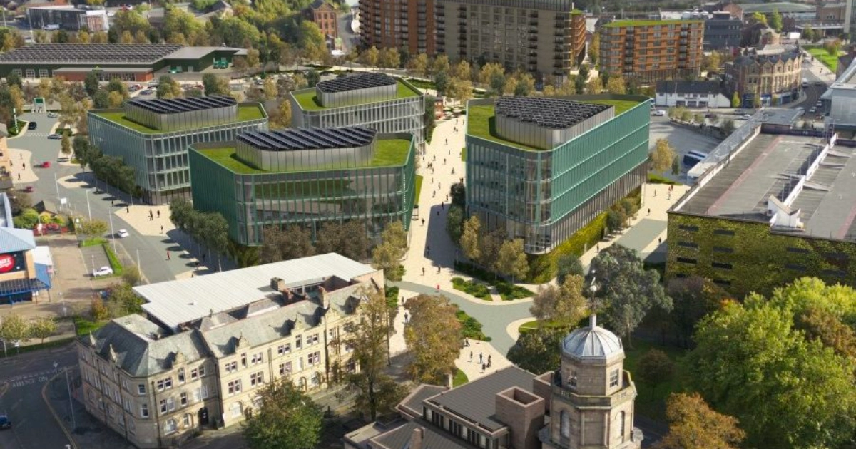
Blackburn's Development Landscape
Blackburn's Development Landscape
Blackburn is in the midst of one of the most ambitious urban regeneration programmes in the North West. The £250m Blackburn Town Centre Masterplan — underpinned by government Levelling Up investment — is transforming the heart of the borough, with plans encompassing a new nationally significant skills and education campus, urban living developments, a new hotel, and significant public realm improvements. Alongside the town centre masterplan, ongoing investment in active travel, heritage conservation, and the borough’s healthcare and education estates means there is sustained, long-term demand for high-quality survey services across Blackburn with Darwen. The borough’s planning framework is now guided by the Blackburn with Darwen Local Plan 2021–2037, adopted in January 2024 — the most up-to-date strategic planning document for development in the area.
Why Choose Site Surveying Services in Blackburn?
Why Choose Site Surveying Services in Blackburn?
Local presence
Based just 10 miles away in Clitheroe, we can mobilise quickly and respond rapidly to programme changes
Proven track record
We have delivered for Blackburn with Darwen Borough Council, the NHS, and private sector clients across the borough
Advanced technology
From UAV surveys and 3D laser scanning to GPR utility mapping, we bring the right tools to every project
Experienced team
Accredited surveyors with deep experience across heritage, infrastructure, commercial, and public sector work
No out-of-hours premium
Our technology-led approach often allows us to deliver complex surveys within standard working hours, reducing costs
Competitive, transparent pricing
No hidden costs, with quotations typically within 24 hours
Frequently Asked Questions
Frequently Asked Questions
How quickly can you mobilise for a survey project in Blackburn?
As we’re based in Clitheroe, just 10 miles from Blackburn town centre, we can typically mobilise within 24–48 hours of instruction for most project types. For urgent requirements, contact our team directly to discuss timescales.
Do you work with Blackburn with Darwen Borough Council?
Yes — we have direct experience working with Blackburn with Darwen Borough Council, including on the Active Travel Scheme topographic survey. We are familiar with the council’s specification requirements and procurement processes.
Can you survey listed and heritage buildings in Blackburn?
Absolutely. We have extensive experience surveying listed and historic buildings across Lancashire and beyond, including the grade II listed Exchange building in Blackburn. We use 3D laser scanning to capture highly accurate data with minimal physical intervention — ideal for sensitive heritage assets.
What types of surveys do you carry out for construction projects in Blackburn?
We support construction projects at every stage — from pre-planning topographic surveys and utility mapping through to setting out, monitoring, and as-built surveys. Our work on active travel infrastructure, commercial developments, and NHS estates in Blackburn reflects the breadth of construction-related survey services we offer.
Can you survey large or complex sites like highways or healthcare estates in Blackburn?
Yes. Our use of UAV (drone) survey technology alongside ground-based laser scanning and total stations means we are well equipped for large, complex, or difficult-access sites. The Active Travel Scheme survey — covering an extensive cycle route network across southeast Blackburn — is a good example of our capability on large linear and multi-site projects.
Do you provide BIM-ready survey data?
Yes. Our 3D laser scanning output can be delivered as point cloud data, processed into BIM-ready models, or converted to CAD drawings depending on your project requirements. We work to agreed specifications and can discuss the right output format for your project team.