


 Leeds
Leeds Doncaster
 Sheffield
 Bradford
 Hull
Hull Halifax
 Sunderland
 Newcastle
 Middlesborough
 Yorkshire Moors
 Teesside
 Cumbria
 Harrogate
 York
York Yorkshire Dales
 Northumberland
 Goole
Goole Carlisle
 Keswick
 Kendal
 Barrow-in-Furness
 Lancaster
 Blackpool
 Morecambe
 Southport
 Liverpool
 Wigan
Wigan Manchester
 Blackburn
 Burnley
 Forest of Bowland
 Oldham
 Chester
 Stockport
 Peak District
 Skipton
 Crewe
Crewe Rotherham
 Stoke
Stoke Driffield
Surveying Services North West
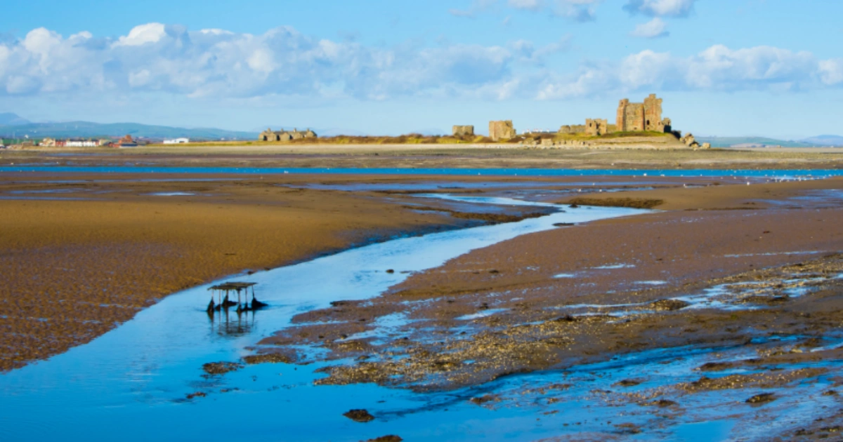
Site Surveying Services in Barrow-in-Furness, Cumbria
England — a place where maritime heritage, advanced manufacturing, and national defence converge on the southern tip of the Furness Peninsula. Home to BAE Systems’ submarine-building programme and the UK’s most important naval defence facility outside of the South Coast, Barrow is a town whose industrial and strategic importance continues to grow as investment in the UK’s submarine and defence capability accelerates.
It is also a town in the midst of genuine regeneration — with the Team Barrow partnership, £20 million of government Pride in Place investment targeting Old Barrow and Hindpool, and the Marina Village development unlocking new waterfront housing at the heart of the town. Barrow’s built environment presents a uniquely varied survey landscape: from live industrial and defence sites with strict access protocols to historic dock infrastructure, coastal and island locations, and an urban residential fabric in active regeneration.
Site Surveying Services has delivered professional surveying work in the Barrow-in-Furness area, including at one of the most historically remarkable project sites our teams have visited — the former World War II bomb testing site on Walney Island, now being repurposed as part of BAE’s expanding defence infrastructure. Based in Clitheroe, our North West survey teams are well placed to serve clients across Barrow and the wider Furness Peninsula.
Our Surveying Services in Barrow-in-Furness
We offer a comprehensive range of professional surveying services to clients in Barrow-in-Furness and across the Cumbrian coast:
Topographic Surveys Barrow-in-Furness
detailed land and site surveys for planning, infrastructure, coastal development, and industrial site assessments
Measured Building Surveys Barrow-in-Furness
floor plans, elevations, and sections for industrial, heritage, and residential buildings
3D Laser Scanning Barrow-in-Furness
high-density point cloud surveys for industrial structures, heritage assets, and complex building documentation
Utility Surveys & Mapping Barrow-in-Furness
underground service detection and mapping using GPR and electromagnetic equipment, essential for complex industrial and brownfield sites
Sectors We Serve in Barrow-in-Furness
Our Barrow project capability covers the town’s distinctive mix of defence, industrial, coastal, and regeneration activity:
Defence & Advanced Manufacturing Barrow-in-Furness
survey work on and adjacent to BAE Systems and associated defence infrastructure on the Furness Peninsula and Walney Island
Industrial & Marine Barrow-in-Furness
surveys for the docklands, marine engineering facilities, and heavy industrial sites that define Barrow's economy
Coastal & Island Barrow-in-Furness
surveys on Walney Island and along Barrow's coastline, accounting for tidal, access, and environmental considerations
Residential Regeneration Barrow-in-Furness
topographic and utility surveys supporting the Marina Village development and wider regeneration housing programmes
Infrastructure & Utilities Barrow-in-Furness
surveys for roads, utilities, and public realm works across the borough
Heritage & Conservation Barrow-in-Furness
surveys of Barrow's Victorian dock buildings, civic heritage, and the remarkable industrial archaeology of the Furness Peninsula
Case Study: WWII Bomb Testing Site, BAE — Walney Island
Case Studies & Project Highlights
Few survey projects carry quite the historical weight of this one. Our commission, delivered for Thomas Consulting, took our team to the former World War II bomb testing site at BAE, Walney Island — a place of significant industrial and military heritage on the tidal island off Barrow’s coast, now being repurposed as a firefighting facility for aircraft landing operations. The brief was precise: conduct a comprehensive topographic survey and utility mapping of the site to provide the spatial and subsurface data needed to inform the design and construction of the new facility. Two skilled surveyors were deployed to Walney Island to execute the survey with the precision and efficiency that a live defence estate demands.
Working on an active BAE site requires strict adherence to access protocols, security procedures, and method statements — an environment where preparation, professional conduct, and technical competence are non-negotiable. Our team delivered across all three, completing a thorough topographic survey of the site’s existing conditions alongside comprehensive utility mapping to identify and locate underground services ahead of construction works.
The resulting dataset gave Thomas Consulting and the project team a complete understanding of the site’s existing conditions — the essential foundation for designing and building a new firefighting facility on a site that has served defence purposes since the Second World War. A genuinely remarkable project, in a genuinely remarkable location.
Client details
Thomas Consulting
service provided
Topographic Survey & Utility Mapping
Project timeline
3 days on site / approx. 1 day in the office
Barrow's Development Landscape
Barrow's Development Landscape
Barrow-in-Furness is entering one of the most significant periods of investment and development in its recent history. The AUKUS submarine programme — in which Barrow plays a central manufacturing role — is driving sustained expansion of BAE Systems’ facilities and bringing with it substantial associated infrastructure investment across the town. Team Barrow, the council’s dedicated regeneration vehicle, is coordinating a broad programme of housing, public realm, and economic development improvements across the borough. The Marina Village development — backed by £24.8 million from Homes England — is unlocking a major waterfront housing site, while £20 million of government Pride in Place investment is targeting improvements in Old Barrow and Hindpool over the next decade. Barrow’s planning framework is currently guided by the former Barrow Borough Local Plan, which remains in place following the creation of Westmorland and Furness Council in April 2023. A new consolidated Westmorland and Furness Local Plan to 2045 is now in early preparation, which will eventually replace the legacy Barrow plan and cover the entire
Why Choose Site Surveying Services in Barrow-in-Furness?
Why Choose Site Surveying Services in Barrow-in-Furness?
Defence and industrial site experience
our Walney Island project demonstrates our capability and professionalism on live, security-sensitive defence and industrial sites
Island and coastal capability
experienced in working on Walney Island and along Cumbria's coast, accounting for access, tidal, and environmental conditions
Topographic and utility combined
delivering both services in a single mobilisation, reducing programme time and coordination overhead on complex sites
North West based
our Clitheroe team serves the whole of Cumbria and the North West, with the reach and resilience to mobilise to Barrow efficiently
Trusted by engineering consultants
working with specialist consulting firms on technically demanding commissions in demanding environments
Fast turnaround
three days on site at Walney Island, one day in the office. We deliver efficiently without compromising accuracy
Frequently Asked Questions
Frequently Asked Questions
Do you carry out surveys on live defence and industrial sites in Barrow?
Yes. Our Walney Island project at BAE was conducted on an active defence estate, requiring strict compliance with access protocols, security procedures, and site-specific method statements. Our team is experienced in working within security-sensitive environments and understands the standards expected on Ministry of Defence and major defence contractor sites.
Can you survey on Walney Island and other coastal or tidal locations near Barrow?
Yes. Walney Island and the wider Furness Peninsula coastline present specific survey challenges around access, tidal windows, and environmental sensitivities. Our team planned and executed the Walney Island commission efficiently, and we are well equipped for coastal and island survey work across the Cumbrian coast.
Do you carry out utility surveys on brownfield and industrial sites in Barrow?
Yes. Industrial and defence sites often have complex, poorly documented underground service networks. Our GPR and electromagnetic utility mapping capability provides detailed, reliable identification of buried services before any ground investigation or construction work begins — essential for safety and programme certainty on sites of this character.
Can you support the Marina Village and other regeneration projects in Barrow?
Yes. The Marina Village development and the wider regeneration programme across Barrow will generate substantial demand for topographic surveys, utility mapping, and setting out services. We are well placed to support developers, contractors, and consultants working on these schemes.
How do you manage working on restricted or security-sensitive sites?
Our team is experienced in preparing and submitting the method statements, risk assessments, and access documentation required for work on defence and security-sensitive sites. We plan site visits carefully, brief our surveyors thoroughly, and comply fully with all site-specific access and security requirements.