


 Leeds
Leeds Doncaster
 Sheffield
 Bradford
 Hull
Hull Halifax
 Sunderland
 Newcastle
 Middlesborough
 Yorkshire Moors
 Teesside
 Cumbria
 Harrogate
 York
York Yorkshire Dales
 Northumberland
 Goole
Goole Carlisle
 Keswick
 Kendal
 Barrow-in-Furness
 Lancaster
 Blackpool
 Morecambe
 Southport
 Liverpool
 Wigan
Wigan Manchester
 Blackburn
 Burnley
 Forest of Bowland
 Oldham
 Chester
 Stockport
 Peak District
 Skipton
 Crewe
Crewe Rotherham
 Stoke
Stoke Driffield
Surveying Services North West
Site Surveying Services in Lancaster, Lancashire
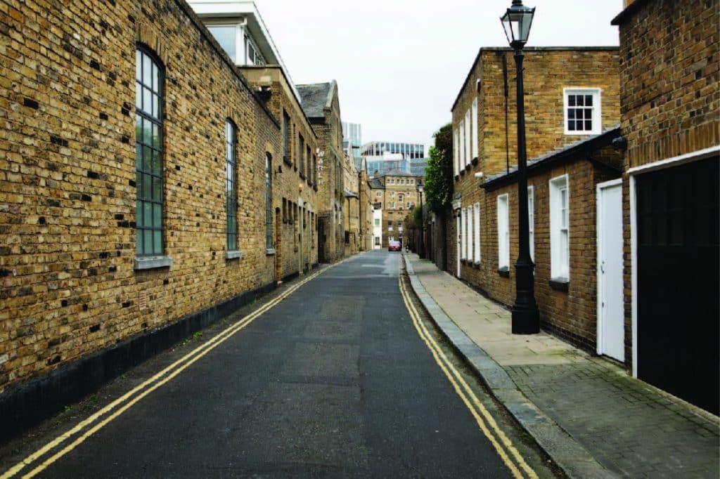
Lancaster is one of Lancashire’s most distinctive cities — a place defined by its extraordinary heritage, its Roman and medieval history, its position on the River Lune, and its role as a major education and cultural centre for the North West. With over 1,300 listed buildings, 38 conservation areas, 38 scheduled monuments, and a university campus that attracts students and researchers from across the world, Lancaster presents a surveying environment as rich and varied as anywhere in the region.
Based in Clitheroe — just 20 miles to the south — Site Surveying Services is the natural local choice for professional surveying in Lancaster and across North Lancashire. We have an extensive track record of delivering survey work across the city and district, from Grade II listed heritage buildings in Lancaster’s historic core to multi-discipline surveys at Lancaster University, river section surveys along the Lune and its tributaries, and coastal surveys along the nearby Morecambe Bay shoreline.
Whatever your project requires, our Lancaster-experienced team brings the technology, expertise, and local knowledge to deliver it accurately and on programme.
Our Surveying Services in Lancaster
We offer a comprehensive range of professional surveying services to clients across Lancaster and the wider district:
Topographic Surveys Lancaster
detailed land and site surveys for planning applications, drainage design, flood risk, and infrastructure
Measured Building Surveys Lancaster
precise floor plans, elevations, and sections for heritage buildings, commercial properties, university estates, and residential conversions
3D Laser Scanning Lancaster
high-density point cloud surveys using Leica RTC360 and other advanced scanners, for heritage recording, BIM, and complex structure documentation
UAV / Drone Surveys Lancaster
aerial data capture for heritage roofscapes, large university campuses, coastal and watercourse sites, and difficult-access structures
River & Watercourse Surveys Lancaster
cross-sections, longitudinal profiles, and flood risk topographic surveys along the River Lune, River Wyre, and their tributaries
Utility Surveys Lancaster
underground service detection and mapping using GPR, CAT & Genny across university campuses, commercial sites, and highways
Setting Out Services Lancaster
precise construction setting out for new-build, refurbishment, and civil engineering projects
Monitoring Surveys Lancaster
structural and ground movement monitoring for construction and heritage assets
Sectors We Serve in Lancaster
Our Lancaster project portfolio reflects the full breadth of the city and district’s development and estate management activity:
Heritage & Conservation Lancaster
surveys of Lancaster's exceptional stock of listed buildings, scheduled monuments, and historic structures
Higher Education Lancaster
multi-discipline survey packages for Lancaster University's extensive campus estate
Environmental & Watercourse Lancaster
river section surveys, flood risk surveys, and coastal survey support across the Lancaster district
Commercial & Residential Lancaster
surveys for commercial property, housing development, and mixed-use regeneration
Case Studies & Project Highlights
Case Studies & Project Highlights
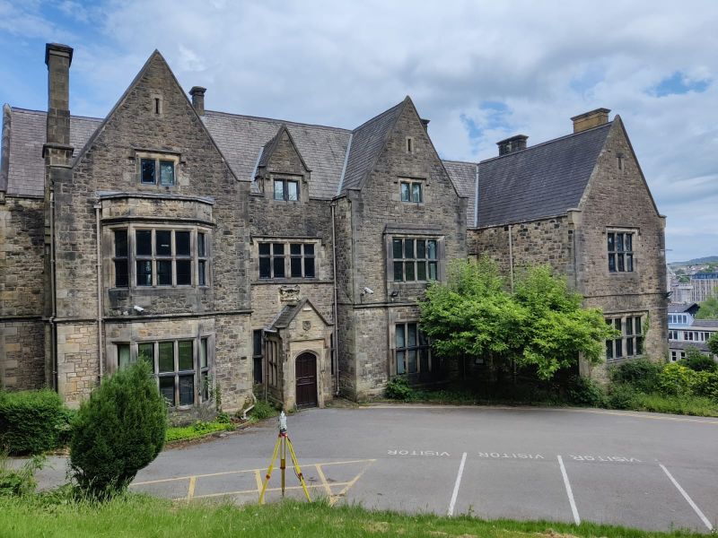
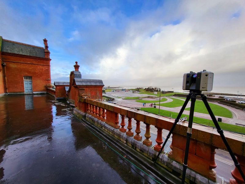
St Mary's Gate, Lancaster — Topographic, Measured Building Survey & UAV
Our team deployed the Leica RTC360 terrestrial scanner to capture precise measurements of the building’s interior and exterior, producing detailed 3D models that document the fine details and complex geometries typical of historic Lancashire architecture. The scanner’s capability ensured that nothing was overlooked — from decorative mouldings and irregular masonry to structural elements that would be difficult to measure by traditional means.
To complement the terrestrial survey, we deployed a Phantom 4K drone to carry out aerial surveys of the building, capturing high-resolution imagery and data from multiple angles to produce accurate roof plans and document upper-level features and hard-to-reach areas. The combination of ground-based scanning and aerial survey delivered a comprehensive, fully documented record of the building — indispensable for preservation planning and ensuring that any future renovation or restoration work remains faithful to the original design.
Client details
Alston and Donnelly Architecture
service provided
Topographic Survey, Measured Building Survey & UAV Survey
Project timeline
5 days on site / approx. 4.5 days in the office
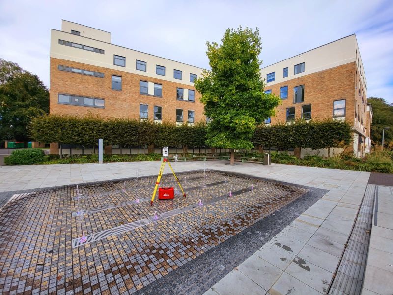
Lancaster University — Topographic, Utility Mapping & Measured Building Survey
Topographic Survey, Utility Mapping & Measured Building Survey
Lancaster University is one of the UK’s leading research universities, and its campus estate is one of the most significant in the North West — a large, complex site with a diverse mix of academic, residential, sports, and support buildings spread across an extensive landscape.
Our team has delivered multiple survey commissions at Lancaster University, providing topographic surveys, utility mapping, and measured building surveys across the campus. On our most recent visit, we deployed a near-complete fleet of survey equipment — total stations, laser scanners, UAV, and GPR utility detection — to deliver a comprehensive multi-discipline dataset in a single mobilisation, minimising disruption to the university’s busy campus environment.
Follow-on visits have tided into our previously established control stations, ensuring seamless data continuity across survey phases and avoiding the need for the university to commission separate survey control work. This efficient, coordinated approach is exactly what large, ongoing estate management programmes require.
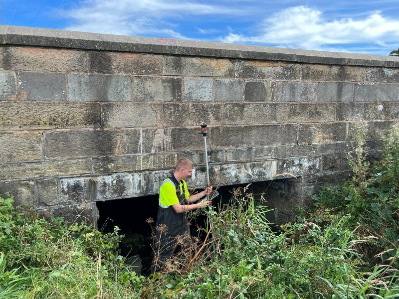
River Section Surveys — Lancaster
River Survey / Hydraulic Modelling Support
Our team has carried out multiple river section survey programmes across the Lancaster district, measuring cross-sections and structures along waterways feeding into and around the city. River survey work of this kind supports flood risk assessments, hydraulic modelling, and environmental management programmes — an important and regular part of our work across Lancashire’s river network.
With dozens of sections to capture and numerous structures to measure, Lancaster’s waterway network keeps our survey teams busy — and the team have been known to enjoy it rather too much.
Lancaster — Topography, Measured Building Survey & UAV Mapping
Topographic Survey, Measured Building Survey & UAV Mapping
A multi-discipline survey commission at a stunning historic property in Lancaster — combining topographic survey, measured building survey, and UAV mapping across a couple of days on site. Lancaster’s historic architecture never fails to impress, and this project was a reminder of why measured surveys of buildings like this matter: detailed, accurate data captured with care is the foundation on which good conservation and refurbishment decisions are made.
Eden Project North — Coming to Morecambe Bay
A significant moment for the wider Lancaster and Morecambe Bay area: the confirmed £50m Eden Project North development at Morecambe will be one of the most significant coastal regeneration projects in the North West, bringing a world-class visitor attraction to the Bay and transforming the economic prospects of the area.
Having already carried out survey work across the Morecambe Bay area — including at Morecambe Winter Gardens, which overlooks the Eden Project North site — we are well placed to support the survey requirements of this and other major investment projects in the Lancaster and Morecambe Bay corridor as they develop.
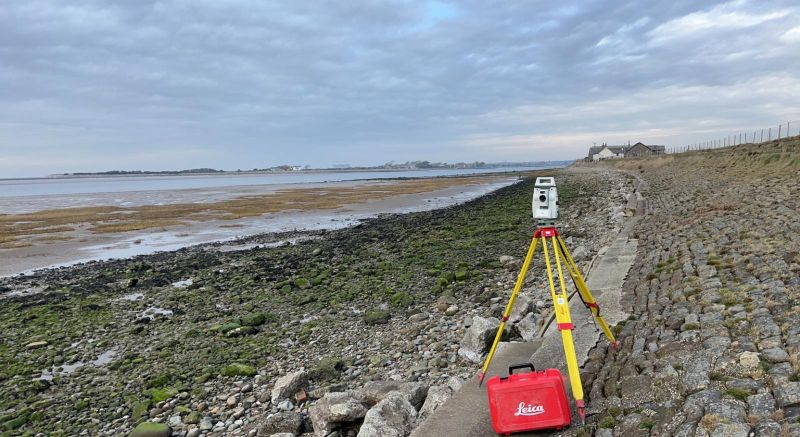
Cockersands — Coastal Survey
Coastal / Topographic Survey
A brisk day on the Lancashire coast at Cockersands — one of the most remote and atmospheric coastal locations in the Lancaster district, where the Lune estuary meets the Irish Sea at the foot of the Fylde peninsula. Our team carried out a survey here on behalf of our sister company, Tri-Tech — working along the shoreline in the kind of conditions that remind you why coastal survey work demands both good equipment and a certain resilience. As the team put it: surveying can be a right beach at times.
Cockersands is a site of significant historical and environmental interest — home to the ruins of Cockersands Abbey and bordered by the tidal flats and salt marshes of Morecambe Bay. Coastal surveys in environments like this require careful planning around tidal windows, access conditions, and environmental sensitivities, and our team delivered with the professionalism the location demands.
Lancaster's Development Landscape
Lancaster's Development Landscape
Lancaster is a city of substantial planning ambition, balancing the preservation of one of England’s richest historic environments with the need to deliver housing, employment, and infrastructure for a growing population and university community.
The city’s planning framework is guided by a freshly updated Local Plan — the Lancaster District Local Plan (Climate Emergency Local Plan Review), adopted on 22 January 2025. This updated plan incorporates strengthened climate change policies and sits alongside the existing Strategic Policies and Land Allocations DPD (adopted July 2020), forming the current development plan for the district.
A new full Local Plan is now in preparation, with a timetable approved by Cabinet in April 2025 — making this an active and evolving planning environment for developers and landowners to navigate.
Why Choose Site Surveying Services in Lancaster?
Why Choose Site Surveying Services in Lancaster?
Extensive local experience
from Grade II listed buildings and university campuses to river surveys and coastal sites, we know Lancaster's surveying landscape exceptionally well
Heritage specialists
Lancaster's listed building and conservation area density is among the highest in England; our team is experienced and equipped for it
Multi-discipline in one visit
as demonstrated at Lancaster University, we can combine topographic, measured building, utility, and UAV surveys in a single mobilisation, saving time and cost
River survey expertise
regular river section survey work across the Lancaster district and the wider Lancashire river network
Trusted by architects and universities
working with clients including Alston and Donnelly Architecture and Lancaster University
Just 20 miles away
fast mobilisation, no excessive travel costs, and genuine local presence
Frequently Asked Questions
Frequently Asked Questions
Do you survey Grade II listed and heritage buildings in Lancaster?
Yes — and Lancaster gives us plenty of opportunity to do so. Our St Mary’s Gate project is a strong example of our approach: Leica RTC360 scanning combined with drone survey to capture every detail of a complex historic building, producing data that architects and conservation specialists can rely on. Lancaster’s exceptional density of listed buildings means this is a core part of our local workload.
Can you carry out multi-discipline surveys at Lancaster University?
Yes. We have delivered topographic surveys, utility mapping, and measured building surveys at Lancaster University in single and phased mobilisations. For large campus estates, our ability to combine multiple survey disciplines efficiently — and tie into previously established control — makes us a cost-effective and low-disruption choice.
Do you carry out river section and flood risk surveys in Lancaster?
Yes. River cross-section surveys, longitudinal profiles, and structure surveys are a regular part of our work across the Lancaster district. We support hydraulic modelling, flood risk assessments, and environmental management programmes along the River Lune, River Wyre, and their tributaries.
Can you carry out UAV drone surveys in Lancaster's historic environment?
Yes. Our UAV survey capability is particularly valuable in Lancaster, where complex roofscapes, restricted access, and tall historic structures make aerial data capture essential for comprehensive surveys. We are experienced in deploying drones safely in urban historic environments and obtaining the necessary permissions.
Do you work with architectural practices in Lancaster?
Yes — our St Mary’s Gate project was delivered for Alston and Donnelly Architecture, and we work regularly with architectural practices across Lancashire and beyond, providing the survey data they need to support planning applications, listed building consent, and refurbishment design.
How quickly can you mobilise for a project in Lancaster?
Lancaster is approximately 20 miles from our Clitheroe base, typically 30–40 minutes’ drive. For most project types we can mobilise within 24–48 hours of instruction. Contact us directly for urgent requirements.