


 Leeds
Leeds Doncaster
 Sheffield
 Bradford
 Hull
Hull Halifax
 Sunderland
 Newcastle
 Middlesborough
 Yorkshire Moors
 Teesside
 Cumbria
 Harrogate
 York
York Yorkshire Dales
 Northumberland
 Goole
Goole Carlisle
 Keswick
 Kendal
 Barrow-in-Furness
 Lancaster
 Blackpool
 Morecambe
 Southport
 Liverpool
 Wigan
Wigan Manchester
 Blackburn
 Burnley
 Forest of Bowland
 Oldham
 Chester
 Stockport
 Peak District
 Skipton
 Crewe
Crewe Rotherham
 Stoke
Stoke Driffield
Surveying Services North West
Site Surveying Services in Kendal, Cumbria
Kendal is one of Cumbria’s most distinctive market towns — a historic wool and textile centre on the River Kent, sitting at the gateway to the Lake District National Park and the broader Westmorland countryside. Known for its grey limestone architecture, its thriving independent retail scene, and of course Kendal Mint Cake, the town is a popular destination for visitors heading into the Lakes and a vibrant commercial and residential centre in its own right.
As a gateway town to one of the UK’s most visited landscapes, Kendal sees consistent development activity across its hospitality, retail, commercial, and residential sectors. Site Surveying Services has delivered professional surveying work in Kendal — from a comprehensive multi-discipline survey package for the Premier Inn Kendal Central Hotel redevelopment to topographic surveys of the town’s retail parks — and our North West teams are well placed to serve clients across Kendal and the wider Westmorland and Furness area.
Whether your project is a hotel redevelopment, a retail survey, a heritage building assessment, or a residential scheme on Kendal’s edges, we bring the accuracy, technology, and responsiveness that Cumbria’s development market demands.
Our Surveying Services in Kendal
We offer a comprehensive range of professional surveying services to clients across Kendal and the wider Westmorland and Furness area:

Topographic Surveys Kendal
detailed land and site surveys for planning applications, retail and commercial development, drainage design, and infrastructure
Measured Building Surveys Kendal
precise floor plans, elevations, and sections for hotels, retail buildings, heritage assets, and residential properties
3D Laser Scanning Kendal
high-density point cloud surveys for complex buildings, heritage assets, and BIM production
Utility Surveys Kendal
underground service detection and mapping using advanced detection technologies, essential for hotel and commercial redevelopment projects
Sectors We Serve in Kendal
Our Kendal and Westmorland project experience covers the town’s distinctive mix of hospitality, retail, heritage, and residential activity:
Hospitality & Hotels Kendal
comprehensive multi-discipline survey packages for hotel redevelopment and conversion projects, including topographic, utility, and measured building surveys
Retail & Commercial Kendal
topographic surveys and measured building surveys for retail parks, town centre commercial properties, and mixed-use developments
Heritage & Conservation Kendal
surveys of Kendal's limestone heritage buildings, historic mill conversions, and the town's characteristic grey-stone urban fabric
Residential Development Kendal
topographic and utility surveys for housing schemes on Kendal's edges and across the wider Westmorland area
Tourism & Leisure Kendal
surveys supporting the development and management of visitor economy assets in the Lake District gateway area
Infrastructure Kendal
surveys for roads, utilities, and public realm improvements across the Kendal district
Surveying Case Studies & Project Highlights in Kendal
Case Studies & Project Highlights
Premier Inn Kendal Central Hotel — Topographic, Measured Building & Utility Survey
A comprehensive, multi-discipline survey commission, delivered for Allison Pike Partnership as part of the redevelopment of the Premier Inn Kendal Central Hotel. The project formed part of Whitbread’s larger programme to convert 112 of its owned restaurant sites into new Premier Inn Hotels — a significant national hospitality rollout adding 3,500 rooms to the Premier Inn network — with Kendal Central one of the key sites in this programme. The survey requirement was substantial, calling on our full team capability to deliver three integrated survey disciplines within a tight, efficient programme.
Topographic Survey:
Our topographic survey captured detailed information about the hotel site’s terrain and existing features — ground levels, contours, drainage patterns, and physical characteristics — providing the essential spatial baseline for the redevelopment’s layout and design. Every element of the site was accurately documented to ensure the architects and design team could plan the new development with complete confidence in the site data they were working from.
Utility Survey:
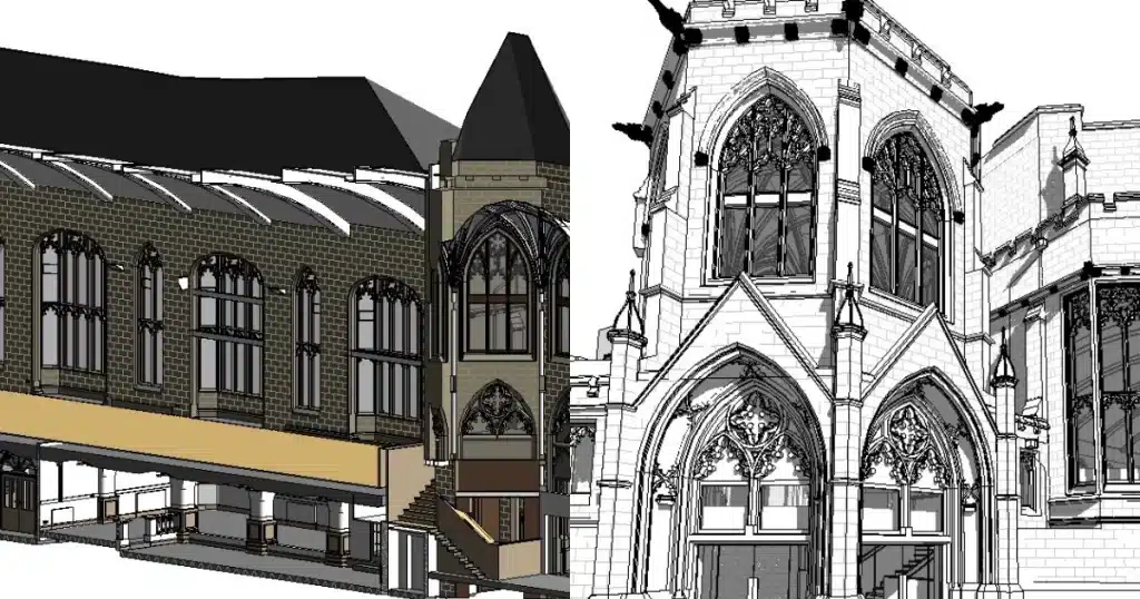
Measured Building Survey (Elevations):
Client details
Allison Pike Partnership
service provided
Topographic Survey, Measured Building Survey & Utility Survey
Project timeline
3 days on site / approx. 3.5 days in the office
Retail Park Topographic Survey, Kendal — Live Trading Environment
Topographic Survey
A topographic survey of a small retail park in Kendal — completed while the site was fully trading, working carefully around the general public and the day-to-day activities of our client’s tenants without causing any disruption to operations. Surveying live retail environments requires discipline, awareness, and efficient planning to ensure that survey equipment is positioned and moved without impacting footfall or trading. The site’s setting — in Kendal, on the edge of the Lake District — made it feel, as one of the team put it, “as if it was Mint to be.” Whether or not we stopped to do a bit of shopping remains unconfirmed.

Kendal's Development Landscape
Kendal's Development Landscape
Kendal is the principal town of the former South Lakeland district — now part of Westmorland and Furness Council since April 2023 — and sits at the heart of one of England’s most distinctive and environmentally sensitive local authority areas. The town’s gateway position makes it a natural hub for the tourism, hospitality, and outdoor leisure economy, while its role as a market town and service centre drives steady residential and commercial development demand. Kendal’s planning framework is currently guided by the South Lakeland Local Plan, which remains in force as the legacy document for this area following the creation of Westmorland and Furness Council. A new consolidated Westmorland and Furness Local Plan to 2045 is now in early preparation, which will eventually replace the South Lakeland and other legacy plans across the council area.
Note: while Kendal sits at the gateway to the Lake District National Park, the town itself falls outside the National Park boundary and is subject to Westmorland and Furness Council’s planning authority, not the Lake District National Park Authority.
Why Choose Site Surveying Services in Kendal?
Why Choose Site Surveying Services in Kendal?
Multi-discipline hospitality experience
the Premier Inn Kendal Central commission demonstrates our capability delivering integrated topographic, utility, and measured building survey packages for major hotel redevelopment projects
Live retail surveying
experienced in working efficiently around trading retail environments without disrupting client operations or the public
Gateway to Cumbria
our North West base and M6/A6 connectivity puts us within easy reach of Kendal and the wider Westmorland and Furness area
Tourism and hospitality sector expertise
working with the architects and consultants who serve the Lake District gateway's visitor economy
Competitive, transparent pricing
no hidden costs, quotations typically within 24 hours
Responsive team
fast mobilisation for Cumbrian projects, with the flexibility to schedule efficiently around live commercial operations
Frequently Asked Questions
Frequently Asked Questions
Do you carry out surveys for hotel development and redevelopment projects in Kendal?
Yes — and our Premier Inn Kendal Central Hotel commission is our most detailed example from the town. We delivered topographic, utility, and measured building surveys as a fully integrated package for Allison Pike Partnership, supporting the hotel’s redevelopment as part of Whitbread’s national conversion programme. We are experienced in working with hospitality architects and project managers on hotel development surveys.
Can you carry out topographic surveys on live retail sites in Kendal?
Yes. Our Kendal retail park survey was completed while the site was fully trading, navigating around public footfall and tenant operations without disruption. Live retail environments require efficient planning and careful on-site management, and our team is experienced in delivering surveys in occupied commercial settings.
Do you carry out utility surveys for construction and redevelopment projects in Kendal?
Yes. Underground utility mapping is an essential component of any redevelopment project involving excavation, and we use advanced detection technologies to locate and map buried services across development sites in Kendal and across Cumbria. Our Premier Inn project included utility mapping as part of the integrated survey package.
Is Kendal within the Lake District National Park for planning purposes?
No — Kendal itself falls just outside the Lake District National Park boundary and is within Westmorland and Furness Council’s planning authority area. The Lake District National Park Authority covers the park area to the north and west. Developments in Kendal are therefore subject to Westmorland and Furness planning policies rather than National Park policies, though proximity to the National Park boundary is a material planning consideration for many sites on the town’s edges.