


 Leeds
Leeds Doncaster
 Sheffield
 Bradford
 Hull
Hull Halifax
 Sunderland
 Newcastle
 Middlesborough
 Yorkshire Moors
 Teesside
 Cumbria
 Harrogate
 York
York Yorkshire Dales
 Northumberland
 Goole
Goole Carlisle
 Keswick
 Kendal
 Barrow-in-Furness
 Lancaster
 Blackpool
 Morecambe
 Southport
 Liverpool
 Wigan
Wigan Manchester
 Blackburn
 Burnley
 Forest of Bowland
 Oldham
 Chester
 Stockport
 Peak District
 Skipton
 Crewe
Crewe Rotherham
 Stoke
Stoke Driffield
Helping farms, estates and rural projects make informed, data-driven land management decisions.
Rural and Agriculture Surveying
Rural and agricultural survey is different from construction survey in one fundamental respect — the consequences of getting it wrong are not measured in programme days and variation costs. They are measured in land that cannot be sold, developed or managed as intended for years. A boundary dispute that a properly executed topographic survey would have prevented. A drainage scheme that failed because the survey did not capture the watercourse accurately enough. A farm diversification planning application refused because the survey submitted with it was not tied to OS National Grid and the LPA could not overlay it with their own mapping.
Site Surveying Services is based in Clitheroe, at the heart of the Ribble Valley — one of the most productive and varied agricultural landscapes in northern England. The Ribble Valley, the Forest of Bowland, the Fylde coast, the Lune Valley, the Lancashire Pennine foothills and the fringes of Cumbria are our home territory. We survey the landscapes we live in — and we understand what the landowners, farmers, estate managers, rural planners and agricultural consultants who work in them need from a survey firm.
Surveying for Rural & Agricultural Projects
Surveying for Rural & Agricultural Projects
Boundaries often stretch across varied terrain, infrastructure can be limited, and land use has to balance productivity, biodiversity and sustainability. Whether it’s planning a new agricultural building, upgrading drainage or assessing flood risk, reliable site data is essential to ensure every decision is grounded in fact and not assumption.
Why Accuracy Matters...
For landowners and rural developers, accuracy underpins efficiency, safety and long-term value:
Plan with
confidence
clear site data supports effective design and planning approval.
Protect the landscape
ensure drainage, irrigation and access routes work in harmony with the environment.
Avoid
disputes
verified boundaries and features prevent costly legal or neighbour issues.
Maximise yield and investment
accurate terrain models and mapping inform smarter land management decisions.
Technology That Delivers Precision
Technology That Delivers Precision
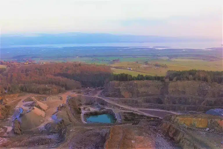
…the CHC i73 GNSS, RS10 SLAM Scanner and Trimble X7 Laser Scanner means we can capture data quickly and accurately, even in remote or uneven terrain. Drone photogrammetry and LiDAR surveys allow rapid mapping of large rural areas with minimal environmental impact.
The Rural and Agricultural Sector in Lancashire and the North West
The Rural and Agricultural Sector in Lancashire and the North West
Rural Lancashire and the surrounding region present a wide and varied survey demand — driven by agricultural change, Environmental Land Management, rural development pressure and the ongoing management of the landscape itself.
Environmental Land Management Schemes (ELMS)
The replacement for the Basic Payment Scheme creates significant demand for accurate land area measurement, habitat baseline mapping and boundary survey. ELM agreements require landowners to demonstrate the extent and condition of habitats being managed under the scheme. Survey data that accurately records field boundaries, habitat types and land areas is fundamental to scheme applications, monitoring requirements and compliance evidence.
Farm diversification and rural development
Barn conversions, holiday lets, solar farms, glamping sites, farm shops and rural business development all require topographic survey and measured building survey for planning applications. The North West’s tourism economy creates sustained demand for rural conversion and diversification projects, each of which requires accurate site data before the planning application is submitted.
Agricultural drainage and flood management
drainage improvement on farmland, management of field drainage systems, flood risk on agricultural land and the integration of farmland into catchment-scale flood management all require accurate topographic survey, watercourse survey and in some cases bathymetric data. The catchments of the Ribble, the Lune, the Wyre and the Hodder all carry active drainage and flood management programmes on agricultural land.
Estate and land management
Large rural estates require periodic survey for estate management, planning, development appraisal and land transaction purposes. Boundary surveys, topographic surveys of development land parcels and measured building surveys of estate buildings are all regular commissions.
Renewable energy on agricultural land
Solar farm development on agricultural and brownfield rural sites is active across Lancashire and the North West. Topographic survey at site selection, UAV LiDAR for large-area terrain modelling, PAS 128 utility mapping along grid connection cable routes and as-built survey at completion are all required.
Rural planning and development
Local planning authorities across the North West assess rural development proposals against landscape character, flood risk and ecological sensitivity. Survey data that is OS-controlled, georeferenced and methodologically documented is the standard that planning authorities expect when making these assessments.
Our Services
Using LiDAR, UAVs, and hydrographic drones to capture precise data in challenging environments.
Topographical Surveys
OS-controlled accurate, efficient and cost effective surveys for highways, civils and development. Cad and BIM-ready output.
PAS 128 utility mapping
Providing the location of underground services in 2D or 3D through qualified utility mapping surveys, using advanced GPR and Electromagnetic Location.
Measured building survey
Delivering accurate as-built information that supports design, refurbishment, planning and construction with the latest technology. Producing reliable drawings and digital models.
Laser Scanning
3D laser scanners capture millions of points per second, creating a point cloud which enables the finer details and the physical site to be viewed remotely.
Mobile mapping
For highway engineers, infrastructure managers, local authorities and contractors working on live road schemes, mobile mapping is now the standard for corridor surveys.
3D Machine control
With decades of supporting major earthworks contractors and large-scale infrastructure schemes, we provide reliable machine control across Lancashire and the wider UK.
Setting out engineers
With strong, long-standing relationships across the civil engineering and construction sector, we supply skilled professionals who keep your projects accurate, efficient and on programme.
bathymetric surveys & river surveys
Using modern technology, we capture detailed underwater and river channel information safely and efficiently – delivering reliable data you can trust.
Stockpile surveys & volumetric analysis
Whether a one-off stockpile measurement or regular monitoring, we deliver reliable, repeatable data tailored to your project using advanced technology.
Control Network Installation
Delivering robust and precise site control systems to support every stage of construction in developments, infrastructure schemes or major earthworks.
aerial & drone surveys
CAA-approved drone operations for aerial mapping, photogrammetry and volumetric analysis, providing a comprehensive view of terrain, structures and landscapes.
3D BIM Modelling
Whether you require an as-built Revit model, federated coordination model or detailed digital twin, our team delivers high quality, design-ready outputs.
survey equipment hire
We offer a vast range of surveying and engineering equipment for hire and will always try to beat a comparable quote. Discover the fleet.
monitoring
Providing reliable monitoring surveys across the UK, delivering precise data that supports risk management, compliance and informed decision making throughout a project lifecycle.
Virtual Tour 3D
An immersive experience which instantly transports your clients to your business, guiding them through your space and creating a seamless experience.
Impermeable area surveys
We deliver georeferenced impermeable area data that drainage engineers and planning consultants can work from directly.
CCTV & Drainage surveys
Acoustic & Noise Assessments
We deliver acoustic and noise assessments, supporting planning applications, discharge of conditions and Environmental Impact Assessments.
Topographical Surveys
PAS 128 utility mapping
Laser Scanning
Mobile mapping
Setting out engineers
bathymetric surveys & river surveys
Control Network Installation
aerial & drone surveys
survey equipment hire
monitoring
Impermeable area surveys
CCTV & Drainage surveys
3D Machine control
Acoustic & Noise Assessments
Stockpile surveys & volumetric analysis
3D BIM Modelling
3D BIM Modelling
Virtual Tour 3D
Why choose site surveying services
On site. On spec. On time.
Remote UAV survey. No ground disturbance.
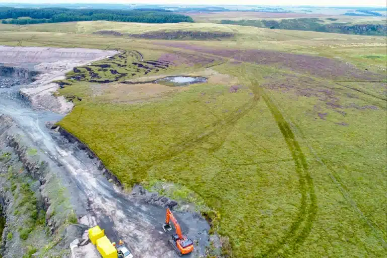
SSSI watercourses, wetland habitats and sensitive agricultural land surveyed from the air without disturbing the ground surface or the ecology beneath. The survey methodology that ecologists and environmental managers specify on sensitive rural sites.
Permanent datums for land management programmes.
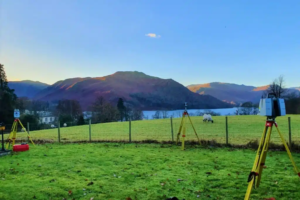
We install permanent ground markers on rural survey commissions where the client anticipates return visits — ensuring boundary surveys, drainage surveys and topographic datasets can be extended and updated at the same datum over time.
Planning-ready data for barn conversions and diversification.
OS-controlled, georeferenced, dated measured building surveys and topographic surveys that meet the standard Lancashire and North West LPAs require for rural development applications. The data that satisfies the planning officer first time.
Frequently Asked Questions
Frequently Asked Questions
What survey do I need for a barn conversion planning application?
A measured building survey of the existing building — floor plans, elevations and sections at a scale appropriate for the planning application — is the minimum required for most barn conversion applications. For larger conversions or buildings with complex geometry, laser scanning produces a more accurate and complete record than tape survey. For applications involving listed buildings, the survey may need to capture additional detail for the heritage officer. A topographic survey of the surrounding land and access is also typically required to show the relationship between the building and the site. We advise on the right survey scope for your specific building and local planning authority at the time of enquiry.
What survey data does an Environmental Land Management scheme application require?
ELM agreements require accurate knowledge of the land parcels being managed — field boundaries, habitat types and areas, and in some cases topographic data to support scheme design. For Higher Tier Countryside Stewardship and Landscape Recovery applications, a more detailed baseline including UAV-captured habitat imagery and boundary mapping may be required. We produce OS-controlled topographic surveys and UAV datasets that ecological consultants and ELMS advisers can use directly in scheme applications and Biodiversity Metric calculations.
How do you survey large agricultural sites efficiently?
For large sites where ground-based GPS survey alone would take multiple days, we combine GPS ground control with UAV survey — capturing the full site area in a single flight programme, with ground control establishing the georeferenced datum. UAV LiDAR penetrates vegetation to capture the ground surface beneath hedgerows, tree lines and riparian vegetation. The resulting dataset covers the full site — boundaries, drainage, woodland, watercourses and terrain — in a fraction of the time a conventional ground survey would require.
Can you survey a watercourse on agricultural land?
Yes. For accessible watercourses where bank survey and bed levels are required, we use GPS and total station survey from the bank combined with wading or probe measurement for bed levels where safe. For deeper or faster-flowing watercourses, or where the riparian habitat should not be disturbed, we deploy the CHC Navigation Apache 4 unmanned surface vessel — capturing accurate bed levels remotely from the bank without personnel entering the water.
Do you survey in the Forest of Bowland AONB and upland areas?
Yes. The Forest of Bowland, the Lancashire Pennine fringe, the Ribble Valley and the upland areas of Cumbria are all within our regular survey territory. Upland survey requires appropriate access planning, weather contingency and in some cases quad-bike or off-road access for equipment transport. Our team is experienced in upland working conditions. We plan upland survey commissions around weather windows, daylight hours and access constraints.
What is the difference between a topographic survey and an OS map for a planning application?
An OS map is a generalised representation of the landscape produced at national scale. It does not capture individual field levels, drainage features, building dimensions or the precise boundary positions that a rural planning application requires. A topographic survey is a site-specific, measured record at the scale and accuracy the application needs — with georeferencing to OS National Grid so it overlays correctly with the LPA’s mapping. For any barn conversion, change of use, holiday let or farm diversification planning application, an OS map is not an adequate substitute for a topographic survey. The LPA will request further information if the submitted plan is based on OS mapping rather than a proper topographic survey.
What areas of Lancashire and the North West do you cover for rural survey?
Our head office is in Clitheroe, Lancashire — at the heart of the Ribble Valley. We cover the Ribble Valley, the Forest of Bowland, the Fylde, the Lune Valley, the Pennine foothills, the Lancashire plain, Cumbria, the Lake District fringe, Greater Manchester’s rural fringe and nationally. All survey work is carried out by our directly employed team. No rural site is too remote for us to access — though we do appreciate when the farmer’s gate is left open.