


 Leeds
Leeds Doncaster
 Sheffield
 Bradford
 Hull
Hull Halifax
 Sunderland
 Newcastle
 Middlesborough
 Yorkshire Moors
 Teesside
 Cumbria
 Harrogate
 York
York Yorkshire Dales
 Northumberland
 Goole
Goole Carlisle
 Keswick
 Kendal
 Barrow-in-Furness
 Lancaster
 Blackpool
 Morecambe
 Southport
 Liverpool
 Wigan
Wigan Manchester
 Blackburn
 Burnley
 Forest of Bowland
 Oldham
 Chester
 Stockport
 Peak District
 Skipton
 Crewe
Crewe Rotherham
 Stoke
Stoke Driffield
surveying services Lancashire
Our Sectors
Site Surveying Services has been delivering accurate, reliable land and geospatial survey since 1997. In that time we have worked across almost every sector in the built environment — from live MOD defence facilities and secure custodial estates to wetland conservation sites and Premier League standard sports facilities. Every sector brings its own environment, its own compliance requirements, its own access constraints and its own consequences when the survey data is not right. We understand that. Our job is to give you data you can move forward with — delivered by a team that knows your sector and what it demands. Based in Clitheroe, Lancashire, with offices in Matlock, Newcastle and Bristol, we cover the North West and operate nationally. Constructionline Gold. All services delivered in-house. Find your sector below.
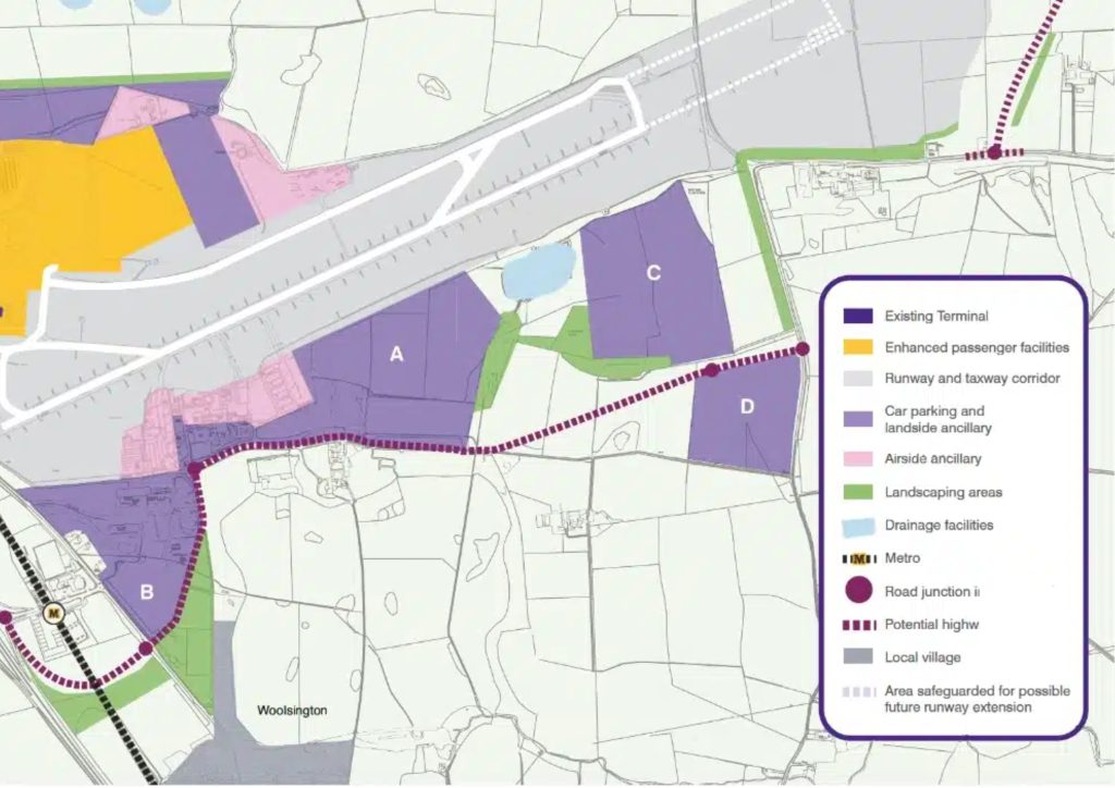
Infrastructure & Transport
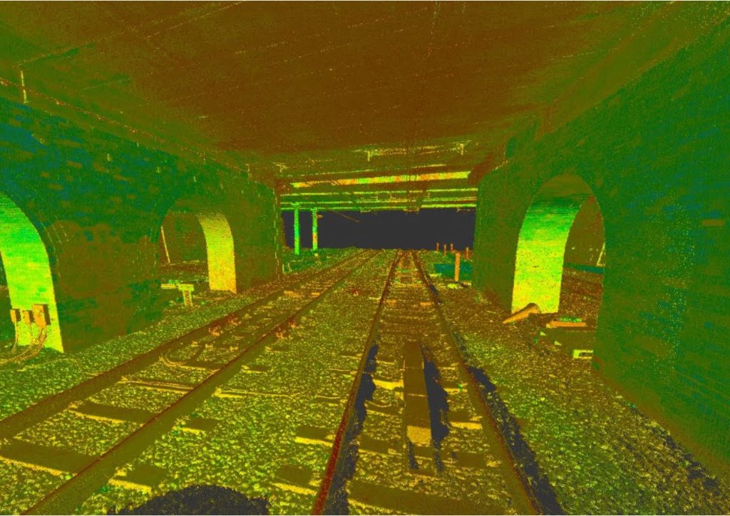
AMP8 water infrastructure, Highways England Area 10 schemes and major civils across Lancashire, Cheshire, Cumbria and Greater Manchester all demand programme-critical survey data.
PAS 128 Utility Mapping — BAE Systems
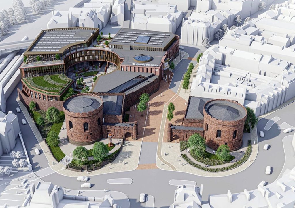
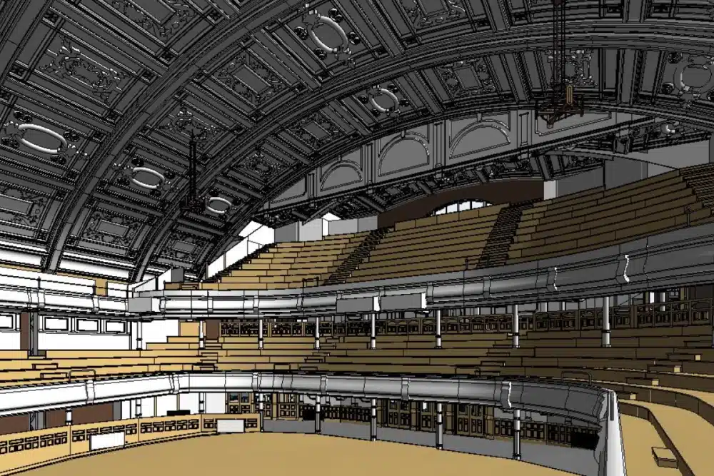
Heritage & Restoration
Heritage survey in the North West means listed mills, Victorian civic buildings, canal infrastructure and historic town centres — each demanding survey data that captures the full complexity of the existing fabric with precision conventional methods cannot always provide.
Laser Scanning — Fire Station Refurbishment
Housing & Development
Housing development across Lancashire and the North West is active. Brownfield land release, urban regeneration and strategic housing sites all require accurate survey data at feasibility, pre-application and pre-construction stages — and a well-specified survey brief at the start saves significant cost during design and avoids programme risk during groundworks.
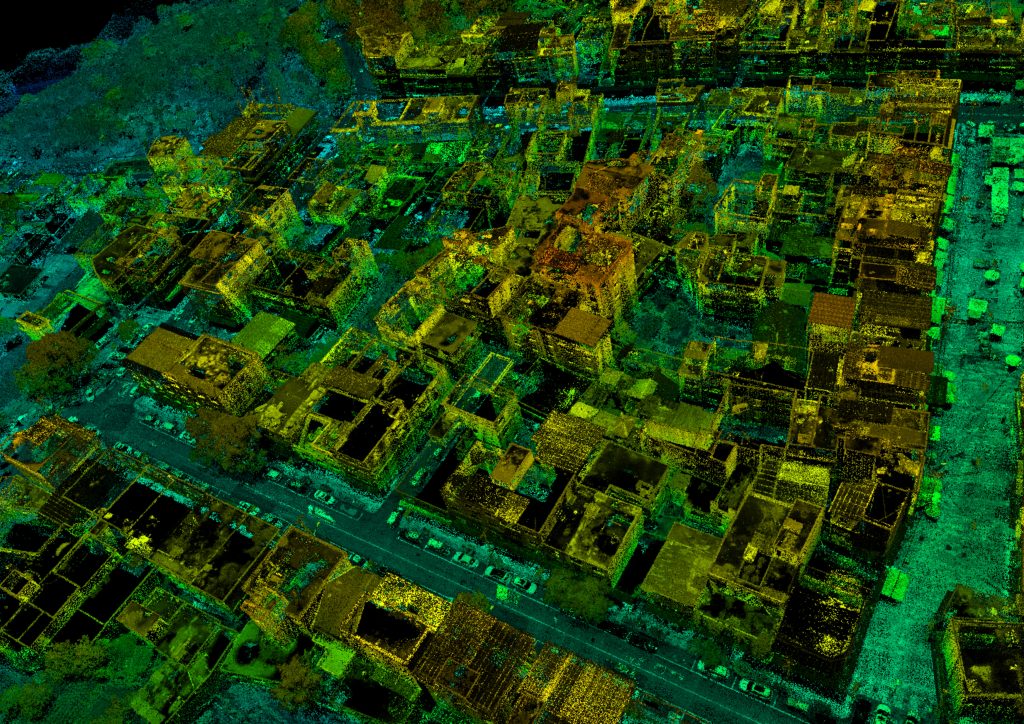
Urban Regeneration Surveys — Darwen & Colne
Environmental & Energy
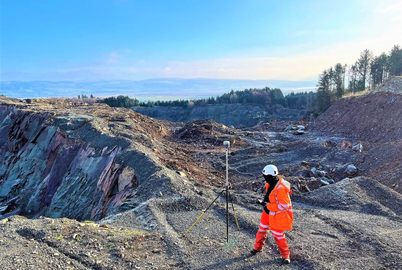
Monitoring Equipment Detects Seismic Activity — Lancashire and the Lake District
Commercial & Retail
Virtual Tour 3D — Eye Clinic, Trafford Centre
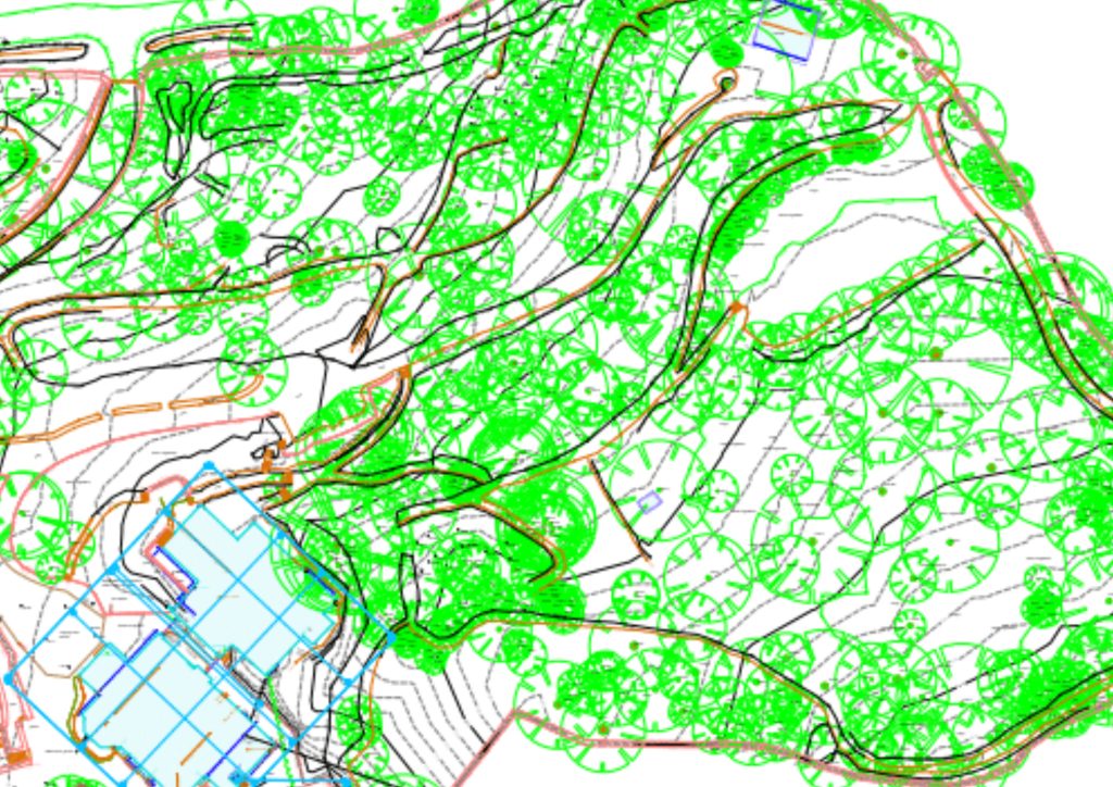
Rural & Agriculture
Topographical Survey — Wetland Site, Lancashire
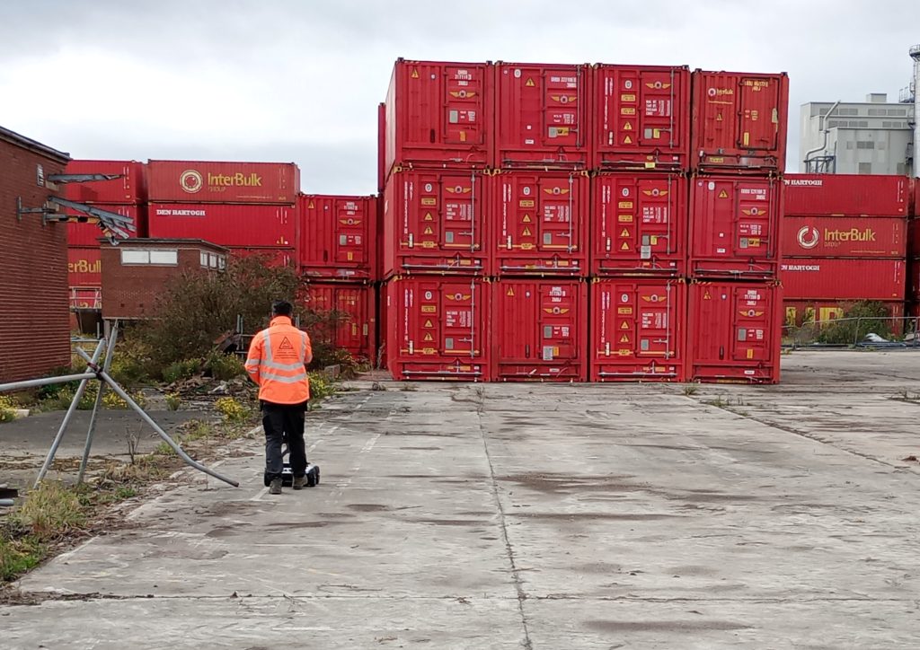
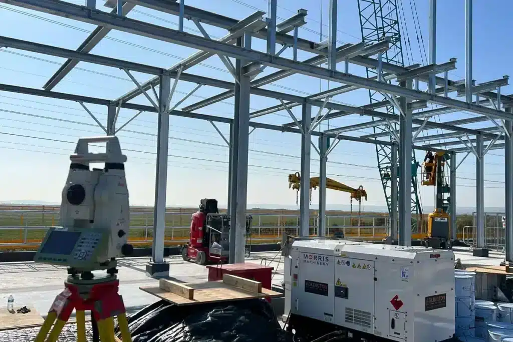
Industrial & Logistics
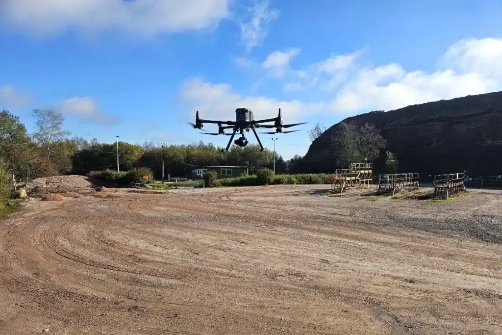
Utility Mapping and Topographic Survey — Major Industrial Facility, Barrow-in-Furness
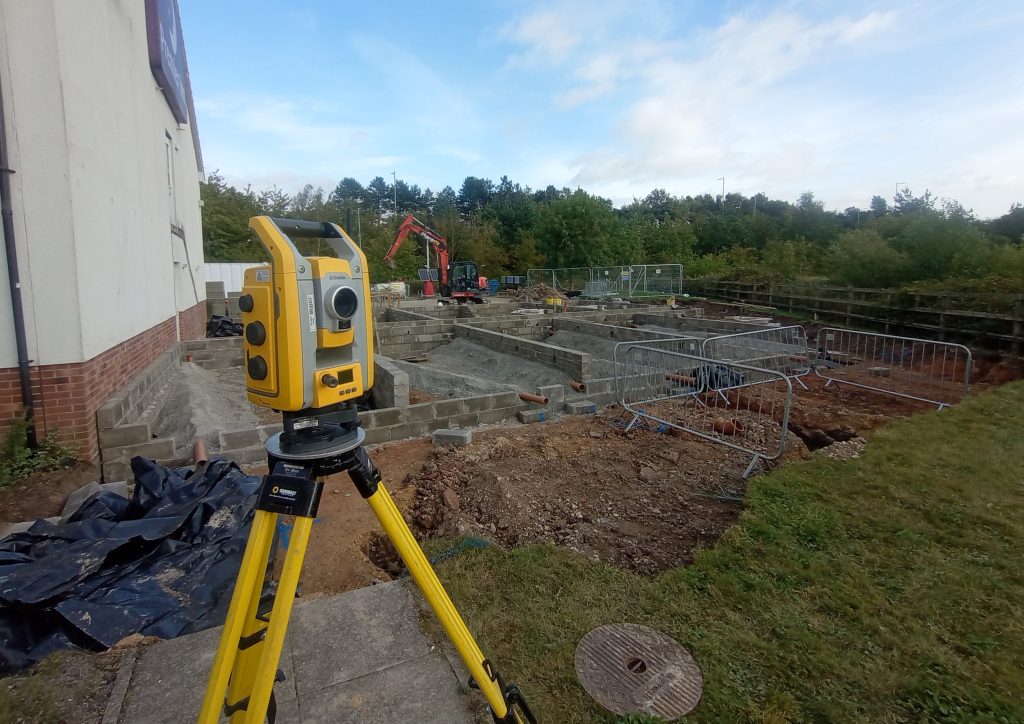
Construction & Civil Engineering
Comprehensive Infrastructure Surveying — Ilkley
Defence & Justice
Defence and justice sites are the most operationally demanding survey environments we work in. Security clearances, access protocols, method statement approval — all before a single measurement is taken. We have the compliance record and professional standing to operate on these sites without issue.
Security-Critical Surveying — HMP Manchester
Architecture & Projects
Architects and project managers need survey data that arrives ready to use — not data that requires reprocessing. Site Surveying Services delivers BIM-ready outputs to your EIR from the outset, and runs CPD sessions for architectural practices across Lancashire and the North West on how survey data integrates with design workflows.