

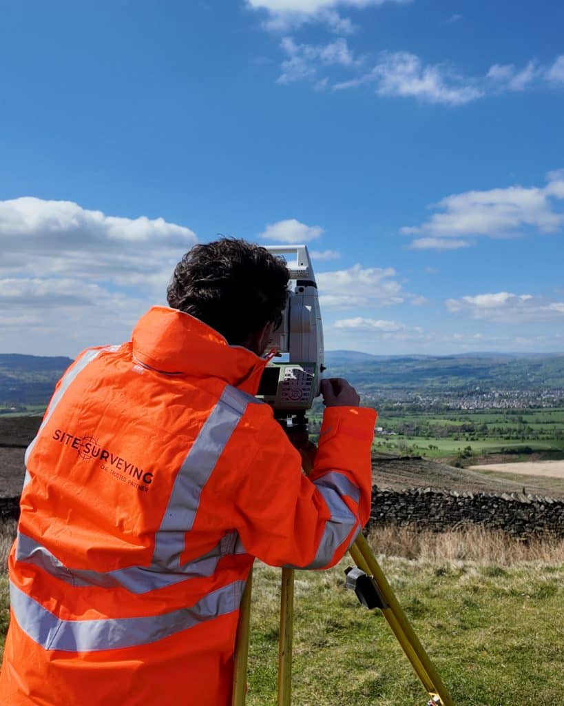
Land and engineering surveyors based in Lancashire
Our Associations, Partnerships & Community.
Site Surveying Services is a Lancashire business. Our head office is in Clitheroe. Our team largely lives and works across the communities we survey in — East Lancashire, the Ribble Valley, Greater Manchester, Cumbria and the wider North West. We believe that being a good business means being a good neighbour — investing in the people, organisations and causes around us, not just the programmes we deliver.
This page sets out who we support, what we contribute and why it matters — both to us as a company and to the clients, contractors and consultants who appoint us.
our social value
More than a survey company. A responsible partner.
More than a Survey Company.
At Site Surveying Services, we understand that the companies we work with — and want to work with — expect more than technical competence. Tier 1 contractors and major infrastructure clients need supply chain partners who can demonstrate real, evidenced commitments across environmental responsibility, social impact, ethical governance, and workforce welfare. This page sets out exactly that.
Our Environmental Responsibility
We are committed to reducing the environmental impact of our operations and supporting the net zero ambitions of our clients and the wider construction industry.
Carbon & Fleet
The majority of our operational emissions come from travel. We are actively encouraging low-emission alternatives, with an electric charging point and reducing unnecessary site visits through efficient programme planning, and where possible consolidating mobilisations to minimise mileage without compromising delivery.
Waste & Materials
We operate paperless workflows wherever possible. Survey data is delivered digitally, reports are issued electronically, and our office operations minimise single-use materials. Equipment and vehicles are maintained and repaired by having regular condition assessments rather than replaced where viable, reducing waste across our supply chain. In the office, we are supplied with only renewable electricity and gas and follow a rigorous recycling system.
Supporting Client Net Zero Targets
Accurate underground utility mapping, topographic surveys, and site data directly support the design efficiency and waste reduction goals of major construction programmes. Getting the data right first time means less rework, less material waste, and fewer return visits — contributing to the carbon reduction targets of the projects we support.
Health, Safety & Wellbeing
Safety is non-negotiable. Every member of our team operates under a robust health and safety framework that meets and exceeds the expectations of Tier 1 contractors. Our safety commitments include:
CDM 2015 compliant across all operations
CAA Approved for UAV operations
Full method statements and risk assessments provided
All field operatives hold current CSCS cards
Regular toolbox talks and site safety briefings
We take the mental and physical wellbeing of our team seriously. We promote a culture where people feel supported to raise concerns, take time when they need it, and build long-term careers. Lone working protocols are in place for all field operations, with regular check-ins and clear escalation procedures.
Equality, Diversity & Inclusion
Site Surveying Services is committed to ensuring that modern slavery, forced labour, and human trafficking have no place in our business or supply chain. We operate in full compliance with the Modern Slavery Act 2015. Our commitments include:
All workers are employed on fair, transparent terms with written contracts
Supply chain partners are vetted for ethical employment practices
We maintain an open-door policy for employees to raise concerns without fear of reprisal
Data Security & Governance
We handle sensitive site data on behalf of clients working on critical infrastructure, utilities, and major developments. Our approach to data security reflects that responsibility.
We operate in line with UK GDPR requirements
Data is stored and transmitted securely, with access controls in place
Deliverables are formatted to your EIR and BIM requirements, reducing the risk of data errors downstream
We are Constructionline Gold accredited, which means our supply chain credentials have been independently verified to a standard recognised across the construction industry.
Our Associations.
Our Associations.
Blackburn Rovers Business Club

Site Surveying Services is a proud member of the Blackburn Rovers Business Club — connecting us with the wider Lancashire business community and supporting one of the region’s most significant cultural institutions. Blackburn Rovers Football Club has been at the heart of East Lancashire for over 150 years. The Business Club brings together businesses from across the region — from sole traders to national companies — in a community that reflects the character of Lancashire itself: direct, loyal and proud of where it comes from. Our membership reflects our commitment to the Lancashire business community and our belief that strong local partnerships make stronger businesses. If you are a fellow Business Club member or are considering joining, we would be delighted to connect.
East Lancashire Hospice

Site Surveying Services is a supporter of East Lancashire Hospice — a charity providing specialist palliative care and support to patients and their families across Hyndburn, Burnley, Pendle and Rossendale. East Lancashire Hospice relies almost entirely on voluntary income and fundraising from the communities it serves. It provides inpatient care, day services, community nursing and family support — offering compassionate, expert care to people with life-limiting illnesses and their loved ones at one of the most difficult times of their lives. Our support for East Lancashire Hospice reflects a straightforward belief: the communities we work in deserve the same investment we give to the programmes we survey. The hospice does extraordinary work for people across our home territory, and we are proud to support it. If you would like to support East Lancashire Hospice directly, you can donate via our JustGiving fundraising page.
Atlantic Grappler — Offshore Charity Challenge
Several members of the Site Surveying Services team have taken part in the Atlantic Grappler — one of the most demanding charity fundraising challenges available. The Atlantic Grappler is a deep-sea fishing expedition in the North Atlantic, combining physical endurance with fundraising for causes chosen by the participants. Our team members who have participated have raised significant funds for charity — demonstrating the character of the people behind the surveys we deliver. These are not people who do the minimum required. On any challenge, professional or personal, they go further.
Youth Development — Investing in the Next Generation of Surveyors
The geospatial survey sector has a pipeline problem. The demand for qualified land surveyors, engineering surveyors and geospatial professionals is growing — driven by infrastructure investment, AMP8, housing programmes and the digital construction transition. The supply of new entrants is not keeping pace. Site Surveying Services takes this seriously. We actively support the development of the next generation of surveyors through practical, meaningful engagement — not tokenism.
Work experience placements
We host work experience students from schools and colleges across Lancashire, giving young people direct exposure to a professional survey environment. Our placements are real — students attend live sites, use real equipment and work alongside our directly employed team. We have hosted students on placements that have taken them to Premier League training facilities, major construction programmes and conservation projects. The experience is memorable. We make it so deliberately.
Graduate and trainee development
We recruit and develop graduate surveyors and trainee engineers, providing structured development pathways from entry level through to qualified professional status. Several members of our current team joined Site Surveying Services as trainees and have grown into senior roles. We are proud of that progression and committed to continuing it.
Enhancing Civil Engineering Education — UCLan
We have worked with the University of Central Lancashire to support civil engineering education — demonstrating real-world survey applications and equipment to engineering students at UCLan. This is the kind of engagement that bridges the gap between academic learning and professional practice, and we are committed to expanding it.
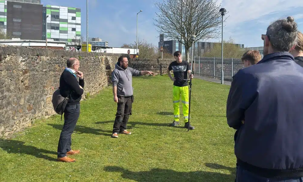
School and college engagement
We engage with surveying, civil engineering and construction courses at colleges and universities across the North West — speaking to students about the breadth of work available in the geospatial survey sector and the career pathways that are open to them. If you are a course leader or careers adviser and would like us to speak to your students, get in touch.
social value
What We Contribute.
What We Contribute.
For clients who require a formal social value statement as part of supply chain assessment or pre-qualification, Site Surveying Services can evidence contribution across the following areas:
Our directly employed team is predominantly drawn from Lancashire and the North West. When you appoint us, the programme spend stays in the region.
Work experience placements, graduate training, CITB contributions and school and university engagement all contribute directly to the skills base of the construction and surveying sector in Lancashire and the North West.
East Lancashire Hospice support, Blackburn Rovers Business Club membership and ongoing fundraising activity represent direct investment in the Lancashire community.
All services are delivered in-house by our directly employed team. No subcontractors, no labour-only arrangements, no supply chain practices that conflict with the ethical supply chain requirements of the clients we work with.
Our UAV survey and mobile mapping capability reduces vehicle movements, site attendance and fuel consumption on programmes where these methodologies replace conventional ground survey. We take the environmental impact of our operations seriously and continue to look for ways to reduce it.
Our Services
Topographical Surveys
OS-controlled accurate, efficient and cost effective surveys for highways, civils and development. Cad and BIM-ready output.
PAS 128 utility mapping
Providing the location of underground services in 2D or 3D through qualified utility mapping surveys, using advanced GPR and Electromagnetic Location.
Measured building survey
Delivering accurate as-built information that supports design, refurbishment, planning and construction with the latest technology. Producing reliable drawings and digital models.
Laser Scanning
3D laser scanners capture millions of points per second, creating a point cloud which enables the finer details and the physical site to be viewed remotely.
Mobile mapping
For highway engineers, infrastructure managers, local authorities and contractors working on live road schemes, mobile mapping is now the standard for corridor surveys.
3D Machine control
With decades of supporting major earthworks contractors and large-scale infrastructure schemes, we provide reliable machine control across Lancashire and the wider UK.
Setting out engineers
With strong, long-standing relationships across the civil engineering and construction sector, we supply skilled professionals who keep your projects accurate, efficient and on programme.
bathymetric surveys & river surveys
Using modern technology, we capture detailed underwater and river channel information safely and efficiently – delivering reliable data you can trust.
Stockpile surveys & volumetric analysis
Whether a one-off stockpile measurement or regular monitoring, we deliver reliable, repeatable data tailored to your project using advanced technology.
Control Network Installation
Delivering robust and precise site control systems to support every stage of construction in developments, infrastructure schemes or major earthworks.
aerial & drone surveys
CAA-approved drone operations for aerial mapping, photogrammetry and volumetric analysis, providing a comprehensive view of terrain, structures and landscapes.
3D BIM Modelling
Whether you require an as-built Revit model, federated coordination model or detailed digital twin, our team delivers high quality, design-ready outputs.
survey equipment hire
We offer a vast range of surveying and engineering equipment for hire and will always try to beat a comparable quote. Discover the fleet.
monitoring
Providing reliable monitoring surveys across the UK, delivering precise data that supports risk management, compliance and informed decision making throughout a project lifecycle.
Virtual Tour 3D
An immersive experience which instantly transports your clients to your business, guiding them through your space and creating a seamless experience.
Impermeable area surveys
We deliver georeferenced impermeable area data that drainage engineers and planning consultants can work from directly.
CCTV & Drainage surveys
Acoustic & Noise Assessments
We deliver acoustic and noise assessments, supporting planning applications, discharge of conditions and Environmental Impact Assessments.
Topographical Surveys
PAS 128 utility mapping
Laser Scanning
Mobile mapping
Setting out engineers
bathymetric surveys & river surveys
Control Network Installation
aerial & drone surveys
survey equipment hire
monitoring
Impermeable area surveys
CCTV & Drainage surveys
3D Machine control
Acoustic & Noise Assessments
Stockpile surveys & volumetric analysis
3D BIM Modelling
3D BIM Modelling
Virtual Tour 3D
Why Choose Site Surveying Services?
On site. On spec. On time.
fast turnaround
Get a quick quote and a survey team prepared for instruction. When the programme window opens, we're ready.
Industry Accredited
Built on recognised industry standards. Constructionline Gold accredited, CAA Approved, CDM 2015 compliant, and surveys delivered to PAS 128
Nationwide
Coverage across the UK with local knowledge you can rely on. Headquartered in Clitheroe, we know the sites, the contractors and the programmes — backed by the capability to deliver anywhere.
Programme-Critical
Data that works in your environment from day one. BIM to your EIR. CAD to your spec. No reprocessing. No delays to the design team.