


 Leeds
Leeds Doncaster
 Sheffield
 Bradford
 Hull
Hull Halifax
 Sunderland
 Newcastle
 Middlesborough
 Yorkshire Moors
 Teesside
 Cumbria
 Harrogate
 York
York Yorkshire Dales
 Northumberland
 Goole
Goole Carlisle
 Keswick
 Kendal
 Barrow-in-Furness
 Lancaster
 Blackpool
 Morecambe
 Southport
 Liverpool
 Wigan
Wigan Manchester
 Blackburn
 Burnley
 Forest of Bowland
 Oldham
 Chester
 Stockport
 Peak District
 Skipton
 Crewe
Crewe Rotherham
 Stoke
Stoke Driffield
Surveying Services North East
Site Surveying Services in Newcastle upon Tyne
Newcastle upon Tyne is one of the great cities of the North — a place where Victorian grandeur, industrial heritage and genuine contemporary ambition sit comfortably side by side on the banks of the Tyne. It is a city that never stopped reinventing itself, and right now, reinvention is happening at pace: city-centre streets being transformed, brownfield land coming back to life, new quarters rising where derelict land has long stood empty. For anyone involved in development, construction, architecture or infrastructure in and around Newcastle, that level of activity creates a constant, pressing need for accurate, reliable survey data.
Site Surveying Services is based in Clitheroe, Lancashire, but we work nationwide — and that very much includes Newcastle and the wider North East. Whether you need a topographic survey for a new development, a measured building survey of a listed Victorian terrace, 3D laser scanning for a heritage project, or utility mapping ahead of groundworks, our team can be on site in Newcastle with everything required to deliver accurate, well-presented results, on time and to specification.
Our Surveying Services in Newcastle
Newcastle’s built environment is varied and demanding — heritage assets, modern commercial blocks, expansive riverside sites, tight urban plots, and everything in between. We offer the full range of land and building survey services to meet that variety:
Topographic Surveys Newcastle
Comprehensive site surveys capturing ground levels, features, boundaries, drainage, services and vegetation. Essential for planning applications, feasibility work, drainage design and construction layouts. Delivered in AutoCAD or compatible formats to your specification.
Measured Building Surveys Newcastle
Accurate floor plans, elevations and sections of existing buildings. Particularly valuable in Newcastle given the number of listed buildings, Victorian terraces and period commercial structures that regularly form the basis of conversion and refurbishment projects.
3D Laser Scanning Newcastle
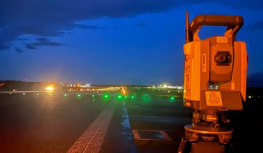
Using the Leica RTC360 and Trimble X7, we capture highly detailed point cloud data of buildings, structures and sites. Ideal for heritage recording, complex refurbishments, structural assessments and BIM integration.
Utility Surveys Newcastle
GPR, CAT & Genny and radio detection surveys to locate and map underground services. Critical ahead of any groundworks in an urban environment. We produce PAS 128-compliant reports for use by designers, contractors and insurers.
Sectors We Serve in Newcastle
Newcastle’s economy is diverse and its development pipeline reflects that. We work across a wide range of sectors in the city and wider North East:
Residential Development Newcastle
From urban infill plots to large brownfield regeneration schemes, residential developers need accurate topographic and utility surveys from the outset. Newcastle's housing pipeline, including the emerging Forth Yards neighbourhood, is creating sustained demand.
Education & Research
Newcastle has two major universities and a significant campus estate. University estates teams and their appointed architects require topographic surveys, measured building surveys and BIM-ready laser scan data for ongoing estates development.
Heritage & Conservation Newcastle
Newcastle has an exceptional stock of listed buildings, conservation areas, Victorian commercial streets and industrial heritage. We regularly support architects, conservation officers and developers working with sensitive historic fabric, using 3D laser scanning and measured building surveys to capture fine detail accurately and non-invasively.
Commercial & Regeneration Newcastle
Newcastle city centre continues to evolve, with major retail and leisure projects underway. Measured building surveys, 3D laser scanning and Matterport tours are all in regular demand for commercial refurbishment and fit-out.
Infrastructure & Utilities Newcastle
River crossings, road schemes, drainage improvements and utility diversions all require topographic surveys, utility mapping and monitoring. The Tyne's waterfront setting adds a particular dimension, with river and watercourse surveys relevant to a number of riverside development schemes.
Industrial & Manufacturing
Crane rail surveys, setting out and monitoring surveys for manufacturing and logistics facilities across the Newcastle and Tyneside industrial estate network.
Newcastle's Development Landscape
Newcastle's Development Landscape
Why Choose Site Surveying Services in Newcastle?
Why Choose Site Surveying Services in Newcastle?
Full-service capability
From initial topographic survey through utility mapping, 3D laser scanning, BIM modelling and monitoring, we can support a project at every stage. There is no need to manage multiple survey contractors — one team, one point of contact, consistent quality throughout.
Heritage experience
Newcastle's built environment demands care and expertise when working with listed buildings and conservation areas. Our measured building surveys and laser scanning services are regularly used on historic fabric, producing high-quality records that meet the expectations of conservation architects and planning authorities.
Reliable, professional output.
Every survey we deliver is checked, structured and presented to a consistent standard. Drawings are produced in AutoCAD to your layer specification; reports are clear and properly formatted. Clients come back because the work is done properly, first time.
Frequently Asked Questions
Frequently Asked Questions
Can you carry out a topographic survey of a riverside or waterfront site in Newcastle?
Yes. We regularly survey riverside and waterfront sites, including river banks, flood plain levels, channel geometry and structures. Our UAV capability is particularly useful for larger riverside sites where conventional access is difficult or where aerial context is needed.
Do you work with heritage buildings and listed structures in Newcastle?
Yes. Measured building surveys and 3D laser scanning are well suited to listed buildings and conservation areas. Non-contact laser scanning is particularly valuable where the building fabric is sensitive or where conventional measurement would be intrusive. We work regularly with conservation architects, heritage consultants and planning authorities on this type of project.
Can you provide PAS 128 utility surveys in Newcastle city centre?
Yes. We carry out utility surveys to PAS 128 specification using GPR, CAT & Genny and radio detection equipment. City centre environments present particular challenges — congested service runs, multiple operators, varying depths and materials — and we have the experience and equipment to work effectively in these conditions.
Do you need to visit site before providing a quote?
Not always. For many standard topographic or measured building surveys, we can quote based on drawings, a site address and a description of your requirements. For larger, more complex or access-restricted sites, a brief site visit or call with our surveyors may be useful.