


 Leeds
Leeds Doncaster
 Sheffield
 Bradford
 Hull
Hull Halifax
 Sunderland
 Newcastle
 Middlesborough
 Yorkshire Moors
 Teesside
 Cumbria
 Harrogate
 York
York Yorkshire Dales
 Northumberland
 Goole
Goole Carlisle
 Keswick
 Kendal
 Barrow-in-Furness
 Lancaster
 Blackpool
 Morecambe
 Southport
 Liverpool
 Wigan
Wigan Manchester
 Blackburn
 Burnley
 Forest of Bowland
 Oldham
 Chester
 Stockport
 Peak District
 Skipton
 Crewe
Crewe Rotherham
 Stoke
Stoke Driffield
Surveying Services North West
Site Surveying Services Across Cumbria — Lakes, Dales & West Coast
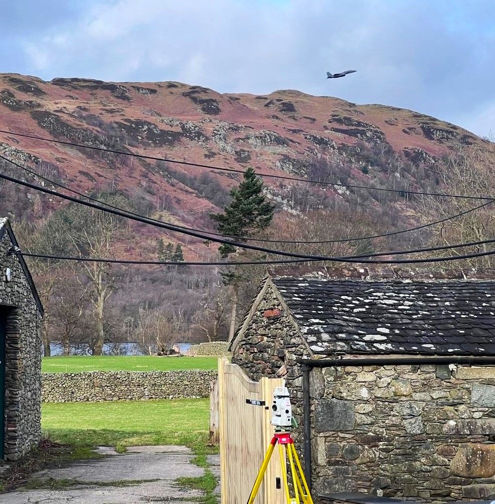
Cumbria is one of England’s most extraordinary counties — a landscape of unmatched variety, from the lake-filled valleys of the Lake District National Park and the rolling limestone pavements of the South Lakeland fringe to the rugged industrial coast of West Cumbria and the sweeping moorland of the North Pennines. It is a county where fighter jets roar over survey sites on crisp mountain mornings, where the British weather can transform a stunning lakeside commission into a wet and windy endurance test overnight, and where the scenery makes even the most routine measured building survey feel like a privilege.
Site Surveying Services works extensively across Cumbria — not just in the major towns of Carlisle, Barrow, Kendal, and Keswick, which have their own dedicated pages, but across the Lake District’s lake towns, the South Lakeland coast, and the communities of West Cumbria. From Ullswater and Windermere to Bowness-on-Windermere, Grange-over-Sands, and Cleator Moor, our teams travel regularly into Cumbria’s most spectacular and challenging survey environments.
Our Surveying Services Across Cumbria
We offer a comprehensive range of professional surveying services to clients across the whole of Cumbria:
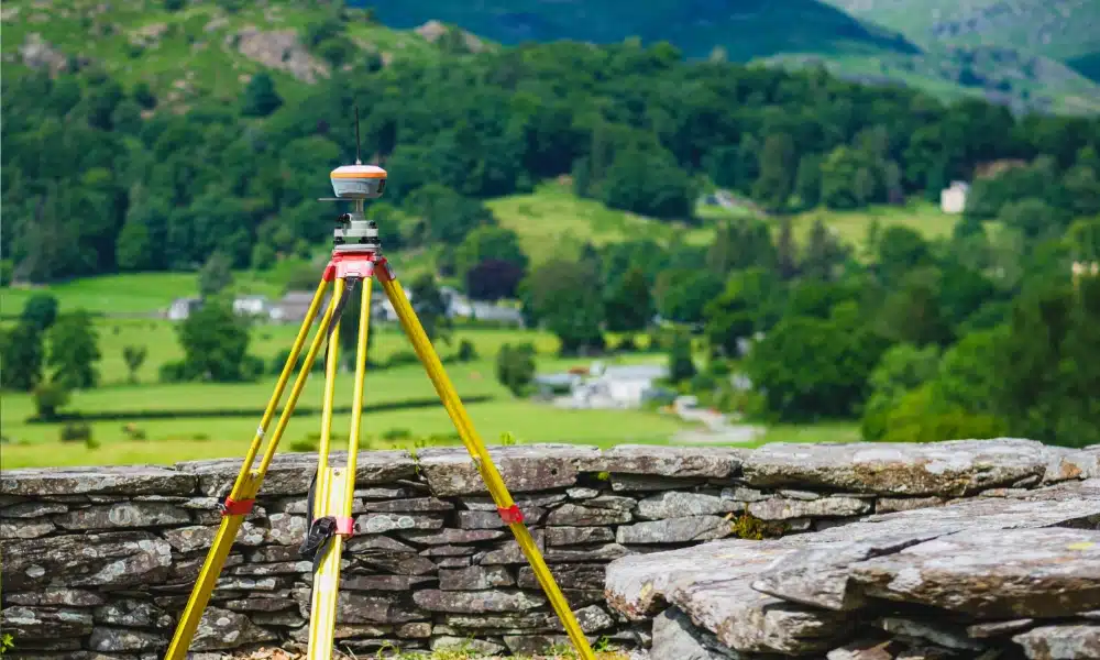
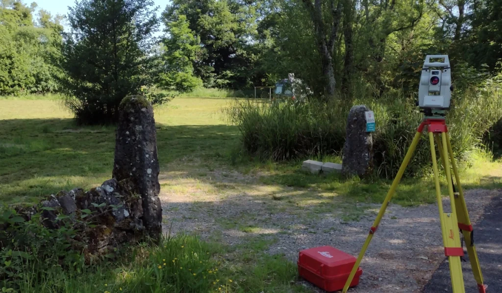
Topographic Surveys Cumbria
detailed land and site surveys across Cumbria's varied terrain, from lakeside estates to coastal properties and upland moorland
Measured Building Surveys Cumbria
precise floor plans, elevations, and sections for residential properties, heritage buildings, community facilities, and commercial assets
3D Laser Scanning Cumbria
high-density point cloud surveys for complex buildings, heritage structures, and BIM production
Utility Surveys Cumbria
underground service detection and mapping for development and infrastructure projects
Sectors We Serve Across Cumbria
Our Cumbrian project experience spans the county’s full range of development, heritage, and community activity:
Public Sector & Regeneration
measured building surveys for civic square redevelopment, community facilities, and public sector assets
Infrastructure & Utilities
survey support for infrastructure improvement programmes across Cumbria's communities
Tourism & Leisure
surveys supporting the Lake District's growing visitor economy
Coastal & Environmental
surveys for South Lakeland's coastal properties and West Cumbria's coastline
Residential & Private Property
topographic and measured building surveys for lakeside properties, coastal homes, and rural residential commissions across the Lake District and South Lakeland
Heritage & Conservation
surveys of Cumbria's exceptional built heritage including listed buildings, civic assets, and historic community facilities
Surveying Case Studies & Project Highlights in Cumbria
Case Studies & Project Highlights
Ullswater — Topographic & Measured Building Survey
Topographic Survey & Measured Building Survey
Grange-over-Sands — Measured Building Survey (Coastal Property)
Measured Building Survey
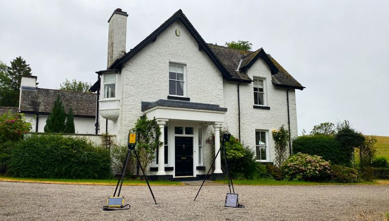
What started as a wintry morning turned into a beautiful spring afternoon by the time our team wrapped up a measured building survey at a coastal property in Grange-over-Sands — one of South Lakeland’s most characterful seaside towns, looking out across the tidal sands of Morecambe Bay. Stunning scenery, a beautiful property, and a fitting way to end the week. Measured building surveys of coastal properties like this capture the precise spatial data that architects and homeowners need to plan alterations, extensions, and refurbishment work with confidence — and the setting makes the whole exercise rather more enjoyable than average.
Bowness-on-Windermere — Topographic & Measured Building Survey
Topographic Survey & Measured Building Survey
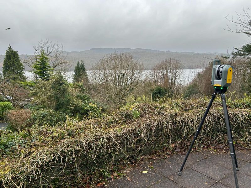
Up in the stunning Bowness-on-Windermere for another combined topographic and measured building survey — one of our team’s favourite working environments and a location we return to regularly. The combination of topographic and measured building survey in a single visit is a practical and cost-effective approach for lakeside residential properties, capturing both the site’s spatial context and the building’s existing condition in one efficient programme.
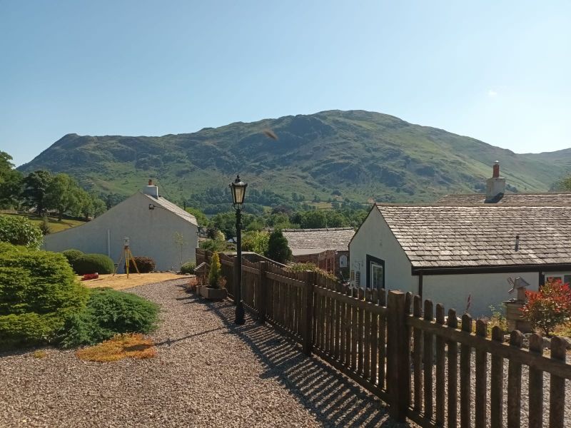
Windermere — Survey in All Weathers
Topographic / Measured Building Survey
What a difference a day makes. Glorious survey conditions one day, and a very different picture the next — Windermere under grey skies and British weather doing what British weather does. But surveyors are built to adapt. Wet and windy conditions are part of the job, and if we couldn’t work through them we wouldn’t be very good at what we do. Where there is a will, there is a way — and the survey was completed to the same standard regardless of what the sky was doing.
Cleaton Moor Civic Square, West Cumbria — Topographic & Measured Building Surveys
A substantial public sector commission in West Cumbria — engaged by Copeland Borough Council (now part of Cumberland Council) to provide comprehensive survey services for the proposed redevelopment of Cleator Moor’s Civic Square. The project required measured building surveys of three key existing buildings across the site: the Copeland Borough Council offices, the Copeland Occupational and Social Centre, and the Library and Phoenix Enterprise Centre — civic assets at the heart of this West Cumbrian community. The surveys were commissioned to inform the redevelopment plans and ensure that the transformation of the Civic Square could proceed smoothly, with accurate spatial data underpinning every design decision. Eight days on site reflects the scale and complexity of surveying three separate public buildings across a civic campus, delivering the detailed floor plans and measured data that the design team needed to work with confidence. A project that demonstrates our capability on large-scale, multi-building public sector survey commissions — and our commitment to supporting the regeneration of Cumbria’s communities.
Client details
Optimised Environments
service provided
Topographic Survey & Measured Building Survey
Timeline
8 days on site / approx. 2 days in the office
Cumbria's Development Landscape
Cumbria's Development Landscape
Why Choose Site Surveying Services Across Cumbria?
Why Choose Site Surveying Services Across Cumbria?
Extensive Cumbrian experience
from Ullswater to Grange-over-Sands, Bowness-on-Windermere to Cleator Moor, we work across the whole county regularly
All-weather capability
Cumbrian weather is famously variable; our teams adapt and deliver regardless of conditions
Combined topographic and measured building surveys
efficient single-visit packages capturing both site and building data, ideal for lakeside and rural residential properties
Public sector and civic experience
the Cleator Moor Civic Square commission demonstrates our capability on large multi-building public sector survey programmes
North West based
our Clitheroe base puts us within practical reach of most of Cumbria via the A65, A591, and M6 corridors
National Park sensitivity
experienced in working within the Lake District National Park's unique planning and environmental context
Frequently Asked Questions
Frequently Asked Questions
Do you carry out surveys across the Lake District including Ullswater, Windermere, and Bowness?
Yes — and regularly. Ullswater, Windermere, Bowness-on-Windermere, and the surrounding lake towns are locations our teams visit frequently. We carry out topographic and measured building surveys across the National Park, understanding both the beauty of the environment and the specific planning considerations that come with working within a UNESCO World Heritage Site.
Can you survey in poor weather conditions in the Lake District?
Yes. Cumbrian weather is part of the job, and our teams are equipped and experienced to work safely and effectively in wet, windy, and cold conditions. Where there is a will, there is a way — and we don’t let the weather stop us delivering the data our clients need.
Do you carry out surveys for public sector and civic regeneration projects in West Cumbria?
Yes. Our Cleator Moor Civic Square commission — a large multi-building measured building survey for Copeland Borough Council — demonstrates our capability on public sector commissions in West Cumbria. We understand the survey requirements of civic regeneration projects and the standards that public sector clients expect.
Can you carry out surveys of coastal properties in Grange-over-Sands and South Lakeland?
Yes. Grange-over-Sands and the wider South Lakeland coastline are within our regular survey territory. Coastal properties present specific survey considerations — from tidal access and ground conditions to the careful documentation of properties that may have evolved significantly over time. Our measured building survey capability handles all of these.
Which council covers planning for the Lake District towns like Windermere and Bowness?
Planning for Windermere, Bowness-on-Windermere, Ullswater, and other locations within the National Park boundary is governed by the Lake District National Park Authority — not the surrounding district or unitary councils. Properties just outside the Park boundary fall within either Westmorland and Furness or Cumberland Council’s planning authority.