


 Leeds
Leeds Doncaster
 Sheffield
 Bradford
 Hull
Hull Halifax
 Sunderland
 Newcastle
 Middlesborough
 Yorkshire Moors
 Teesside
 Cumbria
 Harrogate
 York
York Yorkshire Dales
 Northumberland
 Goole
Goole Carlisle
 Keswick
 Kendal
 Barrow-in-Furness
 Lancaster
 Blackpool
 Morecambe
 Southport
 Liverpool
 Wigan
Wigan Manchester
 Blackburn
 Burnley
 Forest of Bowland
 Oldham
 Chester
 Stockport
 Peak District
 Skipton
 Crewe
Crewe Rotherham
 Stoke
Stoke Driffield
Surveying Services North West
Site Surveying Services in Keswick & the Lake District, Cumbria
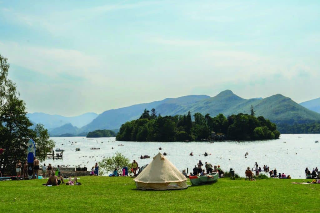
Keswick is one of the Lake District’s most beloved towns — a market town set on the shores of Derwent Water, surrounded by fells of outstanding natural beauty and sitting at the heart of England’s most visited National Park. For surveyors, the Lake District presents an environment unlike almost anywhere else in the country: some of the most spectacular natural scenery in England, a complex planning framework governed by the Lake District National Park Authority, and a built environment that must balance the needs of a living, working community with the conservation and enhancement of a UNESCO World Heritage Site.
Site Surveying Services has delivered professional surveying work across Keswick and the wider Lake District, from topographic and measured building surveys of domestic properties against a backdrop of mountain views to residential surveys in Bowness-on-Windermere. Our North West teams know and love this landscape — and we understand what working within the National Park’s unique planning and environmental context demands. Nothing quite beats working in the Lake District. And we bring the same precision and professionalism to every project here as we do anywhere else across the UK.
Our Surveying Services in Keswick & the Lake District
We offer a comprehensive range of professional surveying services to clients across Keswick, the Lake District National Park, and the surrounding Cumbrian area:
Topographic Surveys Keswick & the Lake District
detailed land and site surveys for planning applications, drainage design, and development within the National Park's sensitive planning environment
Measured Building Surveys Keswick & the Lake District
precise floor plans, elevations, and sections for Lake District residential properties, tourism accommodation, and heritage buildings
3D Laser Scanning Keswick & the Lake District
high-density point cloud surveys using Leica RTC360 for complex residential properties, historic buildings, and structures requiring detailed as-existing records
UAV / Drone Surveys Keswick & the Lake District
aerial data capture across the Lake District's varied and often challenging upland terrain, subject to airspace and National Park access requirements
Sectors We Serve in Keswick & the Lake District
Our Lake District project experience spans the full range of the National Park’s distinctive built environment and development activity:
Residential & Private Property Keswick & the Lake District
topographic and measured building surveys for homeowners making alterations and extensions within the National Park
Tourism & Hospitality Keswick & the Lake District
surveys for holiday accommodation, hotels, and leisure developments serving the Lake District's visitor economy
Heritage & Conservation Keswick & the Lake District
measured surveys and laser scanning of the Lake District's historic built fabric, from stone farmhouses to Lakeside estates
Lakeside & Estate Properties Keswick & the Lake District
surveys for large residential properties with extensive grounds on and around Derwent Water, Windermere, and the other principal lakes
Rural & Agricultural Keswick & the Lake District
surveys for farm buildings, agricultural land, and rural estate properties across the National Park and its fringes
Infrastructure Keswick & the Lake District
topographic surveys for roads, utilities, and public realm works within the National Park's sensitive environment
Surveying Case Studies & Project Highlights in Keswick
Case Studies & Project Highlights
Storrs Park, Bowness-on-Windermere — Topographic & Measured Building Survey
A residential commission in one of the most enviable settings our teams visit — Storrs Park, Bowness-on-Windermere, on the eastern shore of England’s largest lake. Our client, Cow Architecture, engaged us to provide a comprehensive suite of survey services for a newly purchased property where the client intended to make a number of alterations. Capturing the existing condition of both the property and its grounds accurately was the essential foundation for every design decision that followed.
Topographic Survey
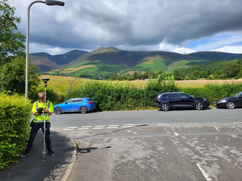
We used a Leica Total Station to carry out a precise topographic survey of the property grounds — capturing ground levels, contours, boundary positions, and other critical features of the site. In a property of this setting and scale, understanding the existing topography is fundamental to planning any alterations or extensions sensitively and in a way that complements both the building and its spectacular natural context.
Measured Building Survey
For the detailed internal and external survey of the building itself, we deployed the Leica RTC360 laser scanner — producing high-resolution, full-colour point clouds of the property’s complete internal and external geometry. The scanner’s capability allowed us to capture every room, elevation, and architectural feature with a level of detail that would be impossible to achieve through traditional measured survey methods in the same timeframe. Checkerboard targets were placed throughout the property to calibrate and align the scan data, ensuring that all scan positions integrated precisely into a coherent, spatially accurate dataset tied to real-world dimensions.
The combination of the Leica TS for ground control and the Leica RTC360 for building capture produced a comprehensive, accurate record of both the property and its setting — detailed floor plans, elevation drawings, and 3D models that gave Cow Architecture the complete picture of the building’s current state that they needed to plan, design, and execute their client’s proposed amendments with confidence.
Client details
Cow Architecture
service provided
Topographic Survey & Measured Building Survey
Project timeline
4.5 days on site / approx. 3 days in the office
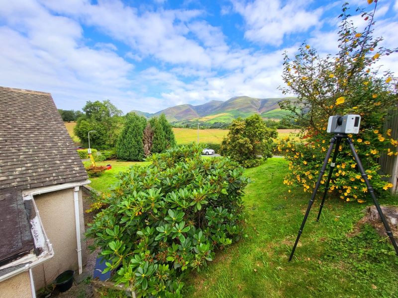
Domestic Property Survey, Keswick — Topographic & Measured Building Survey
Topographic Survey & Measured Building Survey
A domestic property survey with one of the finest backdrops in England — the dramatic fells above Keswick providing a remarkable panorama behind our survey team as they completed a topographic and measured building survey of a residential property in the town. A tricky little survey by our own admission, but all the more enjoyable for its setting. Nothing quite beats working in the Lake District.
The Lake District's Planning Landscape
The Lake District's Planning Landscape
The Lake District is one of the most distinctive planning environments in England — and understanding its unique framework is essential for anyone developing or altering property within it. Unlike conventional local authority areas, the Lake District National Park Authority (LDNPA) is the sole local planning authority for the entire National Park, with its own Local Plan and policies designed specifically to balance sustainable development with the conservation and enhancement of the National Park’s natural beauty, wildlife, and cultural heritage. The current development plan for the Lake District is the Lake District National Park Local Plan 2020–2035, adopted in January 2020. This plan sets out policies for housing, tourism, economic development, transport, and environmental management across the National Park, applying the Sandford Principle — which gives precedence to conservation purposes where conflicts arise — to all planning decisions. Development within the National Park is subject to particularly careful scrutiny. Proposals for extensions, alterations, new accommodation, and infrastructure must demonstrate that they conserve and enhance the National Park’s special qualities. Working with architects and consultants who understand this planning context — and who can commission survey data to the standard required by the LDNPA — is essential for successful applications.
Why Choose Site Surveying Services in Keswick & the Lake District?
Why Choose Site Surveying Services in Keswick & the Lake District?
National Park experience
we understand the specific survey demands, planning sensitivities, and access considerations that come with working within the Lake District National Park
High-quality residential survey capability
the Storrs Park commission demonstrates our ability to deliver comprehensive topographic and laser-scanned measured building surveys for high-value residential properties
Leica Total Station and RTC360 combination
precise ground control and high-resolution 3D scanning working together for complete, spatially accurate property records
Heritage and conservation sensitivity
working with architects serving clients whose properties fall within a UNESCO World Heritage Site demands the highest levels of care and accuracy
North West based
our Clitheroe team is well connected to the Lake District via the A65 and A591, with practical local knowledge of the area
Trusted by Lake District architects
working with practices like Cow Architecture on sensitive residential projects across the National Park
Frequently Asked Questions
Frequently Asked Questions
Do you carry out surveys within the Lake District National Park?
Yes — and we do so regularly. The Lake District National Park presents specific survey challenges around access, planning sensitivity, and the need for high-quality data to support LDNPA planning applications. Our team understands the National Park environment and delivers the accurate, detailed survey data that Lake District projects require.
Do you carry out measured building surveys of residential properties in Keswick and the wider Lake District?
Yes. Our Keswick topographic and measured building survey, and the Storrs Park commission at Bowness-on-Windermere, demonstrate our capability with high-quality residential properties in the National Park. We use Leica RTC360 laser scanning to capture comprehensive, accurate interior and exterior data efficiently, minimising the time our team spends in occupied properties while maximising data quality.
What is the Sandford Principle and how does it affect development in the Lake District?
The Sandford Principle is enshrined in the Environment Act 1995 and states that where there is a conflict between the two statutory purposes of a National Park — enjoying natural beauty and conserving it — conservation must take precedence. For development proposals in the Lake District, this means that even relatively modest extensions or alterations must demonstrate that they conserve and enhance the Park’s special qualities. High-quality survey data is an important foundation for any planning application within the National Park.
Do you carry out topographic surveys for planning applications in the Lake District?
Yes. Topographic surveys are a common requirement for planning applications within the National Park — for extensions, new buildings, drainage proposals, and other development. We produce surveys to planning specification and in formats suitable for submission with LDNPA planning applications.