


 Leeds
Leeds Doncaster
 Sheffield
 Bradford
 Hull
Hull Halifax
 Sunderland
 Newcastle
 Middlesborough
 Yorkshire Moors
 Teesside
 Cumbria
 Harrogate
 York
York Yorkshire Dales
 Northumberland
 Goole
Goole Carlisle
 Keswick
 Kendal
 Barrow-in-Furness
 Lancaster
 Blackpool
 Morecambe
 Southport
 Liverpool
 Wigan
Wigan Manchester
 Blackburn
 Burnley
 Forest of Bowland
 Oldham
 Chester
 Stockport
 Peak District
 Skipton
 Crewe
Crewe Rotherham
 Stoke
Stoke Driffield
What is a Biodiversity Net Gain survey and what data does it need?
Biodiversity Net Gain is now mandatory for most new development in England under the Environment Act 2021. A BNG baseline requires accurate habitat mapping — identifying, classifying and measuring all habitat types on and around the site before development begins. This typically requires a topographic survey to establish accurate site areas and boundaries, along with […]
What survey do I need for a flood risk assessment?
A flood risk assessment typically requires a topographic survey of the site and its surrounding area — capturing ground levels, contours, drainage features, watercourses, culverts, flood plain extents and all features relevant to surface water flow. For sites adjacent to or including watercourses, a bathymetric survey capturing riverbed levels, channel cross-sections and flow profiles may […]
How do site surveys support sustainable design and planning outcomes?
Comprehensive site surveys play a crucial role in sustainable design and planning by providing accurate information about the existing environment, landform, infrastructure and natural features before any design work begins. For architects and planners, survey data — such as detailed topographical maps and aerial/DJI drone imagery — informs decisions about land contours, vegetation, hydrology, and […]
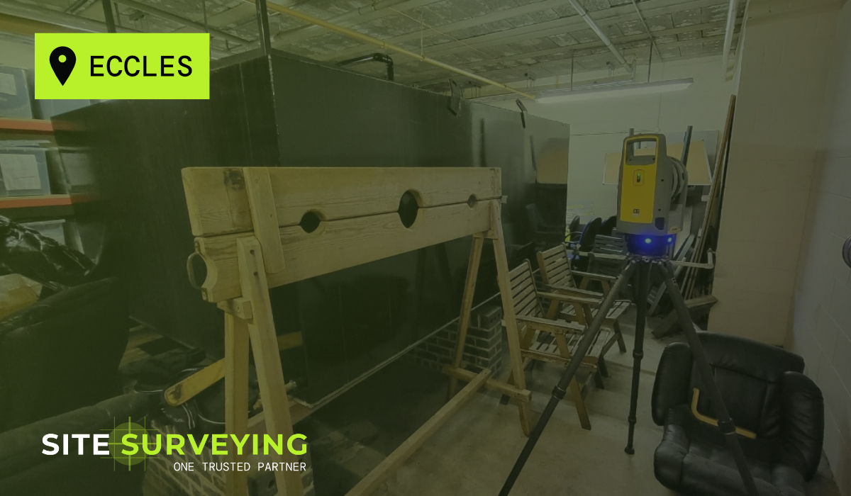
Monitoring Equipment Detects Mini Earthquake in Lancashire and the Lake District
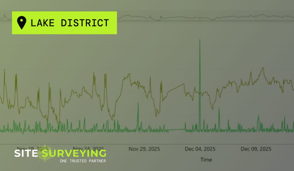
context What Monitoring Is For. Structural and geotechnical monitoring exists for one reason: to detect movement before it becomes a problem. When construction activity takes place near existing structures, live infrastructure or sensitive ground, monitoring is the risk management tool that gives the project team the evidence to proceed with confidence – or the early […]
Accrington Goes Green with Urban Pocket Park Renovations
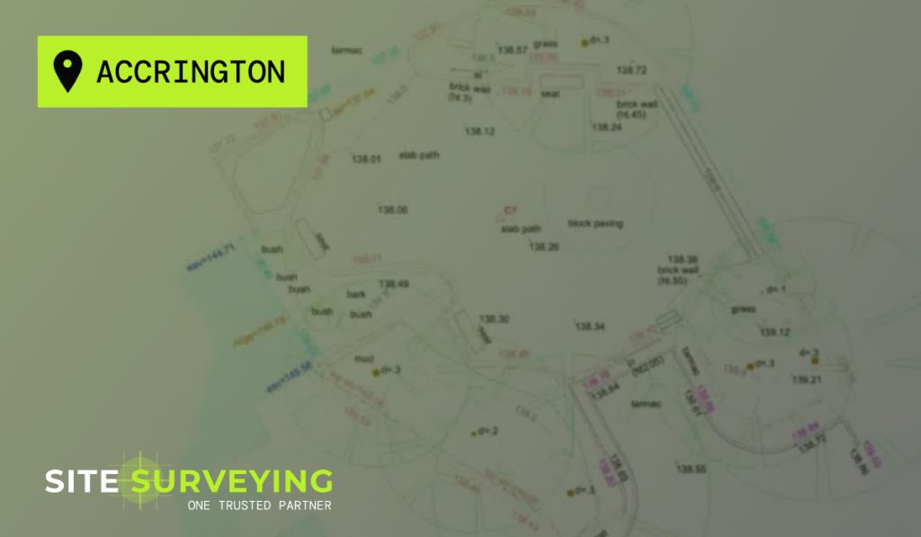
Case Study • Topographical Survey Green spaces have evolved from simple nice-to-haves to vital additions in urban design. For Accrington Town Centre, the proposal to renew and renovate recreational spaces ensured the need for accurate and tailored surveying solutions to lay the groundwork for a successful development. Our team was commissioned by Hyndburn Borough Council […]
Culvert scan at Teesworks, Redcar
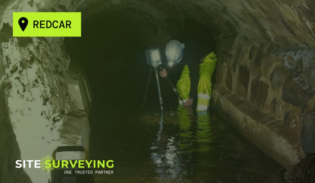
This drone photogrammetry survey was carried out using a DJI M300 drone for a long standing client. The survey compliments a measured building and topographical survey to highlight features not seen from ground level. This enables a broader overview of the specific building alongside neighbouring features, and also provides the ability to easily revisit the […]
Culvert condition survey in Carlisle
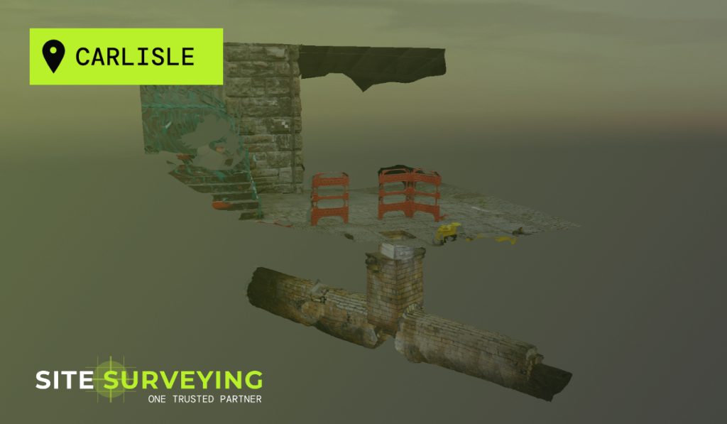
Our sister company Tri-Tech were commissioned to undergo an underground survey, which examined the condition of an old culvert in Carlisle. This survey aids the remote inspection of the culvert to discover its condition and potential failures. Tri-Tech’s Elios 2 Drone is perfect for flying into confined spaces such as this. It provides flawless and […]
Cobscar Survey, Redmire in Wensleydale
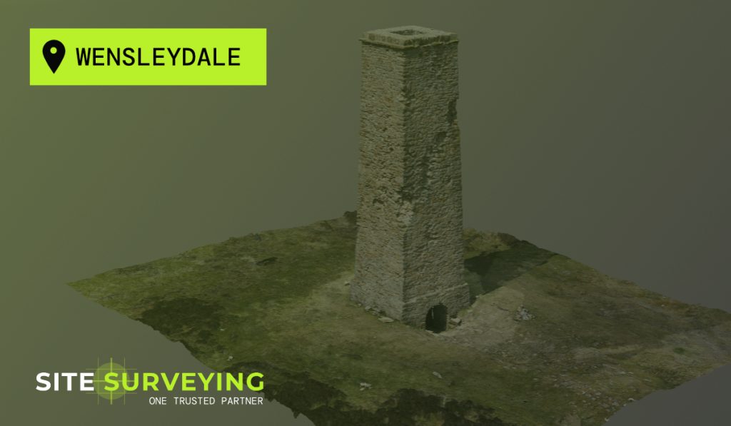
We were commissioned by Atkins Global to survey a culvert at Teesworks. This was a condition survey to aid the visual inspection of the culvert. We launched their Elios 2 drone which was mounted on our sister companies Tri-Tech remote boat to scan the length of the culvert.
Flood Embankment Survey, Fishlake, Doncaster
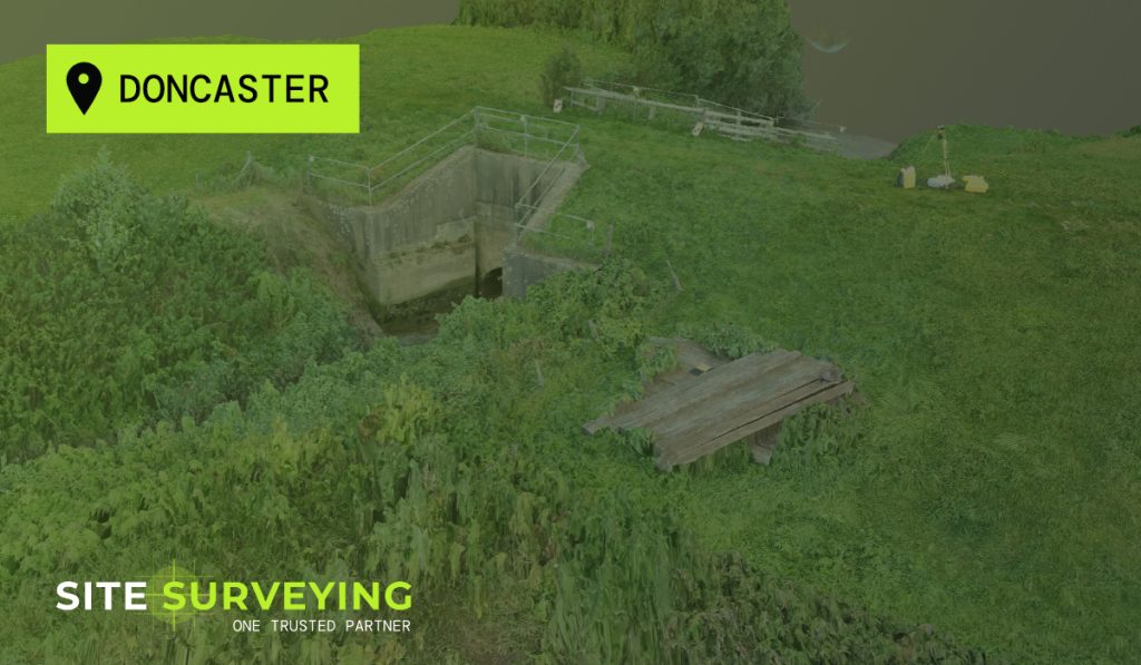
In November 2019 the village of Fishlake near Doncaster gained national notoriety as the River Don, swollen by unprecedented rainfall, overtopped and flooded a huge swathe of land including over 170 homes and businesses. Since this disastrous event there has been a large number of explorative projects, examining potential flood defence schemes and improvements to […]