


 Leeds
Leeds Doncaster
 Sheffield
 Bradford
 Hull
Hull Halifax
 Sunderland
 Newcastle
 Middlesborough
 Yorkshire Moors
 Teesside
 Cumbria
 Harrogate
 York
York Yorkshire Dales
 Northumberland
 Goole
Goole Carlisle
 Keswick
 Kendal
 Barrow-in-Furness
 Lancaster
 Blackpool
 Morecambe
 Southport
 Liverpool
 Wigan
Wigan Manchester
 Blackburn
 Burnley
 Forest of Bowland
 Oldham
 Chester
 Stockport
 Peak District
 Skipton
 Crewe
Crewe Rotherham
 Stoke
Stoke Driffield
Surveying for property developers Lancashire
Surveying for Property Developers.
One Trusted Partner.
Survey Data That Protects the Development — From Acquisition to Handover.
Survey Data That Protects the Development — From Acquisition to Handover.
The developers who use survey data most effectively treat it as a decision-making tool, not a preliminary cost. The topographic survey that informs the acquisition decision is worth significantly more than the same survey commissioned three months after contracts have exchanged and the design is already fixed. The utility mapping that identifies a problematic service run before the scheme layout is finalised saves far more than its fee. The measured building survey that reveals a structural discrepancy before the contractor is on site eliminates the variation it would otherwise become.
Site Surveying Services works with property developers across Lancashire, the North West and nationally — housebuilders, commercial developers, mixed-use and regeneration specialists, brownfield land developers and private residential clients. We understand the development programme and what survey data needs to do at each stage. We deliver it in the format the design team requires, from the first phone call to final handover.
Based in Clitheroe, Lancashire, with offices in Matlock, Newcastle and Bristol, every survey we produce is completed in-house by our directly employed team. The surveyor who quotes your project is the surveyor on site.
Survey at every stage of the development programme
Acquisition and feasibility
The survey brief for acquisition is different from the survey brief for planning, which is different again from the survey brief for construction. Getting the right survey at the right stage — and only paying for what that stage actually needs — is where experienced developers save money and reduce risk.
What is typically needed at acquisition:
For most development acquisitions, an indicative topographic survey at this stage is the minimum that protects the purchase decision. Ground levels that confirm or challenge the assumed developable area. Boundaries that verify the title plan. Drainage features that flag constraint risks. Trees that affect planning and design. Existing structures that inform demolition budgets. This is not the full topographic survey needed for planning — it is a targeted scope that answers the acquisition questions: what is actually there, what are the constraints, and does the development assumption stack up? For acquisitions involving existing buildings, an indicative measured building survey at this stage can be the difference between a development appraisal that is based on reality and one that is based on an estate agent's floor plan. Estate agent floor plans are not surveys. They are marketing documents. The discrepancy between the two, discovered at planning stage, has more than once restructured a development deal.
What we deliver:
Indicative topographic survey covering developable area, boundaries, drainage, trees and key constraints — in the format your planner and architect can work from immediately. Desktop utility records to flag service risk without committing to a full PAS 128 survey. Indicative measured building survey for acquisition decisions involving existing structures.
Survey at every stage of the development programme
Pre-application and planning
What is typically needed at pre-application:
Full topographic survey of the site and its context — ground levels, boundaries, drainage, vegetation, adjacent structures, road levels, services at surface level and all features the planning submission requires. Measured building survey if existing structures are involved in the scheme. Utility mapping at desktop level minimum — and at full PAS 128 QLC level if the scheme involves any ground investigation or intrusive works at this stage.
What we deliver:
OS-controlled topographic survey to planning accuracy, delivered in the coordinate system and format your planning consultant requires. Measured building survey for existing structures. PAS 128 utility mapping to the quality level the stage requires. All data georeferenced to OS National Grid and tied to a consistent site datum.
Survey at every stage of the development programme
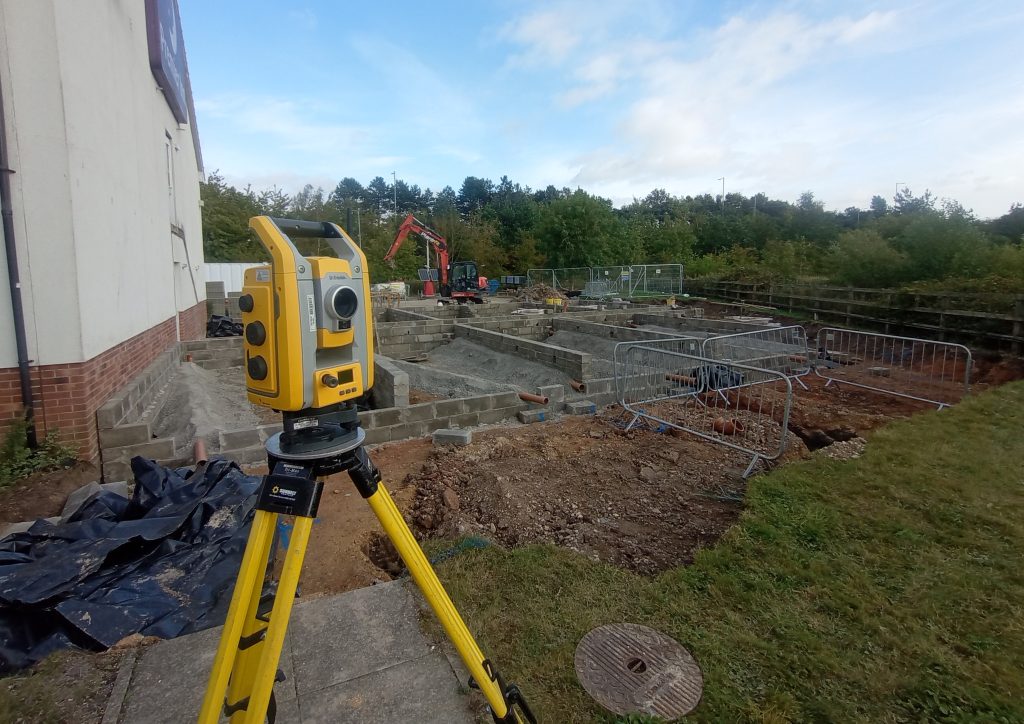
Pre-construction
What is typically needed at pre-construction:
Full PAS 128 utility mapping to Quality Level A before any groundworks begin — physically verified service locations, not desktop records. Updated topographic survey if significant time has elapsed since planning survey, or if the scheme design has evolved to require levels and features not captured at planning stage. Setting-out control network established before any construction activity begins. BIM-ready survey data if the project has a BIM requirement — structured to the EIR and at the LOD the contractor needs.
What we deliver:
PAS 128 utility mapping to Quality Level A — every service physically verified before groundworks. Updated topographic survey to construction accuracy. Control network installation and verification. BIM-ready data to your EIR. All delivered in-house, by the same team, as a coordinated package.
Survey at every stage of the development programme
Construction and monitoring
What is typically needed during construction:
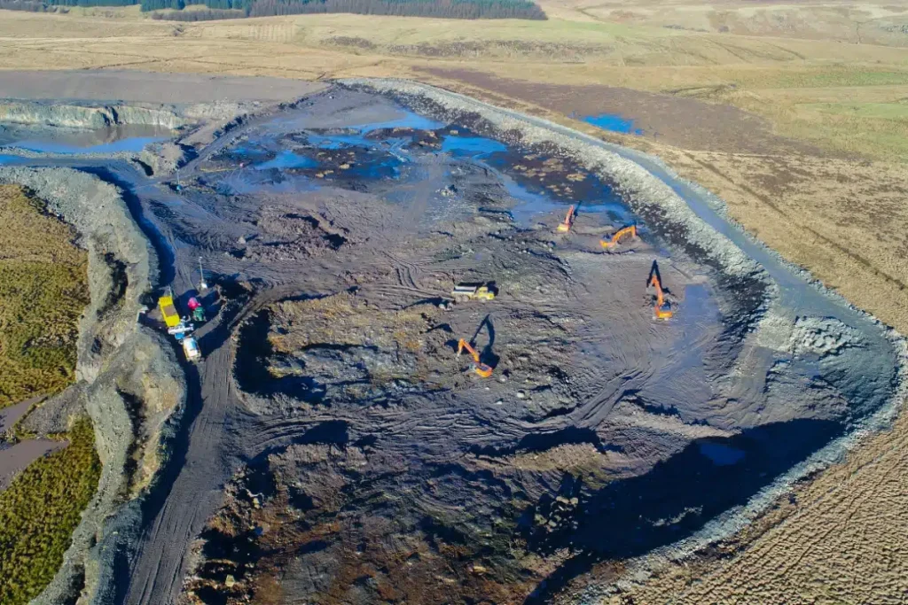
Setting-out engineers where the contractor does not have in-house capability. As-built survey at key programme stages to verify compliance with planning conditions and design. Monitoring of adjacent structures where excavation depth or proximity creates a risk of movement claims from neighbouring owners. UAV survey for progress recording and earthworks reconciliation.
What we deliver:
Directly employed setting-out engineers. As-built survey in CAD format. Structural and settlement monitoring with clear trigger level reporting. UAV progress surveys. All from one team, under one instruction.
Survey at every stage of the development programme
Handover and completion
At handover, the survey function delivers the record of what has been built. For commercial and residential developers, this has two distinct purposes — satisfying the planning authority’s conditions and providing the building owner with a complete record for future reference.
What is typically needed at handover:
As-built topographic survey of the completed site for planning condition discharge. As-built measured building survey of completed structures if required by the planning condition or the building owner. Virtual Tour 3D of completed commercial, residential or mixed-use spaces for marketing and handover documentation.
What we deliver:
As-built topographic survey and measured building survey for planning condition discharge. Virtual Tour 3D using Matterport Pro 3 — from scan to completed immersive model in hours — for marketing, client handover and future reference.
Surveying Services
Most Used by Property Developers.
Surveying Services Most Used by Property Developers.
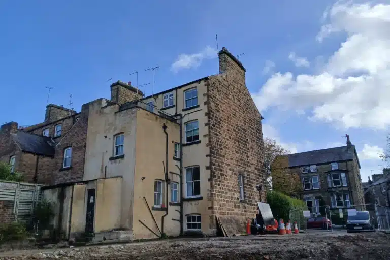
Measured building surveys
Floor plans, elevations, sections and 3D models for all existing structures involved in the development.
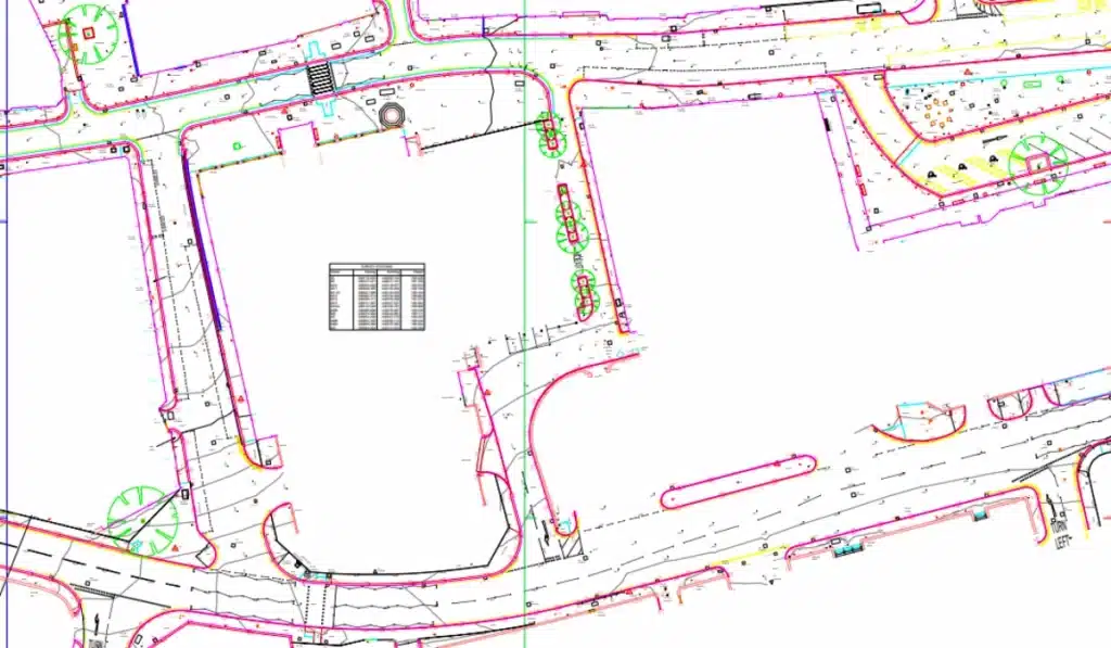
Topographic survey
OS-controlled site survey for acquisition, planning and pre-construction. Every development starts here.
Laser scanning and point cloud
High-density 3D capture for complex or historic buildings where tape survey cannot reliably record the existing fabric.
BIM model creation
survey data to your EIR at the LOD the contractor and design team require.
UAV survey
large site coverage, progress recording and earthworks reconciliation. Rapid and accurate across sites where ground survey alone is impractical.
PAS 128 utility mapping
Physical verification of every underground service before any groundworks begin.
Virtual Tour 3D
Matterport Pro 3 for pre-completion marketing, client handover and building records.
survey for property developers North West
Case Studies: Survey Data in practice
Urban Regeneration Surveys — Darwen, Colne and Accrington
Topographic and utility survey across multiple East Lancashire urban regeneration sites — OS-controlled, georeferenced data delivered in the format required by the planning authority and design team for housing-led regeneration schemes. Three separate sites, one survey team, one coordinated programme.
Case Studies: Survey Data in practice
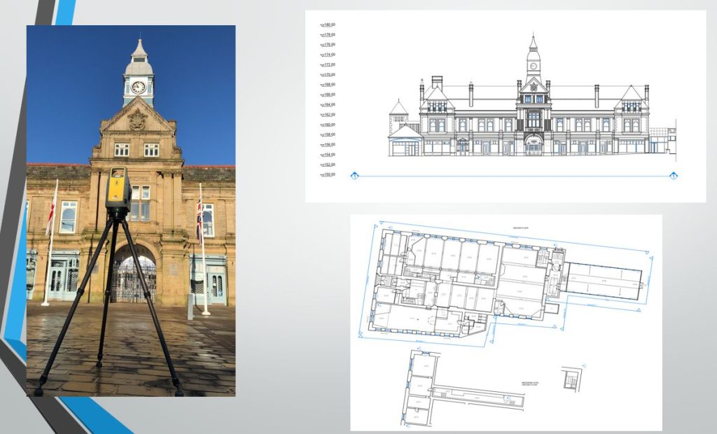
Measured Building Survey — Darwen Market Hall
Why choose site surveying services
On site. On spec. On time.
We support property developers across the UK by delivering accurate, reliable survey data that underpins confident development decisions from land appraisal through to construction and completion. Our surveys provide the clarity needed to reduce risk, avoid costly design issues, and keep projects moving efficiently.
At Site Surveying Services, we understand the commercial and practical pressures faced by developers. We work closely with developers, design teams, and contractors to deliver surveys that align with project objectives, budgets, and programmes. Whether you’re progressing a single residential plot or a large multi-phase scheme, we tailor our approach to suit the scale and complexity of each development.
Our experience across residential, commercial, and mixed-use developments means we anticipate the information required at every stage of the development lifecycle. From feasibility and planning support to technical design and BIM-ready outputs, we provide survey data that integrates seamlessly into the wider design and delivery process.
We operate across a wide range of site conditions and building types, from constrained urban locations to large greenfield sites. Our measured building surveys, topographical surveys, and point cloud data give developers confidence that designs are based on accurate, dependable information—helping to minimise variations and unexpected issues on site.
Quality, communication, and consistency sit at the core of our service. By combining technical surveying expertise with a clear understanding of development workflows, we help ensure projects progress smoothly from concept to construction. For property developers seeking a dependable surveying partner, we provide the data that supports informed decisions and successful delivery.
fast turnaround
Get a quick quote and a survey team prepared for instruction. When the programme window opens, we're ready.
Industry Accredited
Built on recognised industry standards. Constructionline Gold accredited, CAA Approved, CDM 2015 compliant, and surveys delivered to PAS 128
Nationwide
Coverage across the UK with local knowledge you can rely on. Headquartered in Clitheroe, we know the sites, the contractors and the programmes — backed by the capability to deliver anywhere.
Programme-Critical
Data that works in your environment from day one. BIM to your EIR. CAD to your spec. No reprocessing. No delays to the design team.
Frequently Asked Questions
Frequently Asked Questions
What survey do I need before acquiring a development site?
For a new build project on a vacant site, you need a topographic survey capturing ground levels, boundaries, drainage, vegetation and contextual features. For a refurbishment or extension project involving an existing building, you need a measured building survey capturing floor plans, elevations, sections and ceiling heights — and a topographic survey of the external site. If the project involves any excavation, you should also commission a desktop utility search at minimum, or PAS 128 utility mapping if the project is going to planning or construction. Commissioning survey at the start of Stage 1 rather than partway through Stage 2 is consistently more cost-effective — it prevents the brief being based on assumptions that the survey later contradicts.
What is the difference between a planning survey and a construction survey?
The topographic survey produced for a planning application is not the same survey required for construction. A planning survey establishes the existing site context — ground levels, boundaries, adjacent buildings, drainage and planning constraints. A construction survey establishes the accurate spatial framework from which the contractor works — precise levels, verified utility positions, setting-out control. The accuracy specification, the density of data capture and the deliverable format are all different. Commissioning one survey to serve both purposes often means it serves neither adequately. We advise on the right scope for each stage and can produce both from the same mobilisation where the programme allows.
When should I commission PAS 128 utility mapping?
Before any ground investigation or excavation — and before the groundworks contractor is on site. Ideally at pre-application stage if the scheme involves any intrusive investigation, so the utility information is available to the designer when the scheme layout is being fixed. At the very latest, before any groundworks begin. The cost of a PAS 128 survey is always less than the cost of an underground service strike — financially, programmatically and in terms of CDM liability. For brownfield sites, sites with long development histories and urban sites with complex service environments, Quality Level A physical verification is the appropriate standard.
Do I need a new topographic survey if one was done at planning stage?
Possibly. If significant time has elapsed since the planning survey — typically more than 12 months — or if the scheme design has evolved to require levels and features not captured at planning stage, an updated survey may be needed before construction begins. If the planning survey was produced to planning accuracy rather than construction accuracy, it may not be adequate for the contractor and setting-out engineer. We will review the existing survey data and advise honestly on whether it is sufficient for the construction programme or whether an update is needed.
What surveys are required for a brownfield development?
Brownfield sites typically require the most comprehensive pre-construction survey package of any development type. Topographic survey capturing existing ground levels, structures, drainage and vegetation. PAS 128 utility mapping to Quality Level A — brownfield sites carry the highest risk of undocumented and unexpected buried services. Measured building survey if existing structures are involved in the scheme. Pre-demolition surveys if structures are to be demolished. Monitoring if adjacent structures or infrastructure are at risk from demolition or excavation. We scope and deliver all of these as a single coordinated programme on brownfield sites across Lancashire and the North West.
Do you work with both housebuilders and commercial developers?
Yes. Our development clients include national housebuilders, regional residential developers, housing associations, commercial property developers, mixed-use developers and regeneration specialists. The survey scope and deliverable format differ between housing, commercial and mixed-use programmes — we advise on the right approach for your specific development type at the time of instruction.
What format will the survey data be delivered in?
We deliver all survey data in the format your design team requires — AutoCAD DWG, DXF, Revit, PDF and GIS-compatible formats as standard. For developments with a BIM requirement, we deliver to your EIR at the LOD specified. For planning submissions, we produce PDF plans alongside the CAD data in the format your planning consultant requires. Confirm your requirement at the time of instruction and we will build it into the deliverable specification before survey.
Can you combine multiple survey types into a single instruction?
Yes — and for most development projects, we recommend it. Combining topographic survey with PAS 128 utility mapping, measured building survey and UAV survey into a single coordinated programme is more efficient, more cost-effective and produces a more useful dataset than commissioning each discipline separately at different times. A single georeferenced coordinate system, a single point of contact and a single coordinated deliverable. We scope combined packages for development programmes of all types and scales.
What is a Virtual Tour 3D and is it useful for property development?
A Matterport Virtual Tour 3D is an immersive, navigable 3D walkthrough of a building or space — accessible via web browser on any device. For property developers, the applications are pre-completion marketing (allowing prospective tenants and buyers to view spaces before physical access is available), client handover documentation, and building condition records before and after works. We deliver virtual tours from scan to completed model in hours of the site visit. The eye clinic near the Trafford Centre is an example — from scan to live model the same day.
Do you cover areas outside Lancashire?
Yes. Our head office is in Clitheroe, Lancashire, with offices in Matlock, Newcastle and Bristol. We deliver survey across the North West, North East, Midlands and South West as primary territories, and nationally for the right programme. We have delivered development surveys across East Lancashire, Greater Manchester, Cumbria, Cheshire and nationally. All work is carried out by our directly employed team.