


 Leeds
Leeds Doncaster
 Sheffield
 Bradford
 Hull
Hull Halifax
 Sunderland
 Newcastle
 Middlesborough
 Yorkshire Moors
 Teesside
 Cumbria
 Harrogate
 York
York Yorkshire Dales
 Northumberland
 Goole
Goole Carlisle
 Keswick
 Kendal
 Barrow-in-Furness
 Lancaster
 Blackpool
 Morecambe
 Southport
 Liverpool
 Wigan
Wigan Manchester
 Blackburn
 Burnley
 Forest of Bowland
 Oldham
 Chester
 Stockport
 Peak District
 Skipton
 Crewe
Crewe Rotherham
 Stoke
Stoke Driffield
Surveying Services North West
Site Surveying Services in Preston, Lancashire
Preston is Lancashire’s only city — a place of genuine ambition, deep civic pride, and one of the most active development and regeneration programmes of any city in the North West. As the administrative heart of Lancashire and a growing university city, Preston sits at the centre of the Central Lancashire economic area alongside Chorley and South Ribble, with sustained investment in housing, infrastructure, public realm, and economic development reshaping its neighbourhoods and city centre year by year.
Site Surveying Services has delivered professional surveying work across Preston for major contractors working on Levelling Up funded schemes — carrying out large-scale, multi-site topographic survey programmes across the city for Eric Wright Group, one of Lancashire’s most respected construction and development businesses. Working across multiple sites simultaneously, our teams have provided the comprehensive spatial data that underpins Preston’s publicly funded regeneration investment
Based in Clitheroe — just 15 miles from Preston city centre — we are ideally placed to serve clients across Preston and Central Lancashire, with the local knowledge, fast mobilisation, and technical capability that a city of Preston’s scale and ambition demands.
Our Surveying Services in Preston
We offer a comprehensive range of professional surveying services to clients across Preston and Central Lancashire:

Topographic Surveys Preston
large-scale, multi-site topographic survey programmes for public realm, infrastructure, and regeneration schemes
Measured Building Surveys Preston
precise floor plans, elevations, and sections for commercial, heritage, educational, and residential buildings
3D Laser Scanning Preston
high-density point cloud surveys for complex buildings, heritage assets, and BIM production
Utility Surveys Preston
underground service detection and mapping using GPR, CAT & Genny, essential for infrastructure and public realm schemes
Sectors We Serve in Preston
Our Preston project experience covers the full range of the city’s development and investment activity:
Public Sector & Regeneration
topographic survey programmes supporting Levelling Up funded regeneration schemes and public realm improvements across Preston's neighbourhoods
Infrastructure & Highways
surveys for road improvements, public realm, and active travel infrastructure across the city
Commercial & Mixed-Use
surveys supporting commercial development, office refurbishment, and mixed-use regeneration in Preston city centre
Education & University
surveys for UCLan's growing campus estate and Preston's schools and further education estate
Residential Development
topographic and utility surveys for housing schemes across the city and wider Central Lancashire area
Heritage & Conservation
measured surveys and laser scanning of Preston's historic buildings and civic heritage
Surveying Case Studies & Project Highlights in Preston
Case Studies & Project Highlights
Multi-Site Levelling Up Programme — Topographic Surveys for Eric Wright Group
One of our most substantial Preston commissions — a large-scale, multi-site topographic survey programme across the city of Preston, delivered for Eric Wright Construction Limited as part of the Levelling Up funds awarded to Preston City Council.
The programme involved carrying out a variety of large-scale topographic surveys across multiple sites simultaneously — an approach that demands careful resource planning, clear communication between field teams, and a consistent survey methodology across all sites to ensure data quality and compatibility throughout. Our teams were deployed across Preston over a sustained programme, progressing through the full suite of sites steadily and systematically, with the survey data feeding directly into the design and delivery of the Levelling Up-funded improvements.
Eric Wright Group is one of Lancashire’s most respected construction, property, and infrastructure businesses — a multi-disciplinary group with deep roots across the county and a track record of delivering major projects that genuinely improve the communities they serve. Working with Eric Wright on a city-wide Levelling Up programme is exactly the kind of impactful commission that reflects why we built the capability we have.
Despite a slightly damp start to operations, the teams made significant progress across the city — and if you spotted anyone in high-vis and yellow equipment around Preston during this period, there’s a good chance it was ours.
Client details
Eric Wright Construction Limited / Eric Wright Group
service provided
Topographic Survey (Multi-Site)
Preston's Development Landscape
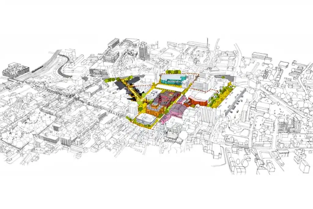
Preston's Development Landscape
Preston is in the midst of one of the most significant periods of investment and strategic development in its recent history. Preston 35 — the city’s regeneration plan for 2024–2035, developed by the Preston Regeneration Board in partnership with Lancashire County Council, UCLan, and the Preston Partnership — sets out an ambitious ten-year vision for the city, targeting housing growth, economic diversification, and neighbourhood renewal across Preston’s communities.
The city’s Levelling Up Fund success has already translated into tangible investment across its neighbourhoods, and the £434 million Preston, South Ribble, and Lancashire City Deal continues to support transport infrastructure expansion and employment growth across the Central Lancashire area.
Preston’s planning framework is currently guided by the Preston Local Plan 2012–26 (adopted July 2015), alongside the Central Lancashire Core Strategy (adopted July 2012). A new Central Lancashire Local Plan 2023–2041 — jointly prepared by Preston City Council, Chorley Council, and South Ribble Borough Council — completed Regulation 19 consultation in early 2025 and was submitted to the Secretary of State in summer 2025. Once adopted, this plan will replace all three current local plans and set the strategic framework for the Central Lancashire area through to 2041.
Why Choose Site Surveying Services in Preston?
Why Choose Site Surveying Services in Preston?
Major contractor trusted
working directly with Eric Wright Group on city-wide Levelling Up survey programmes demonstrates our capability on large-scale, multi-site public sector commissions
Multi-site coordination
experienced in planning and delivering simultaneous survey programmes across multiple city locations, with consistent methodology and quality throughout
15 miles from Preston
our Clitheroe base makes Preston practically a local project; fast mobilisation, no excessive travel costs, and genuine local knowledge of the city
Levelling Up and public sector experience
familiar with the survey requirements and programme pressures of publicly funded regeneration schemes
Full service range
topographic surveys, utility mapping, measured building surveys, laser scanning, and setting out all in-house
Competitive, transparent pricing
No hidden costs, with quotations typically within 24 hours
Frequently Asked Questions
Frequently Asked Questions
Do you carry out large-scale topographic survey programmes in Preston?
Yes — our multi-site Levelling Up programme for Eric Wright Construction across Preston city is our most substantial local example. We are experienced in planning and delivering topographic surveys across multiple simultaneous sites, maintaining consistent quality and methodology throughout even the most complex multi-location programmes.
Do you work with Eric Wright Group and other major Lancashire contractors?
Yes. Eric Wright Construction Limited is one of our Preston clients, and we have delivered a city-wide topographic survey programme for them in connection with Preston City Council’s Levelling Up funded regeneration. We are experienced in working with major regional contractors on large-scale public sector commissions.
Do you carry out utility surveys for infrastructure and public realm projects in Preston?
Do you survey UCLan or other education estates in Preston?
Yes. The University of Central Lancashire’s expanding campus and Preston’s schools and further education estate generate regular survey demand. We are experienced in delivering topographic, measured building, utility, and setting out surveys for education clients across Lancashire.
What is the Central Lancashire Local Plan and how does it affect Preston?
The Central Lancashire Local Plan 2023–2041 is a joint plan being prepared by Preston City Council, Chorley Council, and South Ribble Borough Council. It will replace the existing Preston Local Plan (2015), Chorley Local Plan (2015), and Central Lancashire Core Strategy (2012) once adopted, providing a single, up-to-date planning framework for the whole Central Lancashire area through to 2041. The plan was submitted to the Secretary of State in summer 2025 and is currently awaiting examination.