


 Leeds
Leeds Doncaster
 Sheffield
 Bradford
 Hull
Hull Halifax
 Sunderland
 Newcastle
 Middlesborough
 Yorkshire Moors
 Teesside
 Cumbria
 Harrogate
 York
York Yorkshire Dales
 Northumberland
 Goole
Goole Carlisle
 Keswick
 Kendal
 Barrow-in-Furness
 Lancaster
 Blackpool
 Morecambe
 Southport
 Liverpool
 Wigan
Wigan Manchester
 Blackburn
 Burnley
 Forest of Bowland
 Oldham
 Chester
 Stockport
 Peak District
 Skipton
 Crewe
Crewe Rotherham
 Stoke
Stoke Driffield
Surveying Services North West
Site Surveying Services in Clitheroe — Our Home Town
Clitheroe is where we started, and it’s where we’re based. Nestled in the heart of the Ribble Valley, beneath the shadow of Pendle Hill and at the foot of the Forest of Bowland, it’s a town we know inside out — and one we’re proud to call home. As a Lancashire market town with a Norman castle, a strong agricultural hinterland, and a growing commercial and residential development scene, Clitheroe and the wider Ribble Valley present a genuinely varied surveying environment. From historic listed buildings and rural estate surveys to infrastructure schemes, new-build residential developments, and environmental projects along the River Ribble and its tributaries, the borough offers the full range of challenges that our team has been built to handle. Being based here means we bring something that national firms operating from distant offices simply can’t match — genuine local knowledge, immediate mobilisation, and a deep familiarity with the landscapes, landowners, planning context, and built environment of the Ribble Valley and surrounding East Lancashire area.
We work nationwide. But Clitheroe is home — and we love working on our own doorstep.
Our Surveying Services in Clitheroe & the Ribble Valley
We offer a full range of professional surveying services to clients across Clitheroe, the Ribble Valley, and the surrounding East Lancashire area:

Topographic Surveys Clitheroe
detailed land and site surveys for planning applications, drainage, flood risk, and development across the Ribble Valley
Measured Building Surveys Clitheroe
precise floor plans, elevations, and sections for heritage buildings, commercial properties, converted mills, and residential buildings
3D Laser Scanning Clitheroe
high-density point cloud surveys and photogrammetric models for heritage recording, BIM, and asset management
UAV / Drone Surveys Clitheroe
aerial data capture across the Ribble Valley's varied and often challenging terrain
Sectors We Serve in Clitheroe & the Ribble Valley
Our local project work spans a wide range of sectors that reflect the character of the Ribble Valley borough:
Heritage & Conservation Clitheroe
surveys of Clitheroe's castle, listed buildings, and historic built fabric
Rural & Agricultural Clitheroe
estate surveys, farm buildings, and rural land assessments across the Ribble Valley countryside
Environmental & Watercourse Clitheroe
river surveys, flood risk assessments, and ecological survey support along the Ribble and its tributaries
Residential Development Clitheroe
topographic and utility surveys for new-build housing schemes and conversions across the borough
Commercial & Industrial Clitheroe
surveys for commercial properties, converted mill buildings, and employment sites
Infrastructure & Highways Clitheroe
surveys for road improvements, utilities, and public realm projects in Clitheroe and surrounding villages
Leisure & Tourism Clitheroe
surveys supporting the Ribble Valley's growing visitor economy, including estate, park, and countryside surveys
Case Studies & Project Highlights
Case Studies & Project Highlights
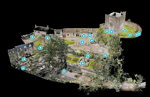
Clitheroe Castle — Topographic Survey & Photogrammetry
Topographic Survey / Photogrammetry / Elevations
t doesn’t get much more local than this. Clitheroe Castle sits at the very heart of our home town — one of the smallest Norman keeps in England, perched on a volcanic rock outcrop with panoramic views across the Ribble Valley and Pendle Hill beyond. We were commissioned to carry out a large-scale topographical survey of the castle and its surrounding grounds, building on earlier survey work we had already undertaken at the site including a detailed photogrammetry model and elevations. Surveying Clitheroe Castle is a genuinely special project — working within a scheduled monument and registered park, at a building that has stood for nearly a thousand years, demands the care, precision, and heritage awareness that our team brings to every sensitive commission. The survey forms part of an ongoing programme of work at the castle, helping to ensure this landmark heritage asset is accurately documented for conservation, maintenance, and future development purposes.

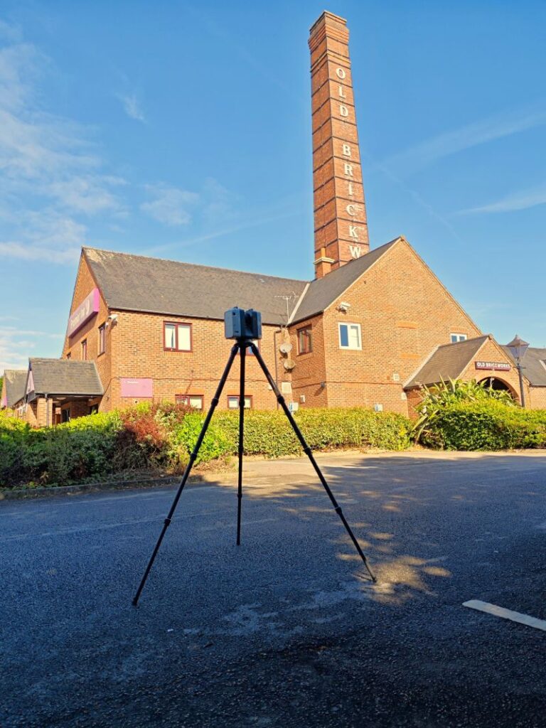
Converted Mill Building — Measured Building Survey
Measured Building Survey
The Ribble Valley and East Lancashire are home to a remarkable stock of former textile mills — many now converted to residential, commercial, or mixed-use purposes, and all presenting the unique surveying challenges that large, complex Victorian industrial buildings bring. Our team carried out a measured building survey at a converted mill building in the area — one of a varied day’s work that also included river cross-sections and a site survey across a recycling plant, demonstrating the breadth of environments our surveyors operate in daily.
Converted mill buildings require careful, systematic survey methodology. Their scale, complex floor-plate arrangements, and often significant structural alterations over the years mean that accurate as-existing drawings are essential for refurbishment design, planning applications, and building regulation submissions.
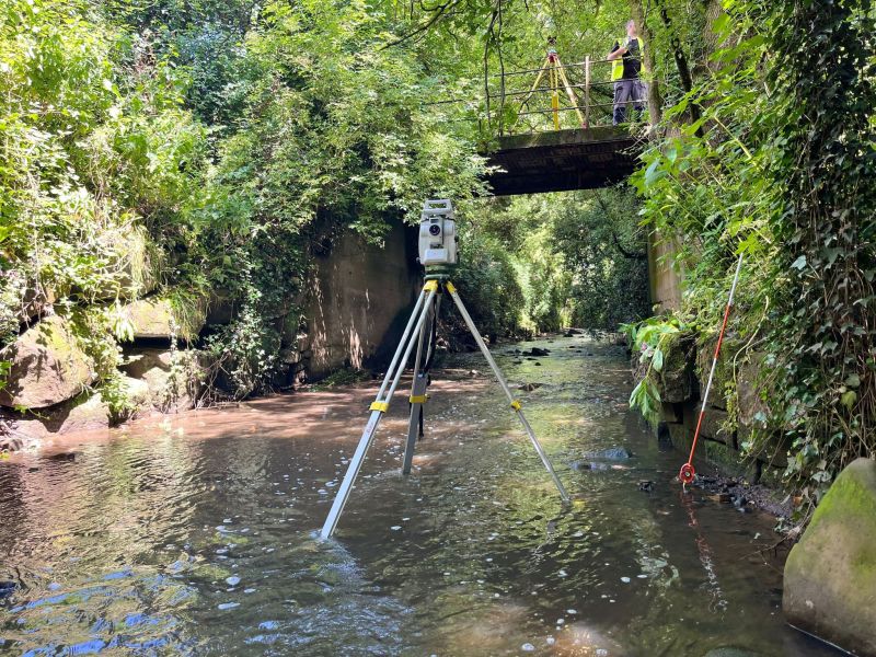
Footbridge Survey, River Ribble — Ribble Valley Borough Council
Bridge & Watercourse Survey
Clitheroe & the Ribble Valley's Development Landscape
Clitheroe & the Ribble Valley's Development Landscape
The Ribble Valley is one of Lancashire’s most distinctive boroughs — a predominantly rural area of outstanding natural beauty framed by the Forest of Bowland AONB, the Yorkshire Dales to the east, and the urban centres of East Lancashire to the south. Clitheroe is the principal market town, and the borough has seen consistent residential development activity alongside growing investment in tourism, heritage, and rural enterprise.
The borough’s planning framework is currently guided by the Ribble Valley Local Development Framework, comprising the Core Strategy (adopted December 2014) and the Housing and Economic Development DPD (adopted November 2019). A new comprehensive Local Plan to 2042 is currently in preparation — a significant undertaking that will shape development across the Ribble Valley for the next two decades.
Why Choose Site Surveying Services in Clitheroe?
Why Choose Site Surveying Services in Clitheroe?
We are local
headquartered in Clitheroe, we know the Ribble Valley, its landscapes, its planning context, and its built heritage better than any out-of-town firm
Immediate mobilisation
no travel costs, no early starts from elsewhere. We can be on site faster than anyone
Heritage specialists
from Clitheroe Castle to East Lancashire's mill buildings, we have the experience and technology to survey sensitive and complex historic structures
Watercourse expertise
river and watercourse surveys along the Ribble and its tributaries are part of our regular local workload
Nationwide capability from a local base
our Clitheroe location doesn't limit us. We deliver projects across the whole of the UK from right here
Community investment
we are part of this community. Supporting local projects, working with local clients, and delivering quality that reflects our pride in the place we call home
Frequently Asked Questions
Frequently Asked Questions
Do you survey in the Forest of Bowland AONB and the wider Ribble Valley countryside?
Yes — regularly. The Forest of Bowland and the rural Ribble Valley are very much our home territory. We carry out topographic surveys, estate surveys, watercourse surveys, and UAV surveys across the AONB and surrounding countryside. We understand the access considerations, landowner relationships, and environmental sensitivities that come with working in protected landscapes.
Can you survey listed buildings and historic properties in Clitheroe?
Absolutely. Clitheroe has a rich stock of listed buildings, from the castle itself to historic commercial buildings and rural farmhouses. We use 3D laser scanning, photogrammetry, and traditional measured survey techniques to record historic structures accurately, with the care and minimal intervention that sensitive heritage assets require.
Do you carry out river and watercourse surveys along the River Ribble?
Yes. River cross-sections, longitudinal profiles, and flood risk topographic surveys along the Ribble and its tributaries are a regular part of our local workload. We work alongside environmental consultants, flood risk engineers, and ecological surveyors on projects supporting planning applications and river management programmes.
Can you survey converted mill buildings in the Clitheroe and Ribble Valley area?
Yes — and we do so regularly. Lancashire’s former textile mills are some of the most characterful and complex buildings to survey, and we have the experience and methodology to capture accurate measured building survey data across even the largest and most complex mill conversions.
Can you Do you work with Ribble Valley Borough Council on local projects?
Yes. We have carried out survey work at council-owned assets including Clitheroe Castle, and we are familiar with the borough’s planning requirements and public sector procurement processes.
Is there a travel charge for projects in Clitheroe and the Ribble Valley?
No additional travel costs for most projects in Clitheroe and the immediate Ribble Valley area — we’re already here. For projects elsewhere in Lancashire and further afield, we provide transparent, all-inclusive quotations.