


 Leeds
Leeds Doncaster
 Sheffield
 Bradford
 Hull
Hull Halifax
 Sunderland
 Newcastle
 Middlesborough
 Yorkshire Moors
 Teesside
 Cumbria
 Harrogate
 York
York Yorkshire Dales
 Northumberland
 Goole
Goole Carlisle
 Keswick
 Kendal
 Barrow-in-Furness
 Lancaster
 Blackpool
 Morecambe
 Southport
 Liverpool
 Wigan
Wigan Manchester
 Blackburn
 Burnley
 Forest of Bowland
 Oldham
 Chester
 Stockport
 Peak District
 Skipton
 Crewe
Crewe Rotherham
 Stoke
Stoke Driffield
Land and engineering surveyors based in Lancashire
Control Network Installation
Control Network Installation Lancashire and the north west
Accurate Survey Control Networks Across the UK
Accurate Survey Control Networks Across the UK
Every survey programme is only as reliable as the control network it is built on. The topographic survey, the setting-out, the machine control calibration, the laser scanning registration, the monitoring datum — every downstream survey activity depends on the control being right from the outset. A poorly established control network does not just introduce errors into the immediate survey. It introduces errors that compound through every subsequent activity on the programme, potentially affecting every structure built from that control for the duration of the project.
Site Surveying Services installs control networks across Lancashire, the North West and nationally — for civil engineers, principal contractors, earthworks contractors, highways engineers and any programme where multiple survey disciplines need to work from a shared, reliable, verified coordinate framework. Based in Clitheroe, with offices in Matlock, Newcastle and Bristol, our directly employed team designs, installs and verifies control networks across projects of all scales — from private development sites to major infrastructure programmes.
We do not just install control points. We advise on the accuracy specification the programme requires, design the network geometry to achieve it, install the physical monumentation to survive the programme, verify the network before any downstream survey activity begins, and re-verify at programme stages to confirm stability. The control network is the foundation. We treat it as one.
What Is a Control Network?
A control network is a series of accurately positioned reference points established across a site. These points provide the coordinate framework used for:
Control networks ensure that all survey and construction activities are working from the same consistent coordinate system.
What We Install & Why Control Network Matters.
What We Install & Why Control Network Matters.
Primary control network
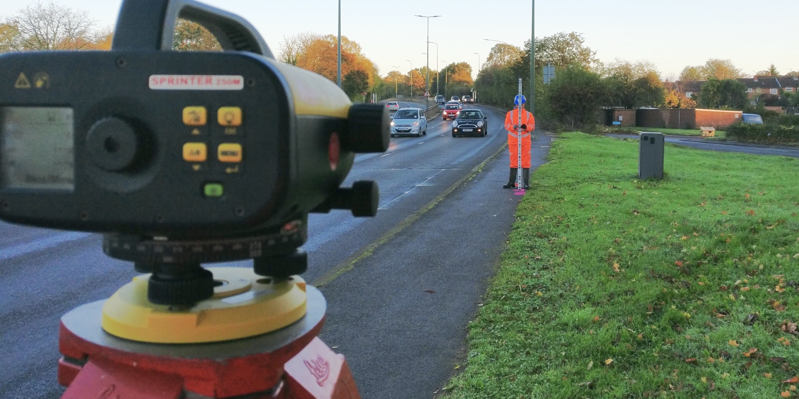
The primary network consists of a small number of high-accuracy, permanently monumented control stations established across the site — typically four to eight points depending on site size and geometry. Primary stations are installed in stable ground, clear of construction influence zones and trafficked areas, and are designed to survive the full programme duration. They provide the geometric skeleton from which secondary control is derived. Primary control is established using dual-frequency GNSS receivers observing over extended sessions, processed against OS Net or Ordnance Survey active control stations to achieve centimetre-level absolute accuracy. Where GNSS is restricted by overhead obstructions, urban canyons or site conditions, primary control is established by total station traverse from OS control points.
Secondary control network
Secondary control extends the primary network into the working areas of the site — providing readily accessible reference points for the setting-out engineers, machine control operators and survey teams working within the programme. Secondary stations are established by total station traverse from primary control, with redundant observations and network adjustment to confirm consistency. Secondary stations are designed for accessibility — stainless steel bolts, concrete-encased spikes or nails in tarmac depending on the surface — positioned to give the setting-out team clear lines of sight to the construction areas without requiring occupations of points in hazardous locations.
Height datum and benchmarks
A reliable height datum is established across the site tied to Ordnance Datum Newlyn by precise levelling from Ordnance Survey benchmarks or GNSS-derived orthometric heights using the OSGM geoid model. Working benchmarks are distributed across the site at the density required by the setting-out and drainage design programme — typically one benchmark per working area or per construction phase.
Verification and quality assurance
A control network is a series of accurately positioned reference points established across a site, tied to a common coordinate system — typically OS National Grid in plan and Ordnance Datum Newlyn (ODN) in height. These points provide the geometric framework from which all survey and construction activities on the programme operate. Every discipline that uses spatial data on a construction programme depends on the control network being correct:
Topographic survey
The survey team occupies control stations to orient their instrument and check their position before capturing site features. If the control is wrong, the topographic data is wrong.
Setting-out
The setting-out engineer occupies control stations to establish their instrument position before locating any construction feature. Wrong control means wrong structure positions.
Machine control
GPS and total station machine control systems are calibrated to the site control network. If the calibration is wrong, the earthworks are wrong — potentially across the entire site extent.
Laser scanning
Point cloud registration and georeferencing is tied to the control network. A scan registered to poor control cannot be accurately positioned in the project coordinate system.
Monitoring
monitoring programmes measure movement relative to a stable reference datum. If the datum points are themselves in the influence zone of the construction works, the monitoring data is unreliable.
BIM coordination
BIM models are positioned within a project coordinate system shared across all disciplines. The control network is the physical realisation of that coordinate system on site.
Control Network Installation for Key Sectors
Control Network Installation for Key Sectors
Site Surveying Services provides professional control network installation across a wide range of industries and project environments. Our survey control solutions are tailored to meet the technical demands of each sector, ensuring accuracy, consistency and long-term reliability. This sector experience ensures we can deliver the right control solution for your project – regardless of size, complexity or environment. We regularly install control networks for:
Civil Engineering & Infrastructure
Supporting highways, bridges, drainage schemes and large-scale infrastructure where precise site control is critical.
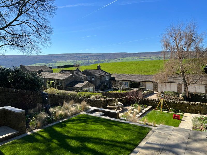
Construction & Commercial Development
SLAM scanners are mobile, allowing surveyors to walk through a space while capturing continuous 3D data. Ideal for confined or intricate interior spaces, industrial facilities, areas with obstructed access
Residential & Housing Projects
Providing robust site control for plot setting out, roads, utilities and phased housing developments.
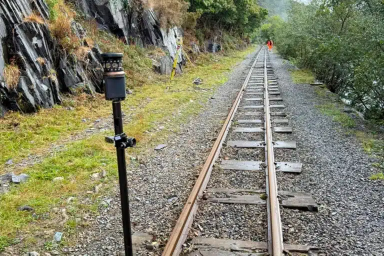
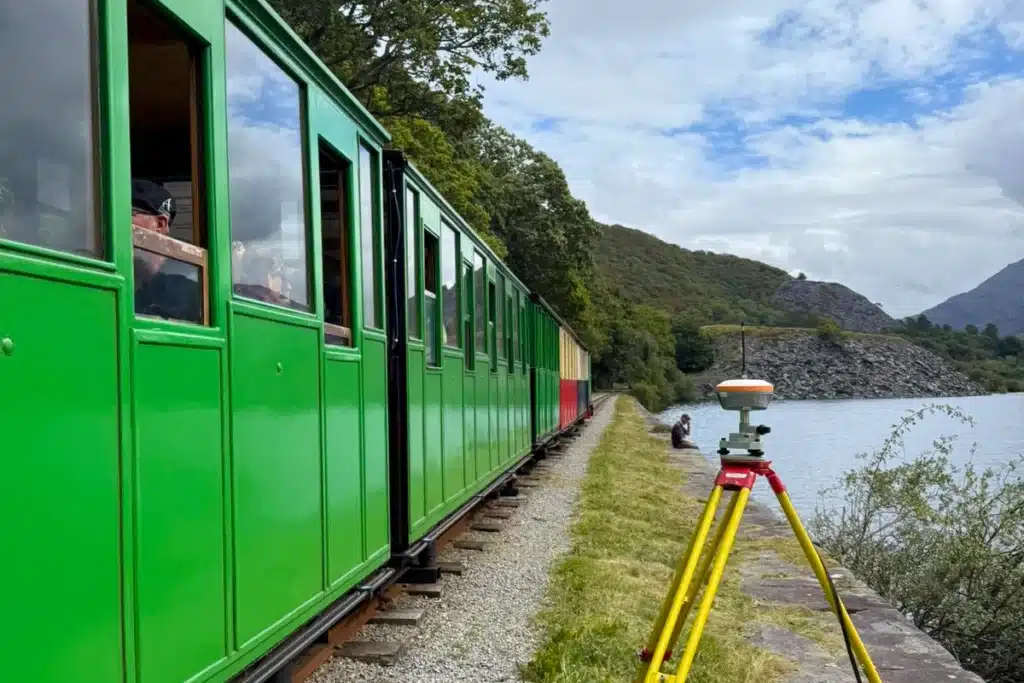
Rail & Transport Schemes
High-accuracy control for rail corridors, stations, depots and transport infrastructure projects.
Airports & Aviation Works
Specialist control networks for runway paving, slipform operations and high-tolerance airport construction.
Earthworks & Bulk Excavation
Control frameworks for large earthmoving projects, enabling machine control calibration and accurate cut/fill operations.
Utilities & Energy Projects
Survey control for pipelines, substations, service installations and PAS 128 utility coordination.
Who commissions control network installation from us
Civil engineers and principal contractors
Establishing site control before topographic survey, setting-out and machine control begins on major construction and infrastructure programmes across the North West.
Highways engineers
Primary and secondary control for road improvement schemes, active travel routes and junction improvement programmes. We understand Highways England coordinate system requirements and OS Net connection methodology.
Earthworks contractors
Control network installation and machine control calibration for bulk earthworks programmes. The control is the first activity before earthworks begins — we are experienced in mobilising quickly and getting the framework in place without delaying the programme.
Rail and transport programmes
High-accuracy control networks for rail corridor schemes, station works and transport infrastructure. The Leeds Train Station image on this page reflects this capability — control on live, operationally active transport infrastructure.
Airport and paving works
Monitoring engineers
Reference benchmark installation for structural and geotechnical monitoring programmes. The stability of the reference datum is the foundation of the monitoring data — we install and verify benchmarks that are genuinely outside the influence zone and founded in stable material.
UAV survey operators and laser scanning teams
Ground control point installation for UAV LiDAR and photogrammetric surveys. GPS-measured targets installed at the density and distribution required to achieve the survey accuracy specification.
Land Surveying Services
Control Network Installation for Your Sector
our Topographical survey case studies
Comprehensive Infrastructure Survey — Ilkley
Control network installation as the foundation for a full topographic and PAS 128 utility mapping package at Ilkley. Primary and secondary control established across the site before survey began, providing the geometric framework from which both the topographic survey and the utility mapping data were captured and delivered as a single georeferenced dataset. The control network ensured both datasets were in the same coordinate system and could be delivered as one coordinated product to the design team.
HMP Manchester — Security-Critical Control Installation
Control network installation at HMP Manchester — a constrained, secure custodial environment where access protocols, coordination with site security and restricted movement across the estate made control installation significantly more complex than a standard site. Primary control established in secure accessible areas, secondary control extended through coordinated access into the survey areas. The framework provided the geometry for the measured building survey programme across the estate.

Our Services
How Control Network Installation Integrates with Other Services.
How Control Network Installation Integrates with Other Services.
Control network installation is rarely a standalone commission — it is the first activity in almost every multi-discipline survey programme we deliver. Control network and topographic survey includes a primary control is established before topographic survey begins, providing the coordinate framework the survey team occupies to capture all site features. On combined programmes, we install control and complete the topographic survey in a single mobilisation. Control network and setting-out where the control network installed before construction begins is the same framework the setting-out engineers work from throughout the programme. Installing it correctly at the start avoids the need to re-establish control mid-programme when setting-out errors are discovered. Control network and machine control where GPS machine control systems are calibrated to the site control network. We install the control and complete the machine control calibration in a coordinated programme, ensuring the earthworks machinery is aligned to the design model from day one.
Topographical Surveys
OS-controlled accurate, efficient and cost effective surveys for highways, civils and development. Cad and BIM-ready output.
PAS 128 utility mapping
Providing the location of underground services in 2D or 3D through qualified utility mapping surveys, using advanced GPR and Electromagnetic Location.
Measured building survey
Delivering accurate as-built information that supports design, refurbishment, planning and construction with the latest technology. Producing reliable drawings and digital models.
Laser Scanning
3D laser scanners capture millions of points per second, creating a point cloud which enables the finer details and the physical site to be viewed remotely.
Mobile mapping
For highway engineers, infrastructure managers, local authorities and contractors working on live road schemes, mobile mapping is now the standard for corridor surveys.
3D Machine control
With decades of supporting major earthworks contractors and large-scale infrastructure schemes, we provide reliable machine control across Lancashire and the wider UK.
Setting out engineers
With strong, long-standing relationships across the civil engineering and construction sector, we supply skilled professionals who keep your projects accurate, efficient and on programme.
bathymetric surveys & river surveys
Using modern technology, we capture detailed underwater and river channel information safely and efficiently – delivering reliable data you can trust.
Stockpile surveys & volumetric analysis
Whether a one-off stockpile measurement or regular monitoring, we deliver reliable, repeatable data tailored to your project using advanced technology.
Control Network Installation
Delivering robust and precise site control systems to support every stage of construction in developments, infrastructure schemes or major earthworks.
aerial & drone surveys
CAA-approved drone operations for aerial mapping, photogrammetry and volumetric analysis, providing a comprehensive view of terrain, structures and landscapes.
3D BIM Modelling
Whether you require an as-built Revit model, federated coordination model or detailed digital twin, our team delivers high quality, design-ready outputs.
survey equipment hire
We offer a vast range of surveying and engineering equipment for hire and will always try to beat a comparable quote. Discover the fleet.
monitoring
Providing reliable monitoring surveys across the UK, delivering precise data that supports risk management, compliance and informed decision making throughout a project lifecycle.
Virtual Tour 3D
An immersive experience which instantly transports your clients to your business, guiding them through your space and creating a seamless experience.
Impermeable area surveys
We deliver georeferenced impermeable area data that drainage engineers and planning consultants can work from directly.
CCTV & Drainage surveys
Acoustic & Noise Assessments
We deliver acoustic and noise assessments, supporting planning applications, discharge of conditions and Environmental Impact Assessments.
Why choose site surveying services
On site. On spec. On time.
Verified in writing before any downstream activity.
The network adjustment results, accuracy achieved and coordinate system are confirmed in a written network report before the setting-out team, survey team or machine control system uses the control. Not assumed. Documented.
Installed away from the influence zone.
Primary control stations positioned to survive the programme duration — away from construction traffic, plant movements and the ground disturbance that shifts control points mid-programme.
The foundation everything else depends on.
Topographic survey, setting-out, machine control, laser scanning, monitoring — all depend on the control network being correct. We treat it as the most important survey activity on the programme. Because it is.
Re-verification at programme stages.
Control stability confirmed at agreed milestones throughout long programmes. The check that catches disturbance before it propagates into setting-out errors — and before the setting-out engineer arrives on site.
Frequently Asked Questions
Frequently Asked Questions
What is a survey control network?
A survey control network is a series of accurately positioned reference points established across a site, tied to a common coordinate system. It provides the geometric framework from which all survey and construction activities on the programme operate — topographic survey, setting-out, machine control, laser scanning, monitoring and BIM coordination all depend on the control network being correctly established before they begin. Think of it as the skeleton of the programme’s spatial data — everything else is built from it.
What is the difference between primary and secondary control?
Primary control consists of a small number of high-accuracy, permanently monumented stations established across the site in stable ground, designed to survive the full programme duration. They provide the geometric skeleton of the network. Secondary control extends the primary network into working areas — providing accessible reference points for setting-out engineers and survey teams at the density required by day-to-day construction activity. Primary control is established to higher accuracy than secondary; secondary is derived from primary by total station traverse.
What coordinate system do you use?
We work in OS National Grid (OSGB36 / EPSG:27700) in plan and Ordnance Datum Newlyn (ODN) in height as standard — the coordinate system required for all construction programmes in England, Scotland and Wales. Where a project uses a local site coordinate system, we establish the transformation between the local system and OS National Grid and document it in the control network report so all disciplines are working from a consistent framework. If the project BIM model or machine control system uses a specific coordinate system, confirm this at the time of instruction.
How long does a control network take to install?
For most construction and development sites, primary and secondary control installation takes one to two days. The GNSS observation sessions for primary control require time on site — typically two to four hours of occupation per primary station to achieve centimetre-level accuracy. Total station traversing for secondary control can be completed more rapidly. We will confirm the realistic programme for your specific site at the time of quoting.
How do you connect to OS National Grid?
We connect to OS National Grid using one of two methods depending on site conditions. Where GNSS observation is unobstructed, we observe primary control stations using dual-frequency GNSS receivers processed against OS Net active reference stations — the national network of continuously operating GPS receivers maintained by Ordnance Survey. Where GNSS is restricted by overhead obstructions or urban environment, we establish primary control by total station traverse from Ordnance Survey triangulation stations or published OS benchmarks in the area.
What happens if a control station is disturbed during construction?
Construction sites are dynamic environments — control stations get disturbed, damaged and buried. This is why primary control stations are installed in stable, protected locations away from construction traffic, and why we recommend periodic re-verification of the network at programme stages. If a primary station is disturbed, the secondary control derived from it may be affected — which is why detecting the disturbance early, before it propagates into setting-out errors, matters. We advise on a re-verification schedule at the time of installation and can attend site to check the network at any point during the programme.
What deliverables do you provide with a control network?
We provide a full control network report including: a schedule of all control point positions (easting, northing, elevation) with their unique identifiers; a site control drawing showing all point locations; the observation methodology and equipment used; the network adjustment results and accuracy achieved; and the transformation parameters if a local site grid is used. All documentation is produced in a format that your structural engineer, MEP consultant and setting-out team can work from directly.
Can you install ground control points for UAV surveys?
Yes. Ground control points (GCPs) for UAV LiDAR and photogrammetric surveys are GPS-measured targets positioned across the survey area before the flight to tie the aerial data to OS National Grid. We install and measure all GCPs ourselves using CHCNAV and Leica GPS instrumentation. The number, distribution and accuracy specification of GCPs depends on the site size and the survey accuracy requirement — we advise on this at the time of scoping for every UAV survey we commission.
Do you re-verify control networks during long programmes?
Yes — and we recommend it. On programmes lasting more than a few months, primary control stations should be re-verified periodically to confirm they have remained stable. Ground settlement, frost heave, adjacent construction activity and accidental disturbance can all affect control stability over time. We can attend site to re-verify the primary network at agreed programme stages and issue an updated control network report confirming the current point positions and any movement detected since the original installation.
What areas do you cover?
Our head office is in Clitheroe, Lancashire, with offices in Matlock, Newcastle and Bristol. We install control networks across the North West, North East, Midlands and South West as primary territories, and nationally. All work is carried out by our directly employed team. No project is too far if the programme requires it.