


 Leeds
Leeds Doncaster
 Sheffield
 Bradford
 Hull
Hull Halifax
 Sunderland
 Newcastle
 Middlesborough
 Yorkshire Moors
 Teesside
 Cumbria
 Harrogate
 York
York Yorkshire Dales
 Northumberland
 Goole
Goole Carlisle
 Keswick
 Kendal
 Barrow-in-Furness
 Lancaster
 Blackpool
 Morecambe
 Southport
 Liverpool
 Wigan
Wigan Manchester
 Blackburn
 Burnley
 Forest of Bowland
 Oldham
 Chester
 Stockport
 Peak District
 Skipton
 Crewe
Crewe Rotherham
 Stoke
Stoke Driffield
Surveying Services North West
Site Surveying Services in the Rossendale Valley, Lancashire
The Rossendale Valley is one of Lancashire’s most characterful landscapes — a deep, winding valley carved between the West Pennine Moors and the Pennine upland, home to the former textile towns of Rawtenstall, Bacup, Whitworth, and Haslingden. It’s a place of striking contrasts: Victorian mill buildings and stone terraces against open moorland, industrial heritage alongside a growing outdoor leisure economy, and a community that takes quiet pride in its distinctive identity. For surveyors, Rossendale is as varied a working environment as anywhere in Lancashire — upland sites with Highland Cows wandering onto your survey, scaffolded town centre buildings on streets made famous by television, water treatment works requiring early starts and emergency topographic surveys, and rural development sites where no two days look the same. Site Surveying Services covers the Rossendale Valley and its surrounding area regularly — based just over the ridge in Clitheroe, we’re practically neighbours. From Whitworth topographic surveys and Bacup measured building surveys to setting out at Rossendale Waste Water Treatment Works and rural surveys on the valley sides, this is familiar territory for our teams.
Our Surveying Services in the Rossendale Valley
Topographic Surveys Rossendale Valley
detailed land and site surveys for planning, drainage, development, and infrastructure across Rossendale's valley and moorland terrain
Measured Building Surveys Rossendale Valley
precise floor plans, elevations, and sections for Rossendale's mill buildings, Victorian terraces, and commercial properties
Setting Out Services Rossendale Valley
precise construction setting out for utilities, infrastructure, and development projects including water treatment works
Utility Surveys Rossendale Valley
underground service detection and mapping using GPR and electromagnetic equipment
Sectors We Serve in the Rossendale Valley
Our Rossendale project experience covers the valley’s distinctive mix of industrial, infrastructure, and rural activity:
Water & Utilities Infrastructure Rossendale
setting out and survey support for water treatment works, utility installations, and environmental infrastructure
Heritage & Conservation Rossendale
measured surveys of Rossendale's Victorian mill buildings, stone terraces, and listed heritage assets
Commercial & Retail Rossendale
measured building surveys for town centre commercial properties across Rawtenstall, Bacup, and Whitworth
Residential Development Rossendale
topographic and utility surveys for housing schemes across the valley towns and moorland edge
Rural & Agricultural Rossendale
topographic surveys on Rossendale's valley sides and upland fringe, including sites shared with the local livestock
Industrial Rossendale
surveys for industrial and employment sites across the Rossendale corridor
Surveying Case Studies & Project Highlights in Rossendale Valley
Case Studies & Project Highlights
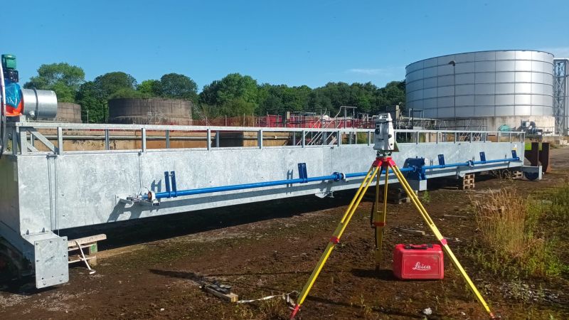
Rossendale Waste Water Treatment Works — Setting Out & Emergency Topographic Survey
Setting Out & Topographic Survey
Up bright and early at Rossendale Waste Water Treatment Works — setting out new tank tracks as part of a works improvement programme, with an emergency topographic survey requirement squeezed into the same day. Not the most glamorous of settings, but an important one — water infrastructure of this kind serves communities across the valley and keeping it operational and up to standard matters. The ability to respond to an emergency topographic survey requirement on the same day as a planned setting out commission reflects the kind of flexibility that infrastructure clients need from their survey teams. When unexpected requirements arise on active utility sites, having a survey partner who can adapt and deliver without delay keeps programmes moving. Not much we can’t overcome.
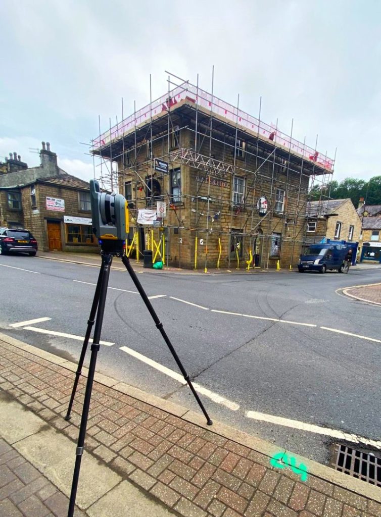
Measured Building Survey, Bacup — The Brassic Streets
Measured Building Survey
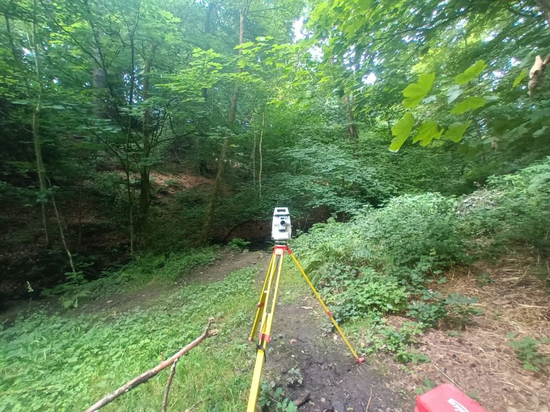
Topographic Survey, Bacup — Woodland & Continuing Work
Topographic Survey
Off out the gates early on a busy week — a topographic survey in Bacup amongst the trees, before continuing survey work in Bradford and heading to sites across Wakefield, London, Ilkley, Stockport, Burnley, and Accrington through the week. A snapshot of the range and pace of our operations: local surveys in Rossendale and Lancashire running alongside projects across Yorkshire, Greater Manchester, and London simultaneously. The Rossendale Valley may be home territory, but our reach extends nationwide from day one.
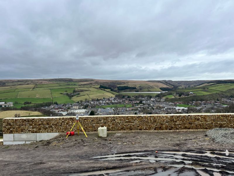
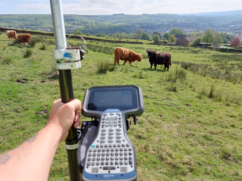
Rawtenstall — Rural Topographic Survey (Highland Cow Edition)
Topographic Survey
A survey on the valley sides above Rawtenstall — and one that came with unexpected company. A small herd of Highland Cows decided our survey equipment was of considerable interest, causing a certain amount of disruption to proceedings. Using initiative and a commitment to not disrupting their day any more than necessary, the team protected the equipment rather than attempted to relocate their new companions. Probably one of the more unusual methods of instrument protection in our operating history — but the survey was completed, the data was captured, and the Highland Cows remained entirely unbothered.
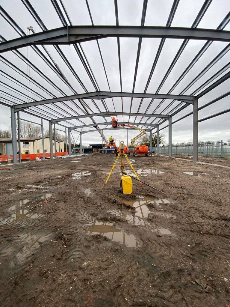
Whitworth & Clayton-le-Woods — Topographic Survey & Steel Plumbing
Topographic Survey & Setting Out
From topographic surveys out in Whitworth to plumbing steel in Clayton-le-Woods — a day that captures the breadth of what our teams deliver. Rural topographic survey in a Lancashire valley community on one side, structural steel setting out on a new build commercial frame on the other. There’s never a dull day, and the range of skills our teams bring to each project is exactly what clients across the region rely on.
Rossendale's Development Landscape
Rossendale's Development Landscape
Why Choose Site Surveying Services in Rossendale?
Why Choose Site Surveying Services in Rossendale?
Practically next door
based in Clitheroe, just over the ridge from the Rossendale Valley, we know this landscape and can mobilise instantly
Emergency response capability
as our Waste Water Treatment Works commission shows, we can absorb same-day emergency survey requirements alongside planned work without missing a beat
All terrains covered
from scaffolded town centre buildings and water treatment works to woodland surveys and Highland Cow-adjacent rural sites, we handle whatever Rossendale throws at us
Nationwide reach from a local base
busy across Rossendale and simultaneously delivering projects across Yorkshire, London, and beyond
Competitive pricing
no city-centre overheads, straightforward transparent fees
Any size project
from a quick topographic survey to a complex industrial commission, no project too big or small
Frequently Asked Questions
Frequently Asked Questions
Do you carry out measured building surveys of Victorian mill buildings and terraces in Rossendale?
Yes. Rossendale’s stone-built Victorian commercial buildings and terraces require careful, accurate survey work — and we deliver it regularly across Bacup, Rawtenstall, and Whitworth. Our laser scanning methodology is particularly effective for buildings with complex geometries, irregular alterations, and access challenges such as scaffolding.
Can you respond to emergency survey requirements on utility and infrastructure sites in Rossendale?
Yes. Our Rossendale Waste Water Treatment Works commission involved completing an emergency topographic survey on the same day as a planned setting out commission. When urgent survey requirements arise on live utility sites, we can adapt and deliver without delay.
Do you carry out topographic surveys on rural and moorland sites in the Rossendale Valley?
Yes — including sites with livestock. Our Rawtenstall rural survey is a case in point. We are experienced in working across the valley sides and moorland fringe, adapting to whatever conditions — and company — we encounter.
Do you carry out setting out for water and utilities infrastructure in Rossendale?
Yes. Setting out for water treatment tank tracks, utility installations, and infrastructure works is a regular part of our workload across East Lancashire. We deliver precise positions and clear marking that keeps infrastructure programmes on track.