


 Leeds
Leeds Doncaster
 Sheffield
 Bradford
 Hull
Hull Halifax
 Sunderland
 Newcastle
 Middlesborough
 Yorkshire Moors
 Teesside
 Cumbria
 Harrogate
 York
York Yorkshire Dales
 Northumberland
 Goole
Goole Carlisle
 Keswick
 Kendal
 Barrow-in-Furness
 Lancaster
 Blackpool
 Morecambe
 Southport
 Liverpool
 Wigan
Wigan Manchester
 Blackburn
 Burnley
 Forest of Bowland
 Oldham
 Chester
 Stockport
 Peak District
 Skipton
 Crewe
Crewe Rotherham
 Stoke
Stoke Driffield
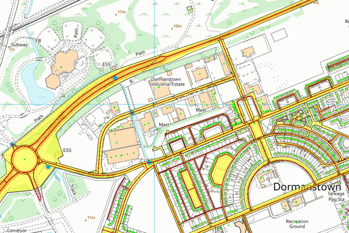
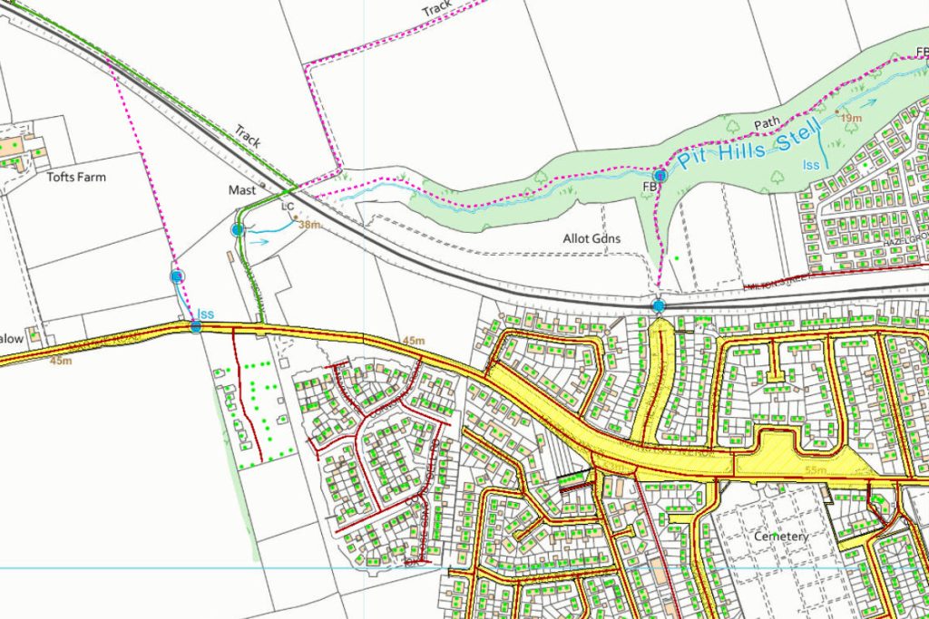
Land and engineering surveyors based in Lancashire
CCTV & Drainage Surveys
CCTV & Drainage Surveys Lancashire and North West
Accurate CCTV and Drainage Survey Services Across the UK
Accurate CCTV and Drainage Survey Services Across the UK
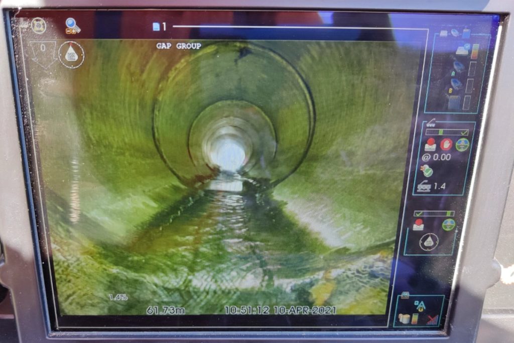
What is a CCTV drainage survey?
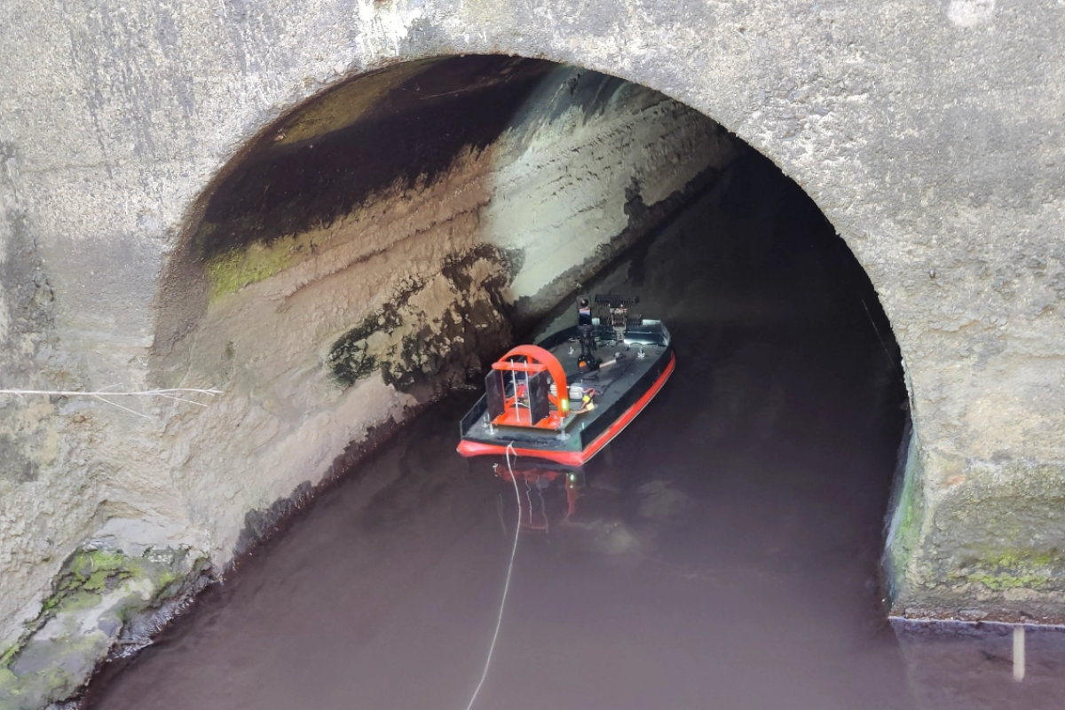
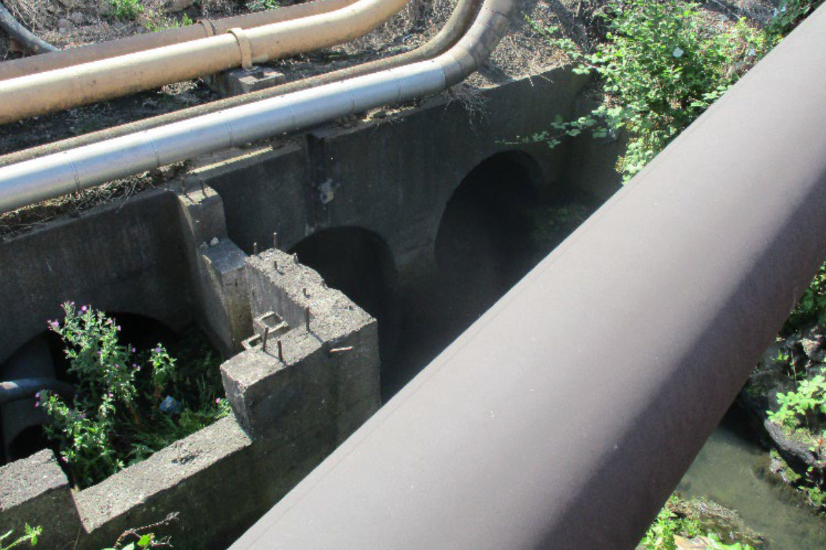
A CCTV drainage survey is a detailed visual inspection of an underground drainage system using a remotely operated camera deployed through existing access points – manholes, inspection chambers and gully pots. The camera travels through the pipe, recording a continuous video record of the internal condition of every pipe run inspected – identifying defects, blockages, root intrusion, structural failure, mis-connections and any feature that affects the drainage system’s performance or condition.
Accurate CCTV drainage data reduces design risk, prevents costly groundworks surprises, supports planning condition discharge, and ensures drainage systems meet adoption standards before the adoption process begins. A CCTV drainage survey from Site Surveying Services forms the reliable foundation for:
Drainage adoption
Inspection and condition records to WRC Sewerage Rehabilitation Manual (SRM) standards and to the requirements of the adopting authority - local authority highway drainage or water company - before Section 38, Section 278 or Section 104 adoption processes begin.
Planning condition discharge
Documented CCTV drainage inspection records that satisfy LPA drainage conditions and LLFA requirements on residential, commercial and infrastructure development.
Pre-purchase and due diligence
Condition records of existing drainage infrastructure before property or land acquisition - identifying defects, capacity issues and maintenance liabilities before contracts exchange.
Drainage design and problem investigation
Condition and capacity data for drainage designers investigating existing systems - blockages, structural defects, mis-connections, surcharging and drainage performance issues on existing sites.
Pre-construction and as-built records
CCTV inspection of drainage before and after construction - confirming existing condition before works begin and producing the as-built drainage record at completion.
across Lancashire and the North West
Our CCTV & Drainage Survey Services
Our CCTV & Drainage Survey Services
Underground drainage infrastructure cannot be designed around, adopted or maintained without knowing its condition. Estimating what is below ground – based on old records, assumed pipe routes or construction drawings that do not reflect what was built – produces drainage designs, adoption submissions and maintenance programmes that fail when the ground is opened and reality does not match the assumption.
Site Surveying Services delivers CCTV drainage surveys across Lancashire, the North West and nationally – for drainage engineers, planning consultants, developers, local authorities, highway authorities and construction contractors who need verified condition data on underground drainage systems. Our team is directly employed. Every survey is planned, delivered and processed in-house – the same organisation that quotes your job is the team that completes it. All inspections are carried out using professional-grade CCTV equipment, coded to recognised industry standards, and delivered in the format the adopting authority and drainage engineer require.
The people who commission CCTV drainage surveys from us are the people whose adoption submission, drainage design and planning condition discharge depends on the data being right. We understand what that means.
Pipe Condition Recording
Full internal CCTV inspection of each pipe run - continuous video record of internal condition, structural defects, root intrusion, joint displacement, debris, blockages and all visible features.
Defect Coding
All defects identified and coded to WRC Sewerage Rehabilitation Manual (SRM) standard or the adopting authority's specified coding system. Defect schedule produced for each pipe run inspected.
Drainage Layout Plan
Georeferenced drainage layout drawing showing all inspected pipe runs, manholes, inspection chambers, gully connections, invert levels, pipe diameters, materials and flow directions. Produced in AutoCAD DWG and PDF format.
Manhole Inspection
Visual inspection of all accessible manhole and inspection chamber structures - cover condition, frame, step irons, benching, channel and any structural defects recorded and reported.
Invert and Cover Level Survey
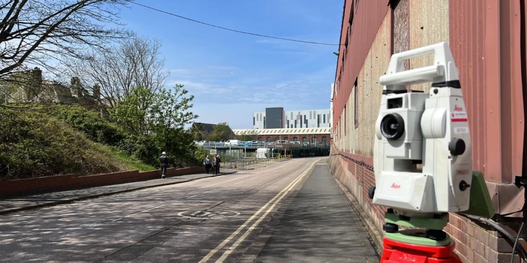
Invert and cover levels of all manholes and inspection chambers surveyed using GPS and/or total station instrumentation and recorded on the drainage layout drawing for adoption and drainage design purposes.
CCTV Video Record
Full video record of every pipe run inspected, delivered as MP4 files referenced to the drainage layout plan. The complete, timestamped visual record of the drainage system's condition at the date of survey.
As-Built Drainage Record
Where CCTV survey is commissioned at practical completion of new drainage, the as-built drainage record confirms the completed pipe runs, invert levels, pipe diameters and materials as constructed - the document required for adoption.
Why Do You Need
A CCTV & Drainage Survey?
Why Do You Need A CCTV & Drainage Survey?
A CCTV drainage survey gives you a verified, documented record of underground drainage condition and layout.
Drainage adoption - Section 38, 278 and 104
Pre-purchase due diligence and condition assessment
Planning condition discharge
Drainage design and problem investigation
Pre-construction condition record
As-built drainage record at completion
Drainage maintenance and rehabilitation planning
Who Commissions CCTV & Drainage Surveys From Us
CCTV drainage survey sits at critical stages of every construction, development and infrastructure programme involving underground drainage. The clients who commission them include:
Drainage Engineers and Drainage Designers
Commissioning CCTV surveys to establish existing drainage condition and layout before designing drainage improvements, adoptions or connections. We deliver data in the format your drainage design software requires.
Property Developers and Housebuilders
Pre-purchase condition records, pre-construction baseline surveys and post-construction as-built records for residential, commercial and mixed-use development across Lancashire and the North West. Section 104 adoption drainage records for new drainage adoptions.
Construction Contractors and Groundworkers
Pre-construction CCTV of existing drainage before groundworks begin – establishing the existing condition before the contractor is on site, protecting against third-party claims for damage. As-built CCTV at practical completion for adoption and planning condition purposes.
Local Authorities and Highway Authorities
CCTV inspection of highway drainage before and after road improvement, public realm and active travel schemes. Drainage condition records for maintenance and rehabilitation planning across the highway drainage network.
Planning Consultants and Architects
CCTV drainage surveys to support planning applications, planning condition discharge and pre-application drainage strategies where the existing drainage condition affects the scheme design.
Property Owners and Facilities Managers
Problem investigation – blockages, flooding, drainage failure, surcharging – and condition records for maintenance planning, insurance purposes and drainage rehabilitation on existing residential, commercial and industrial sites.
CCTV & Drainage Surveys for Your Sector
We provide flexible outputs to suit drainage engineers, local authorities, developers and contractors:
What Will You Receive from a CCTV & Drainage Survey?
What Will You Receive from a CCTV & Drainage Survey?
Full video inspection record of every pipe run, delivered as MP4 files referenced to the drainage layout plan.
Georeferenced drainage drawing showing all pipe runs, manholes, invert levels, pipe diameters, materials and flow directions.
All defects coded to WRC SRM or adopting authority standard, referenced to the drainage plan.
Cover and invert levels, structural condition notes for all manholes and inspection chambers.
Survey coverage, equipment used, inspection standard applied and date of survey.
(Note: Ground penetrating radar and electromagnetic detection of drainage routes - where pipes are not accessible for CCTV - is delivered as part of our PAS 128 utility mapping service. Where both are required, we coordinate both services from a single instruction.)
our Topographical survey case studies
BAE Systems — Barrow-in-Furness
Urban Regeneration Surveys — Darwen, Colne and Accrington

Our Services
How CCTV & Drainage Surveys Integrate With Other Services
How CCTV & Drainage Surveys Integrate With Other Services
CCTV drainage survey delivers its maximum value as part of a coordinated package. The most effective combinations: CCTV and PAS 128 utility mapping are the most powerful pre-construction combination. PAS 128 locates and verifies all underground services using GPR and EML. CCTV provides the internal condition record. Together — a complete picture of underground infrastructure from one instruction. CCTV and topographic surveys use site levels, drainage layout, invert levels and surface drainage features in a single coordinated dataset. Everything the drainage engineer and architect need from one site visit. CCTV and impermeable area survey are where both drainage condition and impermeable area measurement are required for a planning application or condition discharge, one visit is always more efficient than two. CCTV and setting-out is where our setting-out engineers are on a drainage construction programme, we coordinate CCTV as-built inspection at practical completion alongside the setting-out service — producing the adoption record as part of the overall programme.
Topographical Surveys
OS-controlled accurate, efficient and cost effective surveys for highways, civils and development. Cad and BIM-ready output.
PAS 128 utility mapping
Providing the location of underground services in 2D or 3D through qualified utility mapping surveys, using advanced GPR and Electromagnetic Location.
Measured building survey
Delivering accurate as-built information that supports design, refurbishment, planning and construction with the latest technology. Producing reliable drawings and digital models.
Laser Scanning
3D laser scanners capture millions of points per second, creating a point cloud which enables the finer details and the physical site to be viewed remotely.
Mobile mapping
For highway engineers, infrastructure managers, local authorities and contractors working on live road schemes, mobile mapping is now the standard for corridor surveys.
3D Machine control
With decades of supporting major earthworks contractors and large-scale infrastructure schemes, we provide reliable machine control across Lancashire and the wider UK.
Setting out engineers
With strong, long-standing relationships across the civil engineering and construction sector, we supply skilled professionals who keep your projects accurate, efficient and on programme.
bathymetric surveys & river surveys
Using modern technology, we capture detailed underwater and river channel information safely and efficiently – delivering reliable data you can trust.
Stockpile surveys & volumetric analysis
Whether a one-off stockpile measurement or regular monitoring, we deliver reliable, repeatable data tailored to your project using advanced technology.
Control Network Installation
Delivering robust and precise site control systems to support every stage of construction in developments, infrastructure schemes or major earthworks.
aerial & drone surveys
CAA-approved drone operations for aerial mapping, photogrammetry and volumetric analysis, providing a comprehensive view of terrain, structures and landscapes.
3D BIM Modelling
Whether you require an as-built Revit model, federated coordination model or detailed digital twin, our team delivers high quality, design-ready outputs.
survey equipment hire
We offer a vast range of surveying and engineering equipment for hire and will always try to beat a comparable quote. Discover the fleet.
monitoring
Providing reliable monitoring surveys across the UK, delivering precise data that supports risk management, compliance and informed decision making throughout a project lifecycle.
Virtual Tour 3D
An immersive experience which instantly transports your clients to your business, guiding them through your space and creating a seamless experience.
Impermeable area surveys
We deliver georeferenced impermeable area data that drainage engineers and planning consultants can work from directly.
CCTV & Drainage surveys
Acoustic & Noise Assessments
We deliver acoustic and noise assessments, supporting planning applications, discharge of conditions and Environmental Impact Assessments.
Why choose site surveying services
On site. On spec. On time.
Adoption-ready deliverables. First time.
CCTV records coded to WRC SRM standard, drainage layout plans in AutoCAD DWG and manhole schedules in the format the adopting authority requires. Produced correctly the first time.
We know the water companies.
United Utilities and the other North West water companies each have specific adoption format requirements. We know them. We advise on them at instruction and deliver to them on time.
Pre-construction condition record.
Pre-construction CCTV of adjacent drainage before works begin establishes the baseline that protects the contractor if a third-party drainage damage claim arises after construction.
Coordinated with setting-out and PAS 128.
Where setting-out and CCTV as-built are both required on the same programme, we coordinate both from a single instruction. No separate coordination. No separate fees for site access.
Frequently Asked Questions
Frequently Asked Questions
What is a CCTV drainage survey?
A CCTV drainage survey is a detailed visual inspection of underground drainage pipes using a remotely operated camera deployed through existing access points. The camera travels through the pipe recording a continuous video of the internal condition — identifying structural defects, blockages, root intrusion, joint displacement, mis-connections and any feature affecting drainage performance. The output is a video record, a georeferenced drainage layout plan and a defect schedule coded to an industry-standard coding system.
When do I need a CCTV drainage survey?
CCTV drainage surveys are required at several distinct programme stages. Before drainage adoption — Section 38, Section 278 or Section 104 — to confirm the drainage is in adoptable condition. Before property purchase to establish the condition of existing drainage before contracts exchange. Before construction begins to record the pre-construction condition of existing drainage adjacent to the works. At practical completion to produce the as-built drainage record for adoption and planning condition purposes. For problem investigation where drainage is surcharging, flooding or failing.
What is the difference between a CCTV drainage survey and PAS 128 utility mapping?
PAS 128 utility mapping locates and verifies underground services — including drainage — from the surface using ground-penetrating radar and electromagnetic detection. It identifies where pipes are, what type they are and how deep. A CCTV drainage survey inspects the internal condition of drainage pipes using a camera deployed through access points. It tells you what condition the drainage is in. Both are needed on most construction and development sites – PAS 128 before any excavation, CCTV before adoption and at pre-purchase. We deliver both from a single coordinated instruction where both are required.
What standard are drainage defects coded to?
We code drainage defects to the WRC Sewerage Rehabilitation Manual (SRM) standard as default – the industry-standard coding system used by the majority of adopting authorities and drainage engineers in the UK. Where a specific adopting authority requires a different coding standard, confirm this at the time of instruction and we will code to the specified system.
What does the adopting authority need for Section 104 drainage adoption?
Section 104 adoption of new drainage by the water company typically requires a CCTV inspection record of all adoptable drainage – confirming the drainage has been constructed in accordance with the approved design, is structurally sound, is clear of obstruction and meets the water company’s technical standards. The CCTV record, drainage layout drawing, manhole schedule and as-built information are all part of the adoption submission. We produce these in the format the relevant water company requires and advise on specific requirements at the time of instruction.
What file format will the drainage survey be delivered in?
The drainage layout plan is delivered in AutoCAD DWG and PDF format. The defect schedule and manhole schedule in PDF and spreadsheet format. The CCTV video record as MP4 files referenced to the drainage plan. If your drainage engineer requires the data in a specific format for drainage design software, confirm this at the time of instruction.
Can you survey drainage on a live site without disrupting operations?
Yes. CCTV drainage survey is typically carried out from manhole access points without requiring excavation. On live operational sites – occupied buildings, active construction programmes, operational highways – we plan the survey around the operational requirements of the site and coordinate access with the facilities manager or site manager before each visit. For highway drainage surveys, where manhole access requires lane management, we produce a traffic management plan for every highway drainage survey.
Do you cover the whole of the UK?
Yes. Our head office is in Clitheroe, Lancashire, with additional offices in Matlock, Newcastle and Bristol. We deliver CCTV drainage surveys across the North West, North East, Midlands, South West and nationally. All work is delivered by our directly employed team – not subcontractors.