


 Leeds
Leeds Doncaster
 Sheffield
 Bradford
 Hull
Hull Halifax
 Sunderland
 Newcastle
 Middlesborough
 Yorkshire Moors
 Teesside
 Cumbria
 Harrogate
 York
York Yorkshire Dales
 Northumberland
 Goole
Goole Carlisle
 Keswick
 Kendal
 Barrow-in-Furness
 Lancaster
 Blackpool
 Morecambe
 Southport
 Liverpool
 Wigan
Wigan Manchester
 Blackburn
 Burnley
 Forest of Bowland
 Oldham
 Chester
 Stockport
 Peak District
 Skipton
 Crewe
Crewe Rotherham
 Stoke
Stoke Driffield
Accurate corridor data for the programmes that keep the North West moving.
Roads & Highways Surveying
Highways survey in the North West is not a standard construction survey challenge. Live carriageways, tight access windows, multiple statutory undertakers with conflicting utility records, Traffic Management Orders, Highways England framework requirements and public safety obligations — all before the design team has the data it needs to progress the scheme. The survey firm on a highways programme is not a preliminary supplier. It is the first link in the design chain. Get the data wrong and every subsequent decision in the design is built on a false foundation.
Site Surveying Services delivers roads and highways survey across Lancashire, the North West and nationally — for Highways England Area 10 supply chain contractors, local highway authorities, active travel consultants, transport engineers and major civils contractors. We hold Constructionline Gold, PAS 128 accreditation and RICS regulation. We operate the CHCNAV AU20 Mobile Mapping System — the survey methodology that has transformed what is possible on live highway corridors. And our directly employed setting-out engineers have delivered over 600 site engineering programmes in 2025 alone.
Surveying for Roads & Highway Projects
Surveying for Roads & Highway Projects
Whether it’s a highway upgrade, bridge rehabilitation, or airfield resurfacing, every decision depends on reliable spatial data. Even the smallest error in levels, alignment, or utilities can lead to costly rework, construction delays, and compromised safety. Surveying partners must work seamlessly alongside contractors and engineers, providing data that performs under pressure and ensures that progress on the ground matches precision in design.
Why Accuracy Matters...
Accurate, dependable survey data keeps infrastructure projects on time, compliant, and within budget, allowing clients to:

Build safely
ensuring works are delivered within strict tolerances and safety margins.
Minimise disruption
reducing rework, traffic management time, and site revisits.
Deliver design confidence
aligning construction precisely with engineering models and design intent.
Meet regulatory compliance
ensuring geometric and spatial standards are achieved.
Futureproof infrastructure
providing datasets that support long-term maintenance and upgrades.
Innovation in Action
Innovation in Action
By combining traditional engineering expertise with advanced technologies like mobile scanning, UAV LiDAR, and automated 3D modelling, we capture vast, complex sites in record time while maintaining exceptional precision.
This innovation translates to fewer site visits, faster decision-making, and data that stands the test of time – vital for projects with long operational lifespans.

The Roads and Highways Sector in the North West
The roads and highways sector in the North West
The North West carries one of the most active highways investment programmes in England:
Highways England Area 10
The North West’s Highways England investment region covers the strategic road network from the Scottish border to the Midlands. Major improvement schemes, smart motorway maintenance, junction improvements and structures programmes all generate sustained survey demand across the region.
Lancashire County Council and local highway authorities
LCC, the Greater Manchester Combined Authority, Cumbria County Council and district highway authorities across the North West all commission survey for local improvement schemes, public realm works, drainage improvement, resurfacing programmes and active travel investment.
Active travel investment
Sustained national and local government investment in cycling infrastructure, pedestrian improvements, school streets and active travel routes across Lancashire and Greater Manchester is generating highway corridor survey demand on urban streets, bridleways and rural routes.
Road improvement and dualling schemes
Strategic A-road improvement schemes across Lancashire, Cumbria and the wider North West require topographic survey, PAS 128 utility mapping, setting-out and as-built survey throughout the design and construction programme.
Developer-funded highway works
Section 38, Section 278 and Section 106 highway works associated with housing and commercial development across the North West require survey from pre-application through to adoption.
Project Types We Support
Strategic road improvement survey
topographic survey, PAS 128 utility mapping, control network and setting-out for major road improvement and dualling schemes on the strategic and local road network. Long corridors, multiple access constraints, sustained programme presence.
Active travel and cycling infrastructure survey
highway corridor survey for cycling and walking route design. Mobile mapping for rapid data capture on urban streets with minimal disruption. Footway widths, kerb lines, crossing points and carriageway geometry captured in a single pass.
Junction survey and appraisal
detailed topographic survey, visibility splay measurement and road geometry capture for junction improvement schemes and transport assessments. Our mobile mapping capability captures complete junction geometry — including all approach arms, lane markings, signal positions and street furniture — in a single survey operation.
Highway drainage survey
topographic survey capturing drainage channels, gully positions, culvert inlets and outlets, drainage falls and existing drainage infrastructure for highway drainage design and maintenance. CCTV drainage survey for underground drainage condition assessment.
Developer-funded highway works
S38, S278 and S106 highway survey from pre-application through to adoption. Topographic survey, PAS 128 utility mapping before any excavation, setting-out engineers for carriageway construction, and as-built survey for highway adoption.
Port and maritime survey
mobile mapping for highway network condition surveys, asset inventory, carriageway geometry and feature capture across local authority road networks. Regular repeat surveys tied to the same control network for change detection and network deterioration tracking.
Highway structures survey
topographic survey, laser scanning and bathymetric survey of highway bridges, culverts, retaining walls and highway structures for condition assessment and refurbishment design.
Public realm and streetscape improvement
topographic survey for public realm improvement schemes, town centre pedestrianisation, market square redesign and street enhancement. Mobile mapping for rapid existing conditions capture on live urban streets.
Who We Work With in the infrastructure Sector
Who We Work With in the infrastructure Sector
Highways England Area 10 supply chain
Principal contractors and specialist contractors delivering major road improvement, smart motorway and junction schemes on the NW strategic road network. We hold Constructionline Gold and understand the Highways England supply chain requirements.
Lancashire County Council and local highway authorities
Surveying for local improvement schemes, active travel routes, public realm and drainage across the Lancashire highway network and equivalent authorities across the North West.
Transport consultants and transport planners
Topographic survey, visibility splay measurement, road cross-sections and mobile mapping data for transport assessments, junction appraisals and transport planning submissions.
Active travel design consultants
Corridor survey for cycling and walking infrastructure design, including mobile mapping for rapid, low-disruption data capture on live urban streets.
Civils contractors on developer-funded highway works
Setting-out, control networks, topographic survey and as-built survey for S38, S278 and S106 highway schemes.
Drainage and highway drainage engineers
Topographic survey, drainage feature capture and CCTV drainage survey support for highway drainage design and maintenance.
Our Services
Using LiDAR, UAVs, and hydrographic drones to capture precise data in challenging environments.
Topographical Surveys
OS-controlled accurate, efficient and cost effective surveys for highways, civils and development. Cad and BIM-ready output.
PAS 128 utility mapping
Providing the location of underground services in 2D or 3D through qualified utility mapping surveys, using advanced GPR and Electromagnetic Location.
Measured building survey
Delivering accurate as-built information that supports design, refurbishment, planning and construction with the latest technology. Producing reliable drawings and digital models.
Laser Scanning
3D laser scanners capture millions of points per second, creating a point cloud which enables the finer details and the physical site to be viewed remotely.
Mobile mapping
For highway engineers, infrastructure managers, local authorities and contractors working on live road schemes, mobile mapping is now the standard for corridor surveys.
3D Machine control
With decades of supporting major earthworks contractors and large-scale infrastructure schemes, we provide reliable machine control across Lancashire and the wider UK.
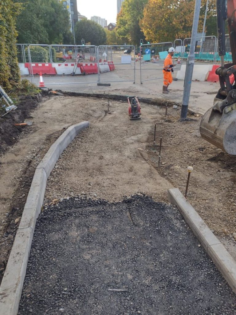
Setting out engineers
With strong, long-standing relationships across the civil engineering and construction sector, we supply skilled professionals who keep your projects accurate, efficient and on programme.
bathymetric surveys & river surveys
Using modern technology, we capture detailed underwater and river channel information safely and efficiently – delivering reliable data you can trust.
Stockpile surveys & volumetric analysis
Whether a one-off stockpile measurement or regular monitoring, we deliver reliable, repeatable data tailored to your project using advanced technology.
Control Network Installation
Delivering robust and precise site control systems to support every stage of construction in developments, infrastructure schemes or major earthworks.
aerial & drone surveys
CAA-approved drone operations for aerial mapping, photogrammetry and volumetric analysis, providing a comprehensive view of terrain, structures and landscapes.
3D BIM Modelling
Whether you require an as-built Revit model, federated coordination model or detailed digital twin, our team delivers high quality, design-ready outputs.
survey equipment hire
We offer a vast range of surveying and engineering equipment for hire and will always try to beat a comparable quote. Discover the fleet.
monitoring
Providing reliable monitoring surveys across the UK, delivering precise data that supports risk management, compliance and informed decision making throughout a project lifecycle.
Virtual Tour 3D
An immersive experience which instantly transports your clients to your business, guiding them through your space and creating a seamless experience.
Impermeable area surveys
We deliver georeferenced impermeable area data that drainage engineers and planning consultants can work from directly.
CCTV & Drainage surveys
Acoustic & Noise Assessments
We deliver acoustic and noise assessments, supporting planning applications, discharge of conditions and Environmental Impact Assessments.
Why choose site surveying services
On site. On spec. On time.
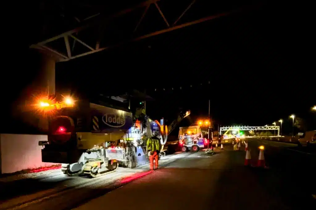
Mobile mapping changes what is practical.
The CHCNAV AU20 captures the full highway corridor at road speed. No lane closure. No static personnel on the carriageway. The survey methodology that makes live highway corridor survey safe and efficient.
The highways supply chain knows us.
Highways England Area 10 supply chain experience. Local authority framework familiarity across Lancashire, Greater Manchester and Cumbria. The accreditations and relationships that matter in this sector.
PAS 128 before every highway excavation.
Service-dense highway environments make pre-excavation utility mapping non-negotiable. We hold PAS 128 accreditation and deliver QLA to QLD across highway schemes throughout the North West.
Setting-out and as-built from the same team.
The surveyor who captured the existing conditions survey and the engineer who sets out the new kerb line are the same organisation. Spatial knowledge of the corridor maintained throughout the full programme.
Frequently Asked Questions
Frequently Asked Questions
What survey is needed for a highway improvement scheme?
A typical highway improvement scheme requires topographic survey of the corridor and surrounding area at preliminary design stage — ground levels, drainage, boundaries, services at surface level and all highway features. PAS 128 utility mapping at Quality Level C for the full corridor at preliminary design stage and Quality Level A at critical crossings and structure positions before construction. Control network installation before construction begins. Setting-out engineers for carriageway construction. As-built topographic survey at completion for highway adoption and planning condition discharge. We advise on the right survey scope and programme for your specific scheme at the time of enquiry.
What is mobile mapping and is it suitable for highway survey?
Mobile mapping is vehicle-mounted survey — a CHCNAV AU20 system combining LiDAR, panoramic cameras, GNSS and an IMU, capturing a 360° point cloud and photographic record of the highway corridor at road speed. It achieves 5mm accuracy from a moving vehicle, captures 2 million points per second and requires minimal traffic management. For highway corridor survey on live carriageways, mobile mapping is significantly faster, significantly safer and produces a richer dataset than any static survey methodology. It is the methodology we recommend for most highway corridor surveys in the North West.
What survey does a Section 38 or Section 278 highway adoption require?
Developer-funded highway works under Section 38 or Section 278 agreements typically require topographic survey at pre-application stage to support the highway design, PAS 128 utility mapping before any highway excavation, setting-out engineers for carriageway and drainage construction, and as-built topographic survey at completion for the highway authority’s adoption records. The as-built survey specification should be agreed with the adopting highway authority before construction begins — we advise on LCC and North West local authority requirements at the time of instruction.
What visibility splay measurements do you take for a transport assessment?
We take sightline measurements at the correct measurement point, eye height and object height for the design speed of the road — in accordance with the relevant design standard (Manual for Streets, DMRB or local authority guidance as applicable). Obstructions within the visibility splay are recorded and flagged. Drawings are produced at a scale that clearly demonstrates whether the required sightlines are achieved. The transport consultant can work directly from our survey data and drawings without additional processing.
Can you survey an active highway without a lane closure?
With mobile mapping — yes, in most cases. The CHCNAV AU20 surveys the corridor from a moving vehicle at road speed, requiring minimal traffic management rather than a full lane closure. For specific survey activities that require static access — vacuum excavation test points for PAS 128 QLA, precise spot level checks, drainage feature capture in confined areas — targeted closures may be required at specific locations. We produce a traffic management plan for every highway survey that minimises closure requirements and protects personnel and road users.
What is the right PAS 128 quality level for a highway scheme?
Quality Level C — active detection of all services using GPR and EML — across the full highway corridor at preliminary design stage. Quality Level A — physical verification at test points using vacuum excavation — at critical locations: service crossing points, utility diversion positions, structure foundations and any location where the design cannot afford uncertainty about what is underground. This combination provides comprehensive coverage across the corridor while focusing the highest standard where it matters most. We advise on the right quality level distribution for your specific scheme at the time of instruction.