


 Leeds
Leeds Doncaster
 Sheffield
 Bradford
 Hull
Hull Halifax
 Sunderland
 Newcastle
 Middlesborough
 Yorkshire Moors
 Teesside
 Cumbria
 Harrogate
 York
York Yorkshire Dales
 Northumberland
 Goole
Goole Carlisle
 Keswick
 Kendal
 Barrow-in-Furness
 Lancaster
 Blackpool
 Morecambe
 Southport
 Liverpool
 Wigan
Wigan Manchester
 Blackburn
 Burnley
 Forest of Bowland
 Oldham
 Chester
 Stockport
 Peak District
 Skipton
 Crewe
Crewe Rotherham
 Stoke
Stoke Driffield
Successful planning outcomes depend on clear, accurate site information.
Surveying for Contractors & Groundworkers.
One Trusted Partner.
The Right Survey, On Site, When Your Programme Needs It.
The Right Survey, On Site, When Your Programme Needs It.
Setting out that is wrong by 50mm becomes abortive work. Utility mapping that was not done becomes a service strike. A control network that was not verified becomes a structure in the wrong position. These are not theoretical risks for contractors and groundworkers — they are the things that happen on live construction sites when the survey function was not specified correctly, was not commissioned early enough, or was done by a firm that could not keep pace with the programme.
Site Surveying Services supports contractors and groundworks teams across Lancashire, the North West and nationally — from pre-start PAS 128 utility mapping and control network installation through to setting-out engineers on site, 3D machine control for bulk earthworks, monitoring adjacent to excavation, and as-built survey at completion. In 2025 we delivered over 600 setting-out and site engineering programmes. The engineer who confirms your booking is the engineer on site. Directly employed, fully equipped, ready when your programme opens.
Survey at every stage of the construction programme
Pre-start and mobilisation
The decisions made before the first spade goes in determine whether the programme runs or stops. Pre-start survey is not a preliminary — it is the risk management that protects the groundworks programme from the two most common and most costly construction site events: a service strike and a setting-out error.
What is typically needed at pre-start:
PAS 128 utility mapping before any excavation — physically verified service locations, not desktop records. Quality Level A for high-risk excavation, Quality Level C as a minimum for any ground investigation. Control network installation and verification — primary and secondary control established before the contractor arrives, providing the coordinate framework the setting-out engineers and machine control systems will work from throughout the programme. Pre-construction condition survey of adjacent structures where excavation depth or proximity creates a risk of third-party damage claims.
The questions that protect the groundworks programme:
Has the utility mapping been physically verified — or is it a desktop search and a QLD plan? Is the control network specification matched to the setting-out tolerance in the contract? Has the control been independently verified before the first setting-out visit? Has a pre-construction condition survey recorded the existing state of adjacent buildings before excavation begins?
What we deliver:
PAS 128 utility mapping to Quality Level A, B or C — physically verified underground service positions before any excavation begins. Primary and secondary control network installed, adjusted and verified. Pre-construction condition survey of adjacent structures. All surveys coordinated into a single pre-start data package.
Survey at every stage of the construction programme
Enabling works and groundworks
Enabling works and groundworks are where setting-out accuracy translates directly into programme performance. The drainage run that is set out correctly runs to grade first time. The pile positions that are set out correctly do not need to be redrilled. The formation level that is accurately established the first time does not need to be reinstated after the drainage designer queries the falls.
What is typically needed during enabling works:
Setting-out engineers for pile positions, drainage inverts, formation levels, retention system positions and all structural elements established during enabling works. As-built verification of drainage and groundworks at key programme stages — particularly before backfilling, where a level or invert that cannot be re-accessed is the stage at which the error needs to be found. Monitoring of adjacent structures during deep excavation — settlement and structural movement monitoring with immediate trigger level reporting.
What we deliver:
Directly employed setting-out engineers with their own Leica and CHCNAV robotic total stations and GPS rovers. As-built drainage verification in CAD format. Structural and settlement monitoring with trigger level reporting — immediate notification when readings approach threshold, not at the next scheduled visit.
Survey at every stage of the construction programme
Structural setting-out and frame
Steel frame, concrete frame, precast, masonry — whatever the structural system, setting-out accuracy at this stage determines everything that follows. The gridlines that are wrong affect every structural element connected to them. The column base plates that are set out incorrectly require structural intervention to correct. The slab levels that are not verified before the frame goes up become a specification dispute at handover.
What is typically needed during structural works:
Setting-out engineers for column positions, gridlines, hold-down bolt templates, slab levels and structural interface positions. Check surveys at key programme milestones — verifying that structural elements have been placed to specification before the next programme stage proceeds. Laser scanning for as-built verification of complex or high-tolerance structural elements where traditional measurement cannot confirm position accurately enough.
What we deliver:
Engineering surveyors experienced in structural frame setting-out — steel and concrete. Check surveys at programme milestones. As-built laser scanning for complex structural elements. All work by our directly employed team.
Survey at every stage of the construction programme
Earthworks and bulk excavation
Earthworks programmes have two survey requirements that are distinct and equally important: accurate setting-out of the earthworks design, and accurate measurement of earthworks progress for commercial reconciliation. Getting both right simultaneously requires the right methodology and the right team.
What is typically needed on earthworks programmes:
3D machine control — design models loaded into the GPS guidance systems on excavators, graders and dozers, calibrated to the site control network. Reduces setting-out time, improves accuracy across the full works extent and tracks earthworks progress against design in real time. UAV volumetric survey — regular drone surveys tied to the site control network, producing cut and fill reconciliation in CAD and spreadsheet format for the commercial team. Setting-out engineers for formation verification, earthworks tie-in positions, retaining structure positions and drainage.
What we deliver:
3D machine control model creation and calibration for bulk earthworks — Trimble, Topcon and Leica systems. UAV volumetric surveys at programme intervals — cut and fill, stockpile volumes, progress against design. Setting-out engineers for earthworks verification and drainage.
Survey at every stage of the construction programme
Highways and external works
External works setting-out — kerb lines, road levels, drainage, footways, parking, landscaping — is often the most compressed stage of any construction programme. The building is complete, the client is expecting handover, and the external works contractor is working flat out to finish. This is when setting-out errors are discovered. It is also when the cost of correcting them is highest.
What is typically needed on highways and external works:
Setting-out engineers for kerb lines, carriageway levels, drainage runs, footway formation and all external works elements. Road cross-section verification and longitudinal profile checks against the highway design. As-built survey of completed external works for planning condition discharge.
What we deliver:
Setting-out engineers experienced in highways and external works across NW and UK programmes. Road cross-section and profile verification. As-built topographic survey for planning condition discharge. All delivered in the format the highways engineer and planning authority require.
Survey at every stage of the construction programme
As-built and completion
The as-built survey at practical completion is not an optional extra — it is the record that the contractor, the developer and the planning authority all depend on to close out the programme. Missing or inadequate as-built data leads to disputes at handover, delayed planning condition discharge and gaps in the building’s record that cause problems for future works.
What is typically needed at completion:
As-built topographic survey of the completed site — confirming earthworks levels, drainage inverts, structure positions and all built features against the design. As-built measured building survey if the programme involved significant internal works or alterations. Drain CCTV support survey where drainage as-built data is required for adoption. Planning condition discharge survey in the format the local planning authority requires.
What we deliver:
As-built topographic survey in AutoCAD DWG, deliverable to the planning authority and highways engineer. As-built measured building survey. Support survey coordination with drainage CCTV teams. All data georeferenced and tied to OS National Grid.
Surveying Services
Most Used by Contractors and Groundworkers
Surveying Services Most Used by Contractors and Groundworkers
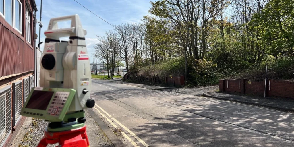
Setting-out engineers
Directly employed engineering surveyors for construction programmes of any scale. Fully self-equipped with robotic total stations and GPS. Over 600 setting-out projects in 2025.
Topographic survey
Pre-start site survey, as-built topographic survey and planning condition discharge
Monitoring
structural and settlement monitoring adjacent to excavation. Sub-millimetre accuracy. Immediate trigger level reporting.
3D machine control
Design models created and calibrated for earthworks plant. Trimble, Topcon and Leica systems. From model creation to on-site calibration, in-house.
UAV volumetric survey
earthworks progress recording and cut and fill reconciliation at programme intervals.
PAS 128 utility mapping
Physical verification of underground services before any excavation. Quality Level B. The standard that protects the groundworks programme and the CDM principal designer.
Control network installation
Primary and secondary site control to the accuracy specification the programme requires. Verified before any downstream survey activity begins.
survey for civil engineers North West
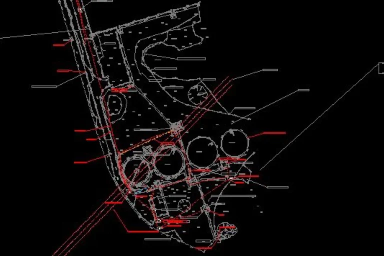
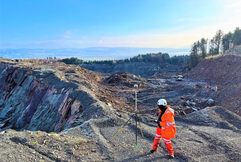
Case Studies: Survey Data in practice
Comprehensive Infrastructure Surveying — Ilkley
Full PAS 128 and topographic survey package for a live infrastructure scheme in Ilkley — all services located, verified and plotted alongside detailed ground and drainage data, delivered as a single coordinated dataset. One instruction, one team, one output.
Case Studies: Survey Data in practice
BAE Systems — PAS 128 Utility Mapping and Topographical Survey, Barrow-in-Furness
PAS 128 QLA utility mapping and topographic survey on a live MOD industrial facility — decades of buried infrastructure, restricted access, phased delivery. Every service physically verified. Zero return visits. One coordinated georeferenced dataset.
Why choose site surveying services
On site. On spec. On time.
We support contractors and groundworkers across the UK by delivering accurate, reliable survey data that stands up to the realities of live construction sites and helps projects progress safely, accurately, and efficiently from mobilisation through to completion. Our surveys provide the clarity needed to reduce risk, prevent setting-out errors, and keep works on programme.
At Site Surveying Services, we understand the practical pressures of construction environments. We work closely with main contractors, groundworks specialists, and subcontractors to deliver surveys that align with construction methodologies, sequencing, and site constraints. Whether supporting enabling works, foundations, or complex infrastructure packages, we tailor our approach to suit each phase of construction.
Our experience within active construction sites allows us to anticipate the information required at every stage of the build. From pre-construction topographical surveys and control establishment to as-built surveys, verification, and progress monitoring, we deliver clear, usable survey outputs that integrate seamlessly into site operations and engineering workflows.
We provide construction and engineering surveying services across a wide range of sectors and site conditions, from tight urban plots to large-scale developments. Our topographical surveys, setting-out control, and point cloud data give contractors confidence that works are based on accurate, dependable information—helping to minimise rework and costly delays.
Quality, communication, and consistency are central to our service. By combining technical surveying expertise with a hands-on understanding of construction processes, we help ensure projects move forward safely and efficiently. For contractors and groundworkers seeking a reliable surveying partner, we provide the data that supports accurate delivery on site.
fast turnaround
Get a quick quote and a survey team prepared for instruction. When the programme window opens, we're ready.
Industry Accredited
Built on recognised industry standards. Constructionline Gold accredited, CAA Approved, CDM 2015 compliant, and surveys delivered to PAS 128
Nationwide
Coverage across the UK with local knowledge you can rely on. Headquartered in Clitheroe, we know the sites, the contractors and the programmes — backed by the capability to deliver anywhere.
Programme-Critical
Data that works in your environment from day one. BIM to your EIR. CAD to your spec. No reprocessing. No delays to the design team.
Frequently Asked Questions
Frequently Asked Questions
Do I need PAS 128 utility mapping before groundworks begin?
Yes — on any site where excavation is planned. Desktop utility records alone are not adequate for CDM compliance on excavation programmes. PAS 128 Quality Level C — active detection using GPR and EML — is the minimum standard for most groundworks. Quality Level A — physical verification using vacuum excavation at test points — is required where the consequences of a service strike are significant, where the ground is service-dense, or where the principal designer or CDM regulations require it. We advise on the right quality level for your specific site and excavation scope at the time of enquiry.
How quickly can you get a setting-out engineer on site?
We mobilise quickly. From instruction to engineer on site within 48 hours as standard for most NW programmes. If your programme needs are more urgent — access window opening the next morning, programme pressure requiring immediate attendance — call us directly and we will tell you honestly what we can do and when. We maintain a team of engineers across Lancashire and the North West and can typically respond faster than firms that rely on freelance networks.
Are your setting-out engineers directly employed or agency?
All our setting-out engineers are directly employed by Site Surveying Services. Not agency placements, not freelancers. They carry our professional indemnity insurance, work to our quality standards, and are accountable to us as well as to you. When something needs resolving, there is one number to call. We do not supply labour — we supply a professional survey team.
Do your engineers bring their own equipment?
Yes. Every setting-out engineer arrives fully self-equipped — their own Leica or CHCNAV robotic total station, GPS rover and digital level. No equipment hire cost, no dependency on site equipment, no delays caused by missing instrumentation. The engineer arrives ready to work from the first moment on site.
What is the difference between Quality Level A and Quality Level C utility mapping?
Quality Level C is an active detection survey — ground-penetrating radar and electromagnetic location used to identify and trace underground services, plotted on a drawing. It tells you where services are likely to be. Quality Level A adds physical verification — vacuum excavation at test points to confirm service depth, position and material by direct measurement. It tells you where services definitely are. On any groundworks programme where the consequence of a service strike is significant — financial, operational or CDM — Quality Level A is the appropriate standard at critical locations. We advise on the right quality level distribution for your specific site.
Can you set out from a 3D design model rather than 2D drawings?
Yes. Our engineers work from both 2D CAD drawings and 3D design models — AutoCAD DWG, Trimble, Topcon and Leica design file formats. They extract setting-out data from the model, check it for internal consistency before site, and flag any conflicts between the design and the existing ground conditions before concrete is poured. If you are working from a machine control file format, our engineers can load and verify the design in the instrument before setting out begins.
What is 3D machine control and how does it work?
3D machine control uses GPS guidance systems fitted to excavators, graders, dozers and other earthworks plant to guide the machine operator in real time — showing the design surface on a cab-mounted screen and indicating cut or fill depth at the blade or bucket position. Instead of working from pegs and boning rods, the operator works directly from the 3D model. Our team creates the machine control models from the design files, loads them to the guidance system and calibrates the system to the site control network. Accuracy improves, rework reduces and the programme moves faster. We have been working with machine control systems since their earliest adoption in the UK construction industry.
Do you do as-built surveys at the end of the programme?
Yes. As-built topographic surveys at practical completion — confirming earthworks levels, drainage inverts, structure positions and all built features against the design — are a standard part of our service to contractors. Delivered in AutoCAD DWG in the format required by the planning authority and highways engineer for condition discharge. We also carry out as-built measured building surveys where required and can coordinate with drainage CCTV teams for drain as-built programmes.
What monitoring is required adjacent to excavation?
This depends on excavation depth, proximity to existing structures or utilities, ground conditions and the structural sensitivity of adjacent buildings. As a general principle, monitoring is appropriate for any excavation within approximately 1.5 to 2 times the excavation depth of existing structures, and for any excavation adjacent to live utilities or infrastructure that cannot be disturbed. We deliver structural and settlement monitoring to the trigger levels and monitoring frequency your geotechnical engineer specifies — with immediate reporting when readings approach or reach threshold levels.
Can you work on live sites with restricted access or complex sequencing?
Yes. The majority of our site engineering work is on live construction sites — active groundworks, plant operations, sequencing constraints, programme pressure and access restrictions are the standard environment rather than the exception. Our engineers understand live construction environments and work at the pace the programme demands without becoming a programme risk themselves.
What areas do you cover?
Our head office is in Clitheroe, Lancashire, with offices in Matlock, Newcastle and Bristol. We supply setting-out engineers and survey teams across the North West, North East, Midlands and South West as primary territories, and nationally. In 2025 we delivered over 600 setting-out and site engineering programmes across these territories. All engineers are directly employed.a