


 Leeds
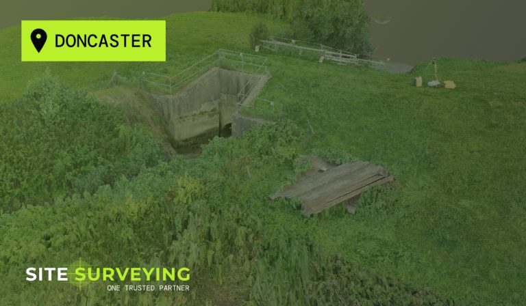
Leeds Doncaster
 Sheffield
 Bradford
 Hull
Hull Halifax
 Sunderland
 Newcastle
 Middlesborough
 Yorkshire Moors
 Teesside
 Cumbria
 Harrogate
 York
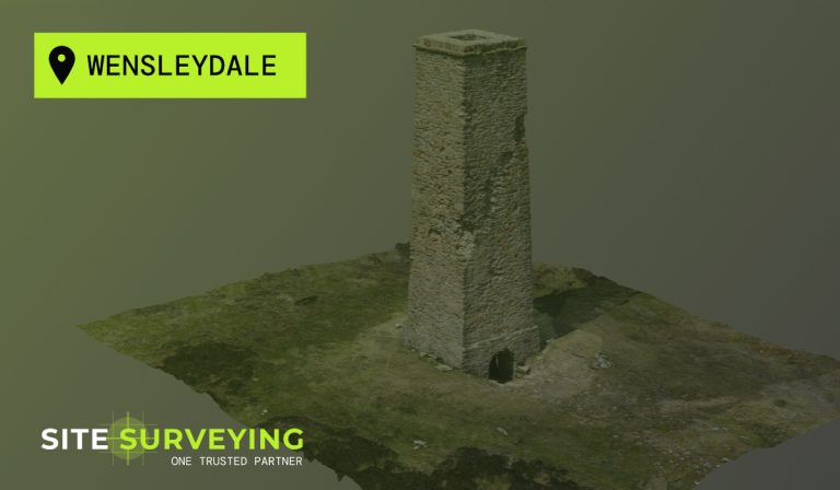
York Yorkshire Dales
 Northumberland
 Goole
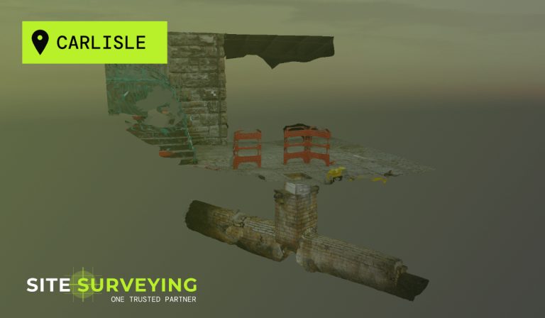
Goole Carlisle
 Keswick
 Kendal
 Barrow-in-Furness
 Lancaster
 Blackpool
 Morecambe
 Southport
 Liverpool
 Wigan
Wigan Manchester
 Blackburn
 Burnley
 Forest of Bowland
 Oldham
 Chester
 Stockport
 Peak District
 Skipton
 Crewe
Crewe Rotherham
 Stoke
Stoke Driffield
Precision data for sustainable decisions. Survey methodology that matches the environment.
Bathymetric & Hydrographic Surveying
Environmental and energy projects in the North West present survey challenges that standard construction methodology cannot always address. Wetland sites where ground-based access is restricted or harmful to the habitat. River corridors where the data needed lies beneath the water surface. Wind farm and solar development sites across challenging Pennine, Lakeland and moorland terrain. Flood risk assessments where every level and drainage feature matters to the modelling. Water infrastructure upgrade schemes operating under AMP8 investment where the survey data directly underpins programme-critical design decisions.
Site Surveying Services has been delivering survey across this sector since 1997 — using UAV LiDAR, unmanned surface vessels, remote sensing and GPS-controlled ground survey to capture data safely and accurately in environments where traditional methods are impractical, too slow or potentially damaging to what is being surveyed. We are Lancashire-based, nationally capable, and our equipment is specifically chosen for the environments this sector demands.
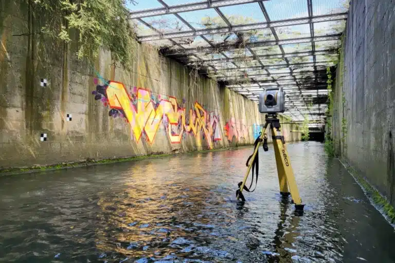
Surveying for Bathymetric & Hydrographic Projects
Surveying for Bathymetric & Hydrographic Projects
Riverbanks can be unstable, currents unpredictable, and access limited yet the accuracy of hydraulic data is critical to flood modelling, watercourse management and civil engineering design. Traditional methods can be slow, unsafe and inconsistent. Today’s environmental, infrastructure and energy projects demand fast, high-resolution datasets captured with minimal disruption and maximum reliability.
Why Accuracy Matters...
As professional land surveyors, we know every measurement, level and coordinate directly influences the success of design, modelling and construction. Accurate hydrographic survey data allows teams to:
Model with confidence
ensure flood risk assessments and hydraulic simulations are based on verified data.
Design safely
support bridge, culvert and weir design with accurate riverbed and bank profiles.
Monitor change
detect erosion, sedimentation or water level shifts over time.
Protect assets
inform maintenance and improvement works for waterways, reservoirs and drainage systems.
Reduce risk
improve safety and planning by understanding channel geometry and flow conditions.
Commitment to Safety & Environment
Commitment to Safety & Environment
From remote-controlled USVs to drone reconnaissance, our methods reduce site risk while maintaining full environmental compliance. Our work contributes directly to sustainable water management, helping clients make informed decisions that protect habitats and mitigate flood impact.
Why choose site surveying services
On site. On spec. On time.
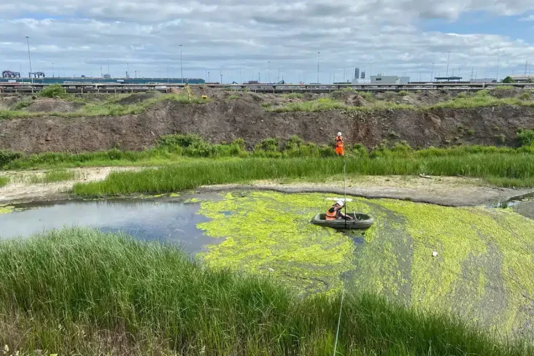
Nobody enters the water. Every survey.
The Apache 4 USV operates from the bank on every bathymetric commission. Safe, ecologically non-invasive and more accurate than wading survey.
EA-compliant deliverables. Format confirmed before mobilisation.
HEC-RAS, InfoWorks ICM, ISIS and EACSD — the required format confirmed with the hydraulic engineer before we start. Not adapted after delivery. Confirmed and delivered as specified.
Maintained datums for return surveys.
Long-term environmental and flood risk programmes require data that is directly comparable across survey dates. We maintain datums and install permanent markers.
Our Services
Topographical Surveys
OS-controlled accurate, efficient and cost effective surveys for highways, civils and development. Cad and BIM-ready output.
PAS 128 utility mapping
Providing the location of underground services in 2D or 3D through qualified utility mapping surveys, using advanced GPR and Electromagnetic Location.
Measured building survey
Delivering accurate as-built information that supports design, refurbishment, planning and construction with the latest technology. Producing reliable drawings and digital models.
Laser Scanning
3D laser scanners capture millions of points per second, creating a point cloud which enables the finer details and the physical site to be viewed remotely.
Mobile mapping
For highway engineers, infrastructure managers, local authorities and contractors working on live road schemes, mobile mapping is now the standard for corridor surveys.
3D Machine control
With decades of supporting major earthworks contractors and large-scale infrastructure schemes, we provide reliable machine control across Lancashire and the wider UK.
Setting out engineers
With strong, long-standing relationships across the civil engineering and construction sector, we supply skilled professionals who keep your projects accurate, efficient and on programme.
bathymetric surveys & river surveys
Using modern technology, we capture detailed underwater and river channel information safely and efficiently – delivering reliable data you can trust.
Stockpile surveys & volumetric analysis
Whether a one-off stockpile measurement or regular monitoring, we deliver reliable, repeatable data tailored to your project using advanced technology.
Control Network Installation
Delivering robust and precise site control systems to support every stage of construction in developments, infrastructure schemes or major earthworks.
aerial & drone surveys
CAA-approved drone operations for aerial mapping, photogrammetry and volumetric analysis, providing a comprehensive view of terrain, structures and landscapes.
3D BIM Modelling
Whether you require an as-built Revit model, federated coordination model or detailed digital twin, our team delivers high quality, design-ready outputs.
survey equipment hire
We offer a vast range of surveying and engineering equipment for hire and will always try to beat a comparable quote. Discover the fleet.
monitoring
Providing reliable monitoring surveys across the UK, delivering precise data that supports risk management, compliance and informed decision making throughout a project lifecycle.
Virtual Tour 3D
An immersive experience which instantly transports your clients to your business, guiding them through your space and creating a seamless experience.
Impermeable area surveys
We deliver georeferenced impermeable area data that drainage engineers and planning consultants can work from directly.
CCTV & Drainage surveys
Acoustic & Noise Assessments
We deliver acoustic and noise assessments, supporting planning applications, discharge of conditions and Environmental Impact Assessments.
Frequently Asked Questions
Frequently Asked Questions
What types of projects require bathymetric and hydrographic survey?
Bathymetric and hydrographic survey is required on any project where the physical characteristics of a water body — river, reservoir, canal, lake, estuary or coastal environment — need to be accurately measured. Common applications include flood risk assessments and hydraulic modelling for development near watercourses, bridge scour assessment and structural inspection, dredging programmes (pre-dredge volume and post-dredge verification), reservoir capacity and dam safety surveys, environmental monitoring and habitat assessment, and infrastructure works involving pipeline crossings, culverts and watercourse diversions.
What is the difference between bathymetric survey and hydrographic survey?
Bathymetric survey refers specifically to the measurement of water depth and bed levels — capturing the underwater topography of a water body. Hydrographic survey is a broader term encompassing all survey of water bodies and their boundaries, including water surface levels, tidal data, flow measurements and coastal survey. In practice, most river and watercourse survey commissions involve both — bathymetric data capture for the channel bed alongside topographic survey of the banks and surrounding land. At Site Surveying Services, we use both terms to describe the integrated survey of watercourses and water bodies.
Does bathymetric survey require personnel to enter the water?
No — we use the CHC Navigation Apache 4 unmanned surface vessel, which captures bathymetric data remotely from the bank. The Apache 4 navigates the survey lines autonomously, streaming real-time data to the operator on the bank throughout. This eliminates the safety risks associated with wading surveys on fast-flowing or deep watercourses, removes the ecological disturbance caused by personnel disturbing the riverbed, and produces more accurate data than wading methods which compress the bed surface underfoot.
What sectors commission bathymetric and hydrographic survey most frequently?
The most active commissioning sectors are: Environmental and energy — flood risk assessment, environmental monitoring and catchment management programmes. Infrastructure and transport — bridge inspection, culvert assessment and watercourse crossings on highway and rail schemes. Construction and civil engineering — flood risk assessments for development near watercourses and drainage design on sites adjacent to rivers. Rural and agriculture — drainage improvement, watercourse management and agricultural flood risk. Water companies — reservoir inspection and mains crossing surveys as part of AMP8 investment programmes.
Can you survey reservoirs and canals as well as rivers?
Yes. The Apache 4 USV is equally applicable to reservoir, canal and lake survey as to rivers. For reservoir capacity surveys, the vessel maps the full bed at close line spacing to produce an accurate volume calculation for dam safety and capacity management programmes. For canal condition surveys, it captures channel profile, bed levels and underwater features along the navigation. For lakes and standing water bodies, full bed mapping using multibeam echo sounding produces a complete bathymetric model of the water body. We have delivered surveys across reservoirs, canals and river systems throughout the North West.
What EA-compliant deliverables do you produce?
We produce long and cross-sections to EA standard format, HEC-RAS geometry files for direct import, InfoWorks ICM and ISIS cross-section data, and EACSD format for EA-managed river models. All data is referenced to OS National Grid in plan and Ordnance Datum Newlyn in height. Water surface levels at time of survey are confirmed to AOD and included in the methodology statement. We confirm the specific deliverable format required with the hydraulic engineer and the EA before mobilisation on every flood risk river survey.
How do you handle ecologically sensitive watercourses?
The Apache 4 USV operates entirely from the bank — no personnel enter the water and there is no disturbance to the riverbed or riparian habitat. For very sensitive watercourses where even bank access may affect designated habitats, we plan access routes to minimise ecological impact and confirm the approach with the ecologist or environmental manager before mobilisation. UAV LiDAR survey of the flood plain and valley floor similarly avoids ground disturbance — capturing terrain across sensitive habitats without a survey team walking through them.