


 Leeds
Leeds Doncaster
 Sheffield
 Bradford
 Hull
Hull Halifax
 Sunderland
 Newcastle
 Middlesborough
 Yorkshire Moors
 Teesside
 Cumbria
 Harrogate
 York
York Yorkshire Dales
 Northumberland
 Goole
Goole Carlisle
 Keswick
 Kendal
 Barrow-in-Furness
 Lancaster
 Blackpool
 Morecambe
 Southport
 Liverpool
 Wigan
Wigan Manchester
 Blackburn
 Burnley
 Forest of Bowland
 Oldham
 Chester
 Stockport
 Peak District
 Skipton
 Crewe
Crewe Rotherham
 Stoke
Stoke Driffield
Morecambe Winter Gardens – BIM Model
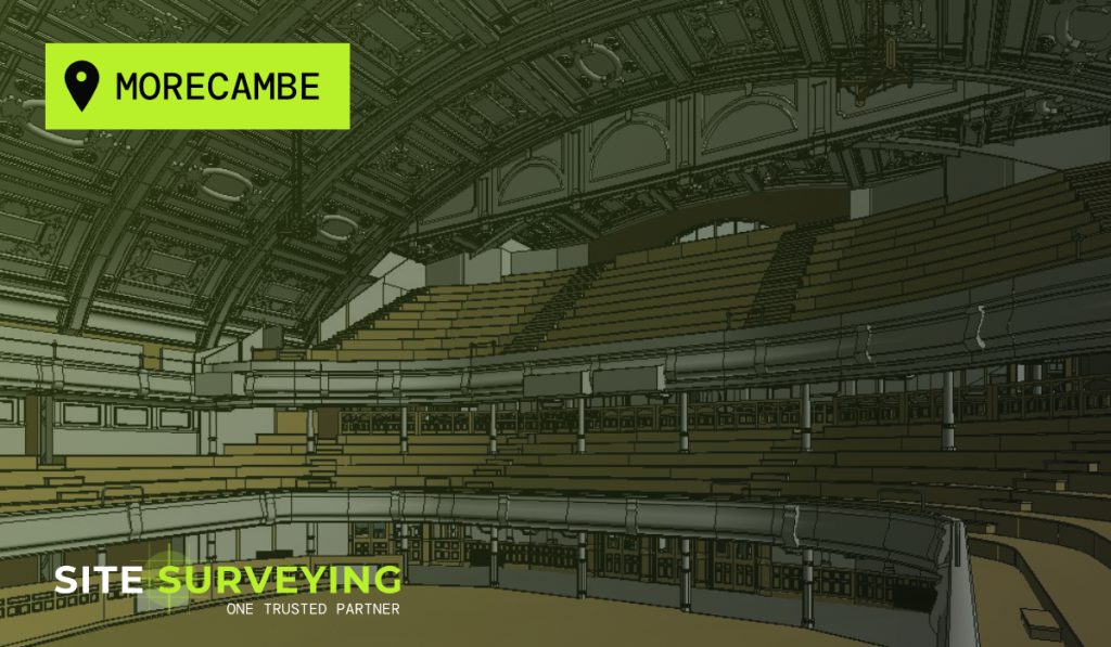
History of the Morecambe Winter Gardens The Winter Gardens Morecambe opened in 1897 as the Victoria Pavilion Concert Hall and Variety Theatre. This was an extension to the existing Winter Gardens Complex which opened in 1878. Over the years the 2,500 capacity venue has hosted the stars of popular music and variety theatre. With its lavish […]
Back Lane Survey
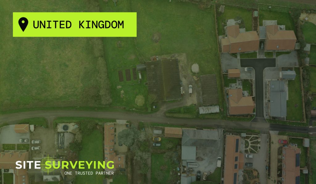
This drone photogrammetry survey was carried out using a DJI M300 drone for a long standing client. The survey compliments a measured building and topographical survey to highlight features not seen from ground level. This enables a broader overview of the specific building alongside neighbouring features, and also provides the ability to easily revisit the […]
The Exchange – Surveying Blackburn
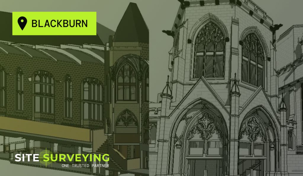
History of the Exchange The Grade II listed ‘Exchange’ in Blackburn was initially opened as the Cotton Exchange in 1865. Blackburn was then at the centre of Lancashire’s textile industry, with mills all across the town. Even from the start, the building was used for a variety of purposes and was renowned for the reading […]
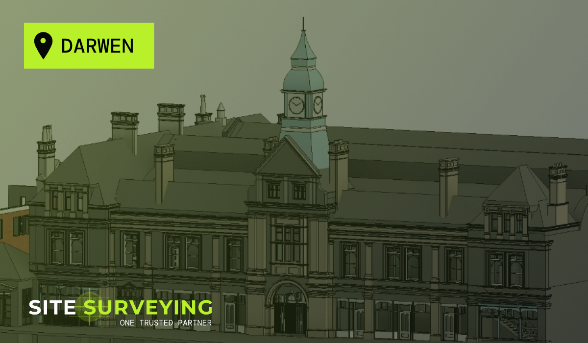
Surveying for The Darwen Town Deal
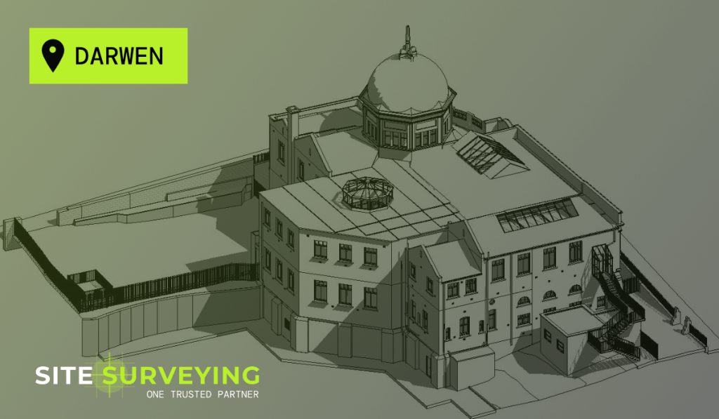
Site Surveying Services is delighted to have been requested by Buttress to survey the Darwen Market Hall and Grade II Listed Library Theatre, as part of ‘The Darwen Town Deal‘. The Darwen Town Deal is a once in a lifetime opportunity to kick-start the transformation of Darwen and the surrounding areas. The project consists of £25m […]
Survey of The Citadel in Carlisle for the University of Cumbria and McAlpine
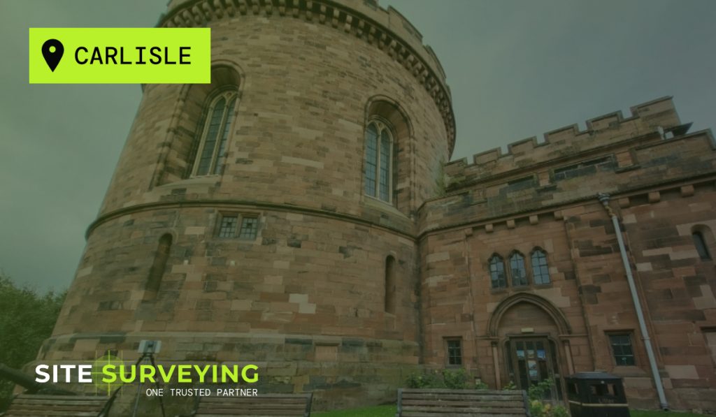
Site Surveying Services have recently been requested by Sir Robert McAlpine to survey the historical Citadel in Carlisle. The original building was commissioned by King Henry VIII and completed in 1541 to replace the gateway through the city walls. It consisted of a triangular enclosure with a huge tower at each angle. It ceased to […]
Drone Surveying at Clitheroe Football Club
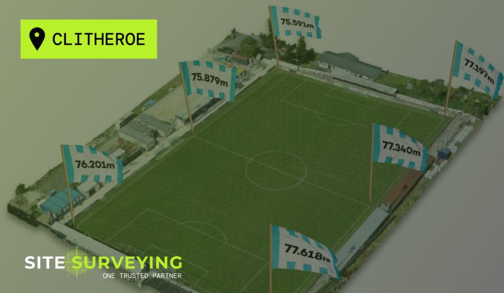
One of our Land Surveyors, Michael Read has been a regular supporter of Clitheroe Football Club. He recently created an interesting Topographical Survey and UAV Mapping of the pitch which helps solve a niggling thought which he has had for many years. The pitch is clearly not level, but how un-level is it? Using photogrammetry […]