TOPOGRAPHICAL SURVEY
UAV MAPPING
Overview
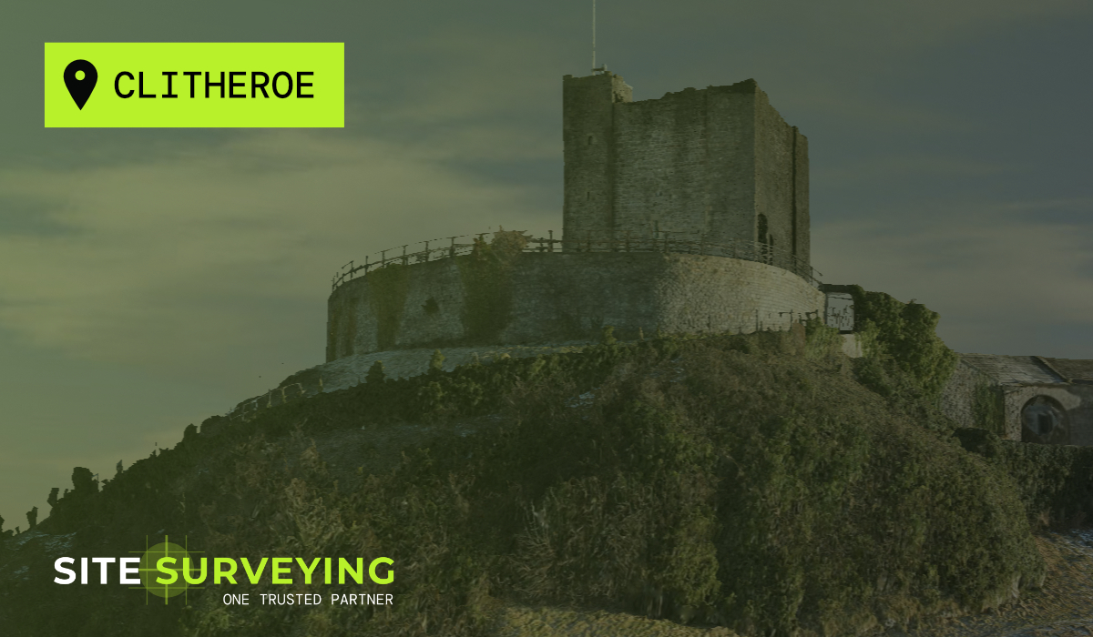
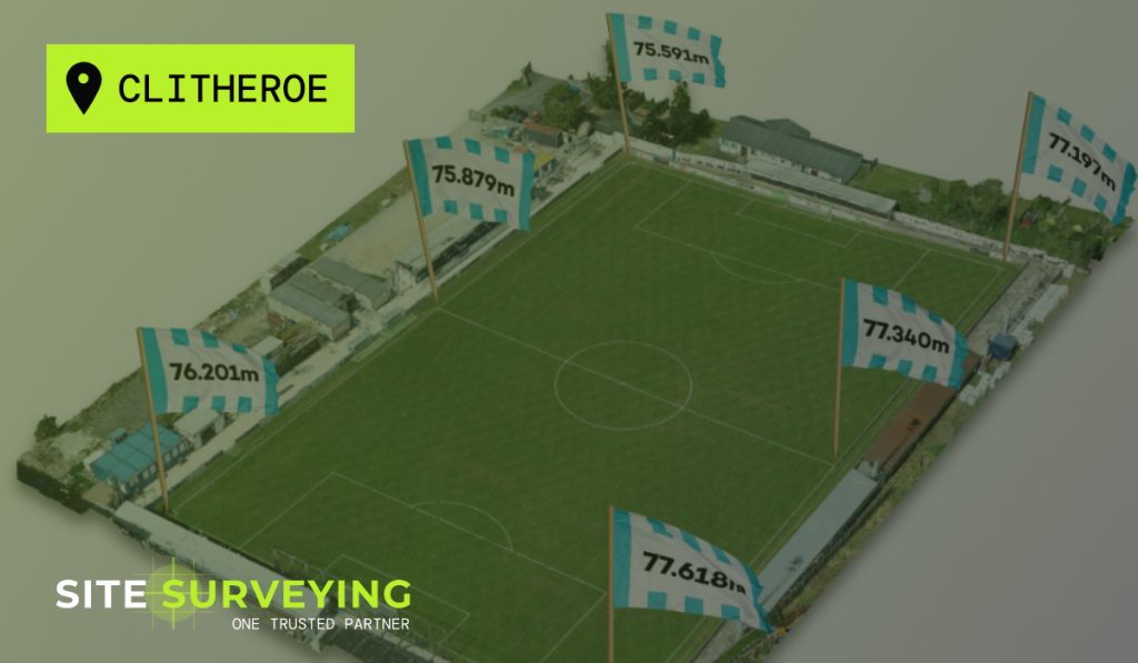
One of our Land Surveyors, Michael Read has been a regular supporter of Clitheroe Football Club. He recently created an interesting Topographical Survey and UAV Mapping of the pitch which helps solve a niggling thought which he has had for many years. The pitch is clearly not level, but how un-level is it?
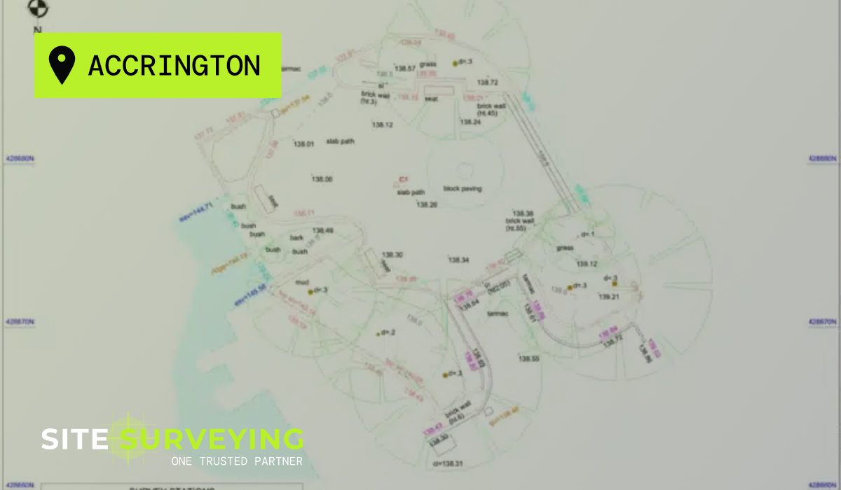
Using photogrammetry created by a drone, Michael was able to use the inbuilt GPS to map the pitch onto an ordnance survey grid. The mesh depicted is then used to create a topographical survey of the football club. This technique is not quite as accurate as a typical survey on dry land. But, it is a fantastic way to cover larger areas quickly and efficiently. It is more commonly used for quarry surveys and volume calculations.
This graphic showcases the height above sea level of the pitch edges.
I have been a proud supporter of Clitheroe Football Club since I was a child and have fond memories of attending with my Dad and Grandad. Nowadays, I regularly attend and shout on my cousin, Ross Dent. Whilst watching the games I have often wondered about the pitch... well it clearly looks a little wonky. So, during lockdown I decided to mix business and pleasure, by offering to do a free topographical survey of the pitch. The results were really interesting.
Michael Read - Land Surveyor
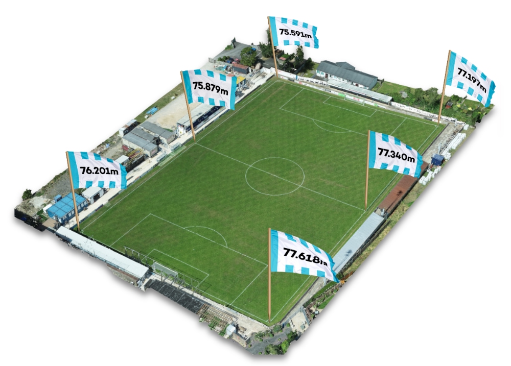
Drone Mapping of Clitheroe FC